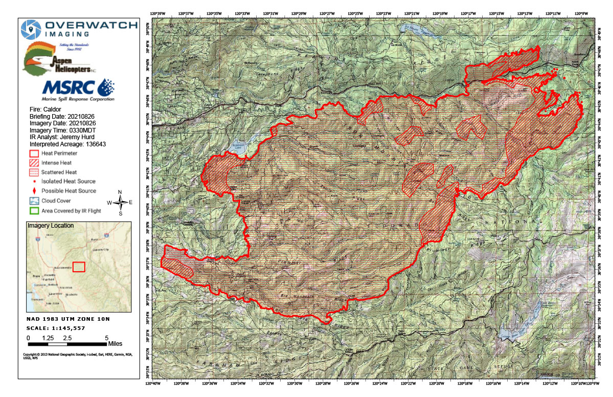
Flight Notes: Interpreted Acreage: 136,643 a Growth of 10,461 acres from last period
Northeast island merged with the main perimeter over the course of 24 hours and continued to grow eastwardly. Further expansion of the main perimeter in the NNE section, also in an eastwardly direction. West perimeter saw minor growth to the west. Southern perimeter remains unchanged. Scattered heat throughout the incident, with intense heat around the NNE and SSE.
Note: Map is 1,200 pixels wide
Click here for Friday's Infrared Map: California Caldor Fire Infrared Map for Friday, August 27, 2021
Thursday, August 26, 2021 - Above Map is the Caldor Fire Infrared Map for Today with Flight Notes.Click Here for: California Caldor Fire Thursday, August 26, 2021 Updates


