


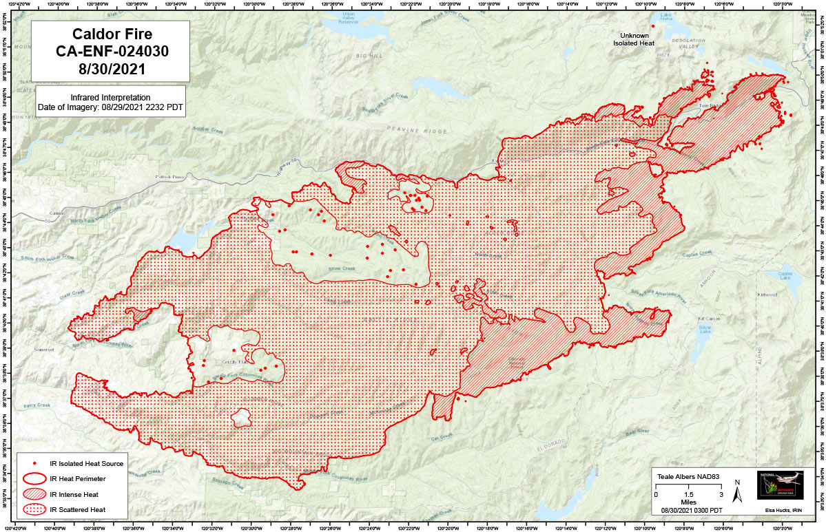
Flight Notes: Interpreted Acreage: -- a Growth of -- acres from last period
Tonight’s interpretation began using the most recent perimeter downloaded from NIFS at 2100 on 8/29. Interpretation identified lots of intense heat in an eastern spread pattern. North / Northeastern spotting detected. There is an unknown heat source which looks like a spot in a rocky outcrop, approximately 3 miles north of the fire (38 51 56.3, -120 9 36.17) along the Western edge of Lake Aloha. Scattered heat is still present across the fire area.
Note: Map is 1,200 pixels wide
Monday, August 30, 2021 - Above Map is the Caldor Fire Infrared Map for Today with Flight Notes.Click Here for Tuesday's Infrared Map
California Caldor Fire Infrared Map for Tuesday, August 31, 2021
