Update 7:30 P.M.: Evacuation Warnings - Effective Immediately for Douglas County, Nevada
Evacuation Warning:
The following affected communities in Douglas County, Nevada (excluding Stateline Casinos) are:
- Upper Kingsbury (South)
- Upper Kingsbury (North)
- Central Kingsbury
- Lower Kingsbury
- Round Hill region and roads including Lower Elks Point
- Lake Village
- Lower Olivers, Kahle Drive region and roads
- These Evacuation Warnings will include areas from Highway 50 at Lake Parkway, East to Elks Point Road (excluding Stateline Casinos) and State Route 207 (Kingsbury Grade) from Highway 50 to Tramway Drive, including all area roads North and South of Kingsbury Grade.
Evacuation Shelters:
- Truckee Veterans Hall 10214 High Street, Truckee, CA 96161
- Douglas County Community Center: Shelter is at capacity 1329 Waterloo Lane, Gardnerville, NV
- Carson City Community Center 851 E. William Street, Carson City, NV
- Carson High School 1111 N. Saliman Road, Carson City, NV Animal Shelters
- Fuji Park 601 Old Clear Creek Road, Carson City, NV 89701 (small and large)
- Douglas County Fairgrounds 920 Pine Nut Road, Gardnerville, NV 89410
All previous evacuation orders and warnings remain in effect.
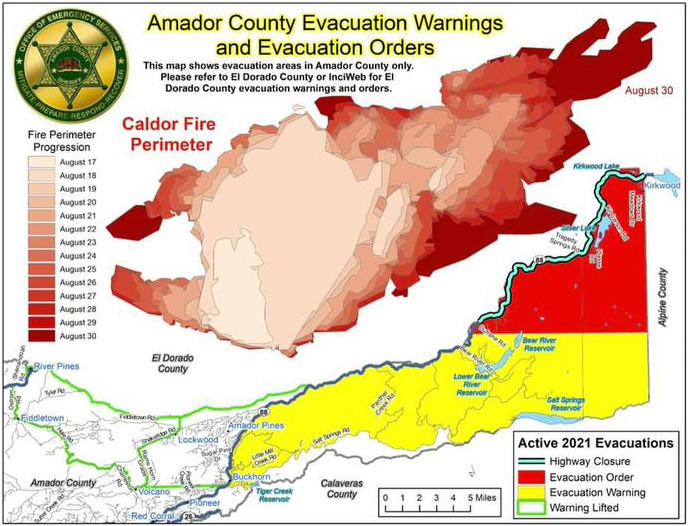
*** Update: Partial Evacuation Warning Area Lifted ***
The Amador County evacuation warning area west of Highway 88 at Omo Ranch Rd to the intersection of Highway 88 and Tiger Creek Rd has been lifted. This area stretches west to include the Amador Pines, Volcano, Fiddletown, and River Pines communities. Refer to the green outlined area of the attached map (Bottom Left) below.
Additionally, the road closure at Highway 88 and Dew Drop Road has been moved east to Highway 88 and Peddler Hill. This will allow residents into the area of Bear River Reservoir to remove property if necessary.
A CodeRED notification will follow. All evacuation warning/order areas to the east remain in effect.
Source: Amador County Sheriff's Office
Update 3:00 P.M.: Caldor Fire Evacuation Orders Downgraded and Evacuation Warnings Lifted - Effective Immediately for El Dorado County and Amador County
 The following Evacuation Orders have been downgraded to Evacuation Warnings in El Dorado County:
- Pipi - East of North South Road from Omo Ranch to Cat Creek and east to Highway 88 1 mile east of Omo Ranch Road.
- Cosumnes - This is a small section south of Farnham Ridge, north of the Amador/El Dorado County Line, and east of Bridgeport School Road.
- Cement Hill - Cement Hill area, south of Omo Ranch south to Farnham Ridge Road
- Farnham Ridge - The east end of Omo Ranch Road south to the Amador County Line
The following Evacuation Warnings have been lifted in Amador County:
- South of the El Dorado-Amador County line with a western border of Shenandoah Road. Southern border of Fiddletown Road, Hale Road and Charleston Road. Eastern border of Shake Ridge Road and Rams Horn Grade.
- South of the El Dorado-Amador County line with a western border of Shake Ridge Road and Rams Horn Grade. Southern border of the intersection of Charleston Road and Rams Horn Grade, due east to Highway 88 at Tiger Creek Road. Eastern border of Hwy 88 at Omo Ranch Road to Highway 88 at Tiger Creek Road.
NOTES: Please go to: www.tinyurl.com/EDSOEVAC for an online evacuation map. All previous evacuation orders and warnings remain in effect. A mandatory evacuation order is defined as an immediate threat to life. This is a lawful order to leave now. The area is lawfully closed to public access. An evacuation warning is defined as a potential threat to life and/or property. Those who require additional time to evacuate and those with pets and livestock should leave now.
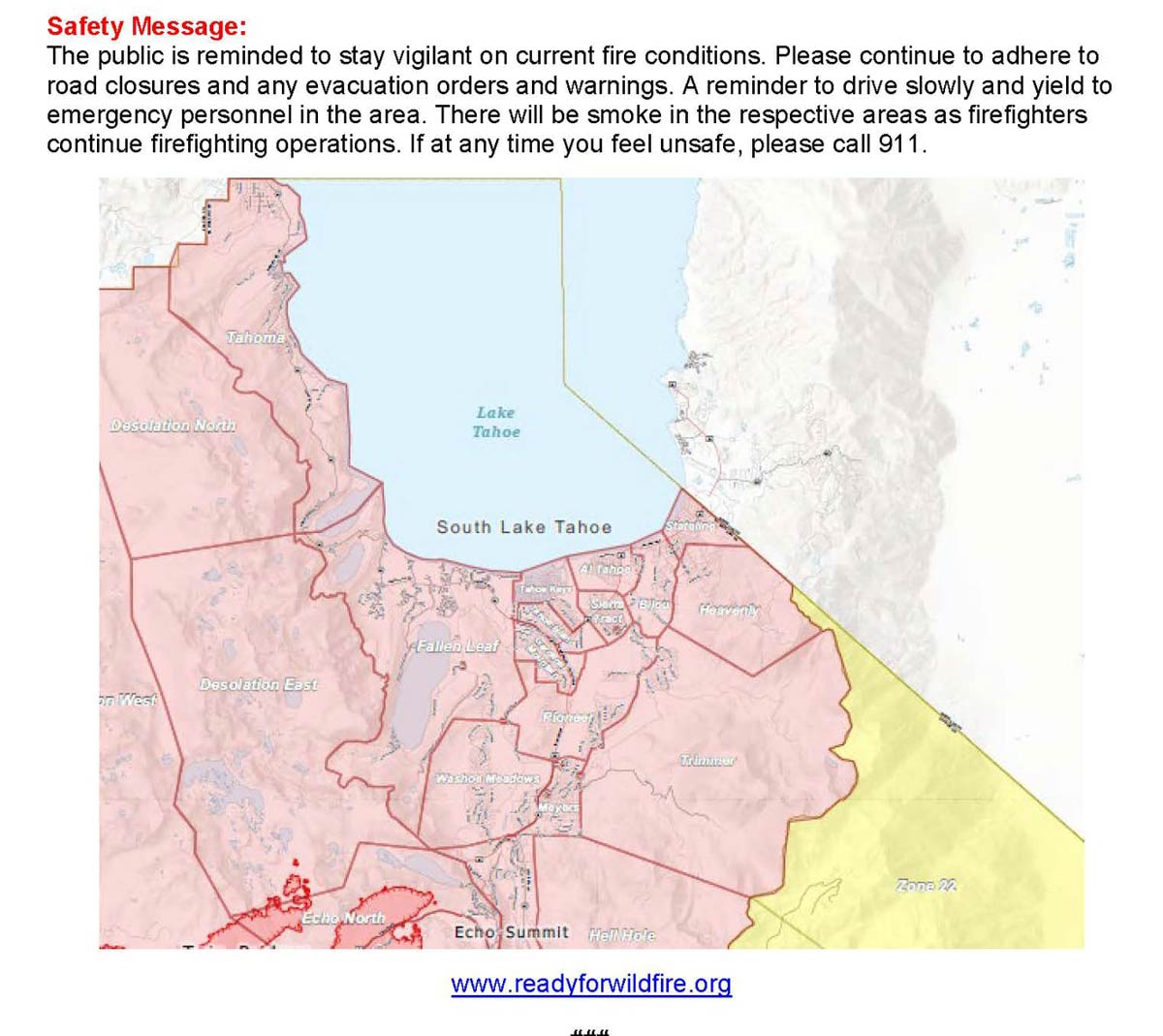
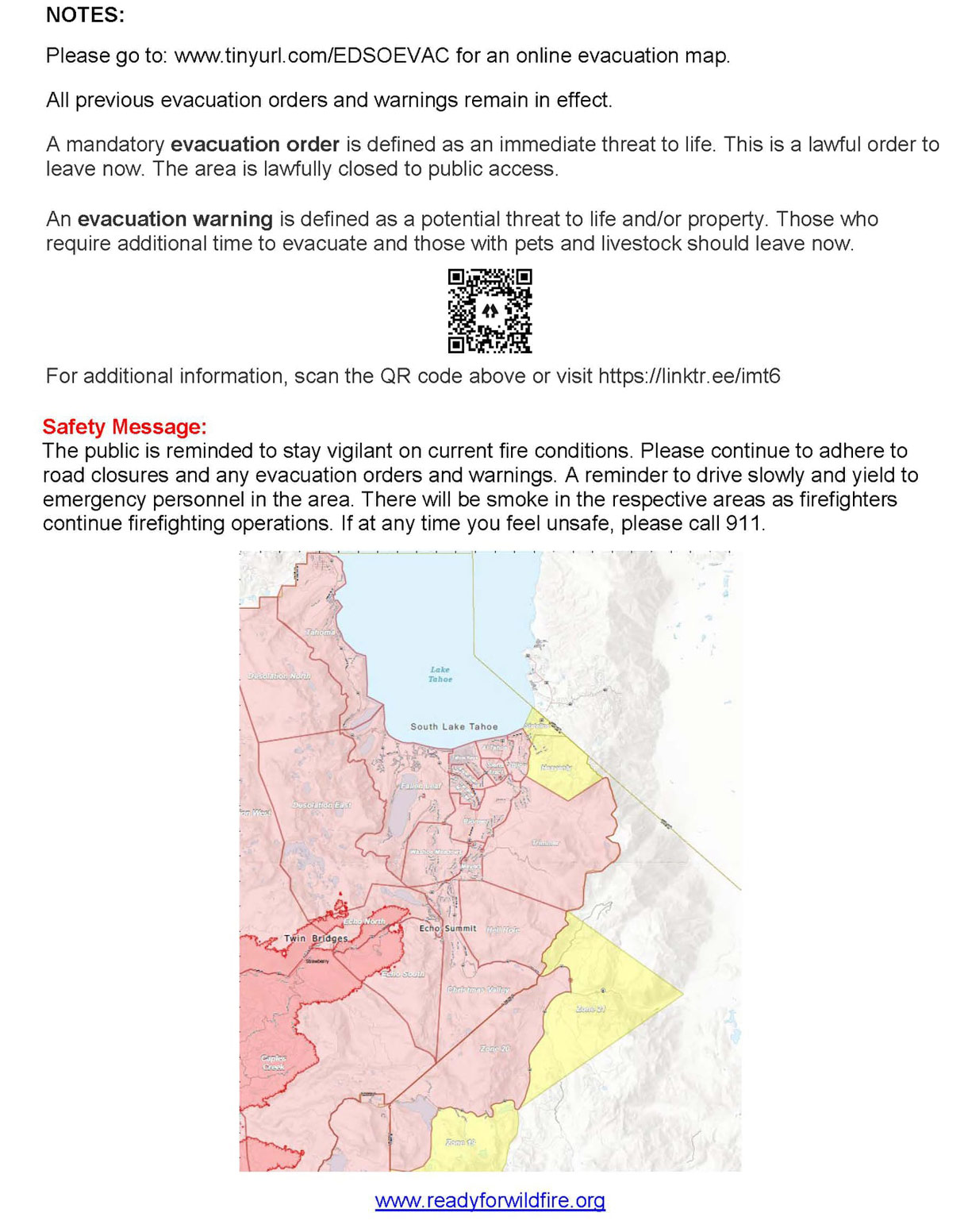
Safety Message: The public is reminded to stay vigilant on current fire conditions. Please continue to adhere to road closures and any evacuation orders and warnings. A reminder to drive slowly and yield to emergency personnel in the area. There will be smoke in the respective areas as firefighters continue firefighting operations. If at any time you feel unsafe, please call 911.
August 30, 2021 - Caldor Fire Updates to Evacuation Orders, Warnings, and Road Closures for Monday, August 30, 2021