Update: Dixie Fire – Lassen County Evacuation Warning issued - EFFECTIVE IMMEDATELY
The Lassen County Sheriff’s Office has issued new evacuation warning for the following areas:
- North Doyle area west of Hwy 395 from the County Rd A26 intersection south to Berniece Ln and all roads accessed by Pickens Rd – Zones LAS E001-C, D, E
ALL PREVIOUSLY ISSUED ORDERS AND WARNINGS REMAIN IN PLACE
Update: PUBLIC NOTICE – DIXIE FIRE – NEW EVACUATION ORDER ISSUED (5:00 P.M.)
Check the status of your address at: community.zonehaven.com
A NEW MANDATORY EVACUATION ORDER has been issued for:
- Milford and Herlong area east (lake side) of Hwy 395 from Milford Grade intersection south to County Rd A26/Garnier Rd east to Pole Line Rd north of A25 and east to but NOT including Sierra Army Depot on the south side of A25– Zone LAS-002-B, Zones LAS-E008-A, B, E002-C
ALL PREVIOUSLY ISSUED ORDERS AND WARNINGS REMAIN IN PLACE
Source: Lassen County Sheriff's Office
Update: PUBLIC NOTICE – DIXIE FIRE – EVACUATION ORDERS AND WARNINGS REDUCED FOR SOME AREAS
Check the status of your address at: community.zonehaven.com
Residents should be aware that changing conditions in fire activity may cause this area to escalate back to a mandatory evacuation order at any time. If you have evacuated large animals and ![]() vehicles, please keep them out of the area.
vehicles, please keep them out of the area.
Mandatory Evacuation Orders have been reduced to Warnings for:
- South of Hwy 36 east of Pine Town east to Willard Hill area south to the Lassen County line – Zone LAS-EO26, E017-A
- North of Hwy 36 from the Lassen County line to east to Coppervale – Zone LAS-E027-A, LAS-E029-A
Evacuation Warnings have been lifted for:
- Clear Creek, Westwood, and Pine Town area south of Hwy 36 from the Lassen County line to the eastern border of Pine Town– Zones LAS-E020, EO23, E027-B, E029-B
Mandatory Evacuation Orders remain in place for:
- Milford area west (mountain side) of Hwy 395 from Raker Place south to the intersection of County Rd A26/Garnier Rd – Zones LAS-E010-A, E009-A&B, E001A
- North of Hwy 44 from Forest Route 33NO2 east to County Rd A21 and north to Crater Lake Campground – Zones LAS-E035-F
- South of Hwy 44 from the Lassen County Line east to Devil’s Corral – Zone LAS-E028
- South of Hwy 36 south and east of Mtn Meadows Reservoir east to Old Town Rd– Zones LAS-E019, EO18
- Janesville and Milford east of the Plumas County Ln from Janesville Grade south to Milford Grade along the mountain side (unpopulated area) Zones LAS-E012-K, E010-B, C, F
Evacuation Warnings remain in place for:
- Milford and Herlong area east (lake side) of Hwy 395 from the Thunder Mountain Rd intersection south to County Rd A26/Garnier Rd. This includes the south side of County Rd A25 east to but NOT including Sierra Army Depot – Zones LAS-E011-A, E008-A, B, E002-B, C
- Herlong area north of County Rd A25 from Long Valley Cr. east to Pole Line Rd – Zone LAS-E053-B
- Antelope Mountain and Campbell Mountain area east of County Rd A21 and west of County Rd A1 – Zone LAS-E035-B and E035-I
- Janesville and Milford west of Hwy 395 from Janesville Grade south to Raker Place Zones LAS-E012-F,J LAS-E010-G&H, D, E
- Milford west (mountain side) of Hwy 395 from Milford Grade south to the intersection of County Rd A26 Garnier Rd - Zones LAS-E009-A and E001-A
- South of Hwy 36 from Devil’s Corral east to Korver Rd and south to Gold Run Rd Zone LAS-E016-G
- Bizz Johnson Trail area south of Hwy 36 from Thumper Hill east to Miller Crossing and south to Bauer Rd – Zone LAS-016-B, D, E
- Willard Creek Rd south of Hwy 36 and Korver Rd from Hwy 36 south to the fork of Korver Rd – Zones LAS-E016-A and E017-C
- Area south of Hwy 44, north of Hwy 36, west to Hog Flat Reservoir – Zones LAS-E030-A & B
- Bogard area north of Hwy 44 from Pittville Rd east to County Rd A21 and north to Blacks Mountain, Harvey Mountain and south of Ashurst Lake – Zones LAS-E035-D,E,F,G
- West of County Rd A1 from the A21 intersection north to Forest Services Route 32NO2 – Zone LAS-E035-C
Source: Lassen County Sheriff’s Office
Update: The following areas are being changed from a Mandatory Evacuation Order to an Evacuation Warning at 3:00 P.M.:
- Manzanita Mtn. Echo Lake areas. North of Hwy 36 [PLU Zone 38 A]
- Swain Mtn., Echo Lake, Star Butte area [PLU Zone 39]
- Sifford Mountain, North Stover Mountain [PLU Zone 40]
- North and Eastern parts of Indian Valley, from upper Williams Valley and upper Pecks Valley east to include all portions of North Valley Rd and Diamond Mtn. Rd. [PLU Zone 13]
- Peters Creek Area, North Arm [PLU Zone 18A/B]
![]() The Warner Valley area will remain under Mandatory Evacuation Order, until Phase One hazardous cleanup is completed.
The Warner Valley area will remain under Mandatory Evacuation Order, until Phase One hazardous cleanup is completed.
UPDATED Evacuation Zone MAP: community.zonehaven.com
*Residents should evaluate their own circumstances when determining if they will return home.
WATER: Please consult your water district authority for information on drinking water quality.
Essential services: Will likely be delayed in starting back up again. There remains potential risk of intermittent power outages for the remainder of this fire. When residents do return to burned areas, it is important to follow protocols for re-entry provided by Plumas County Environmental Health. Only those with residence in the area should enter at this time.
For more information visit www.plumascounty.us/2868/Dixie-Fire-Information
While we understand evacuated residents are understandably eager to get back to their homes and properties, the Dixie Fire is still active, and the public must remain out of Mandatory Evacuation Order zones until the orders are downgraded to warnings or lifted. There are also several health and safety hazards in affected areas that must be mitigated prior to reentry. Please do not attempt to enter restricted areas until evacuation orders are lifted. You can determine your zone and see evacuation status by entering your address on the evacuation map located at: community.zonehaven.com
In the burn area, you will encounter dangerous conditions and will be exposed to toxic materials that may include but are not limited to: Embers /hot ash, Hazardous materials, including: ash, asbestos, heavy metals, oils, fire retardants, pesticides and other hazardous materials, Puncture hazards, including: broken pipes, exposed nails, broken glass, damaged structural elements, Potential explosive hazards including: propane tanks, ammunition, and solvents, Slippery surfaces, Toxic airborne particles, Uneven ground and Unstable structures. We strongly suggest no habitation of destroyed property until property is declared clear of hazardous waste and structural ash and debris by Plumas County Environmental Health.
Roadway Conditions: Caltrans District 2 would like to remind residents returning to their properties that emergency work is underway in several areas on State Route 89 and State Route 70 due to damage from the Dixie Fire. Delays range from 1 to 2 hours depending on the location. To get the most up-to-date information on closures and delays, please visit QuickMap.dot.ca.gov
Please note area National Forest closures remain in effect.
For more information visit https://www.plumascounty.us/2868/Dixie-Fire-Information and follow the county Facebook.
For more information visit www.plumascounty.us and follow the county Facebook.
![]() Update: Dixie Fire – Lassen County Evacuation Order Issued - EFFECTIVE IMMEDIATELY (2:30 P.M.)
Update: Dixie Fire – Lassen County Evacuation Order Issued - EFFECTIVE IMMEDIATELY (2:30 P.M.)
The Lassen County Sheriff’s Office has issued new evacuation order for the following areas:
Milford area west (mountain side) of Hwy 395 from Raker Place south to the intersection of County Rd A26/Garnier Rd – Zones LAS-E010-A, E009-A&B, E001A
Source: Lassen County Sheriff’s Office
Update: Dixie Fire – Lassen County Sheriff Office New Evacuation Warnings (1:00 P.M.)
DIXIE FIRE- LASSEN COUNTY EVACUATION WARNING ISSUED - EFFECTIVE IMMEDIATELY for Herlong area north of County Rd A25 from Long Valley Creek East to Pole Line Rd – Zone LAS-E053-B
ALL PREVIOUSLY ISSUED ORDERS AND WARNINGS REMAIN IN PLACE
Check the status of your address at: community.zonehaven.com
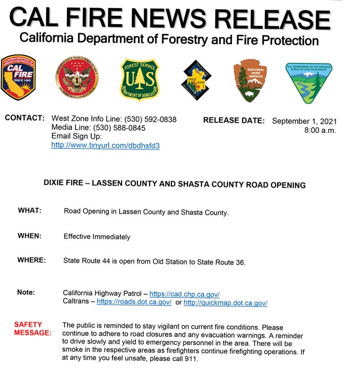
Caltrans Update: State Route 44 is now open, between the junction with State Route 89 to County Road A-21, following a closure due to the Dixie Fire.
September 1, 2021 - Dixie Fire Updates to Evacuation Orders, Warnings, and Road Closures for Wednesday, September 1, 2021.
CAL FIRE: