


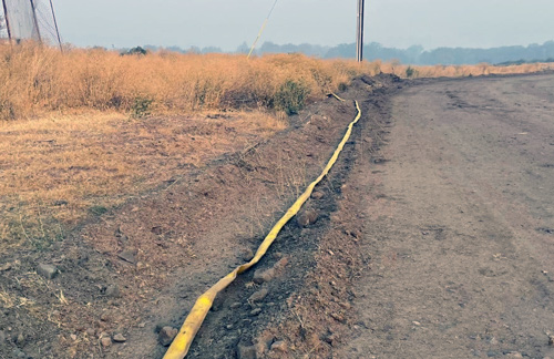
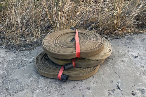
Update: Do you have fire hose or other firefighting equipment left on your property by the Dixie firefighters? If so, tell us via email or phone, and we will come and pick up the equipment. Please provide your physical address and any concerns accessing the property.
Contact:
E-mail: DixieFire2021@gmail.com
Subject: Dixie Fire Equipment
or
Phone: 530-592-0838
Source: CAL FIRE Lassen-Modoc Unit

Update: The Plumas County Emergency Operations Center has coordinated with the California Governor's Office of Emergency Services to deliver trash bins to several areas around Greenville for residents returning home to utilize for their household trash.
Please use these bins only for your regularly accumulated household trash and not to dump excess trash that you would have otherwise taken to the dump.
**This service should only be used for standard household trash, and you MUST NOT dispose of items, such as paint, solvents, car batteries, gas, oil, refrigerators, televisions, etc. **
These dumpsters will be available through Friday, September 10 (9/10)
- Evergreen Market 427 Crescent Street in Greenville
- Indian Valley Academy at 4352 Main Street in Taylorsville
- Taylorsville Campground: 125 Genesee Road
- 152 Green Meadows Lane in Greenville
- Greenville Elementary at 225 Grand Street
- 430 Main Street in Greenville
Source: Plumas County Sheriff's Office

PUBLIC NOTICE – DIXIE FIRE 9/4/2021 1:00 P.M.
EVACUATION STATUS SUMMARY
Check the status of your address at: community.zonehaven.com
Mandatory Evacuation Orders remain in place for:
- Milford area west (mountain side) of Hwy 395 from Milford Grade south to the intersection of County Rd A26/Garnier Rd – Zones LAS - E009-A&B, E001A
- Milford and Herlong area east (lake side) of Hwy 395 from Milford Grade intersection south to County Rd A26/Garnier Rd east to Long Valley Creek - Zones LAS-E008-A, B, E002-C
- North of Hwy 44 from Forest Route 33NO2 east to County Rd A21 and north to Crater Lake Campground – Zones LAS-E035-F
- South of Hwy 44 from the Lassen County Line east to Hog Flat Reservoir – Zones LAS-E028, E031A
- South of Hwy 36 south and east of Mtn Meadows Reservoir east to Old Town Rd– Zones LAS-E019, EO18
- Janesville and Milford east of the Plumas County Line from Janesville Grade south to Milford Grade along the mountain side (unpopulated area) Zones LAS-E012-K, E010-B, C, F
Evacuation Warnings remain in place for:
- Milford area west (mountain side) of Hwy 395 from Raker Place south to Milford Grade – Zone LAS-E010-A
- North Doyle area west of Hwy 395 from the County Rd A26 intersection south to Bernice Ln and all roads accessed by Pickens Rd – Zones LAS E001-C, D, E
- Milford area east (lake side) of Hwy 395 from the Thunder Mountain Rd intersection south to Milford Grade intersection. – Zone LAS-E011-A
- Herlong area north of County Rd A25 from Long Valley Creek east to Pole Line Rd - Zone LAS-E053-B
- Herlong Proper south of County Rd A25 from Long Valley Creek east to Sierra Army Depot and south to County Rd A26, including all residences accessed off of County Road A26 - Zone LAS-E002-B
- Janesville and Milford west of Hwy 395 from Janesville Grade south to Raker Place Zones LAS-E012-F,J LAS-E010-G&H, D, E
- South of Hwy 36 east of Pine Town east to Coppervale – Zone LAS-EO26
- North of Hwy 36 from the Lassen County line to east to County Rd A21 – Zone LAS-E027-A
- Antelope Mountain and Campbell Mountain area east of County Rd A21 and west of County Rd A1 – Zone LAS-E035-B and E035-I
- Bogard area north of Hwy 44 from Pittville Rd east to County Rd A21 and north to Blacks Mountain, Harvey Mountain and south of Ashurst Lake – Zones LAS-E035-D,E,F,G
- West of County Rd A1 from the A21 intersection north to Forest Services Route 32NO2 – Zone LAS-E035-C
Source: Lassen County Sheriff's Office
As of 1:00 P.M. Plumas County is making the following changes:
The following areas are being changed from a Mandatory Evacuation Order to an Evacuation Warning:
- Canyon Dam [PLU Zone 5C]
- Harkness and Warner Valley, Kelly Mountain [ PLU Zone 41]
UPDATED Evacuation Zone MAP: community.zonehaven.com
*Residents should evaluate their own circumstances when determining if they will return home.
Roadway Conditions: Caltrans District 2 would like to remind residents returning to their properties that emergency work is underway in several areas on State Route 89 and State Route 70 due to damage from the Dixie Fire. Delays range from 1 to 2 hours depending on the location. To get the most up-to-date information on closures and delays, please visit QuickMap.dot.ca.gov.
WATER: Please consult your water district authority for information on drinking water quality.
Essential services: Will likely be delayed in starting back up again. There remains potential risk of intermittent power outages for the remainder of this fire. When residents do return to burned areas, it is important to follow protocols for re-entry provided by Plumas County Environmental Health. Only those with residence in the area should enter at this time. For more information visit plumascounty.us/2868/Dixie-Fire-Information
While we understand evacuated residents are understandably eager to get back to their homes and properties, the Dixie Fire is still active, and the public must remain out of Mandatory Evacuation Order zones until the orders are downgraded to warnings or lifted. There are also several health and safety hazards in affected areas that must be mitigated prior to reentry. Please do not attempt to enter restricted areas until evacuation orders are lifted. You can determine your zone and see evacuation status by entering your address on the evacuation map located at: community.zonehaven.com.
In the burn area, you will encounter dangerous conditions and will be exposed to toxic materials that may include but are not limited to: Embers /hot ash, Hazardous materials, including: ash, asbestos, heavy metals, oils, fire retardants, pesticides and other hazardous materials, Puncture hazards, including: broken pipes, exposed nails, broken glass, damaged structural elements, Potential explosive hazards including: propane tanks, ammunition, and solvents, Slippery surfaces, Toxic airborne particles, Uneven ground and Unstable structures. We strongly suggest no habitation of destroyed property until property is declared clear of hazardous waste and structural ash and debris by Plumas County Environmental Health.
Please note area National Forest closures remain in effect.
The evacuation warning for the following areas have been lifted:
- South portion of Hwy 147, North of Canyon Dam area, including Dyer Mountain [PLU Zone 10A]
- Indian Falls, Northwest of Round Valley Lake to Long Valley Mine and north to Hwy 89 [PLU Zone 011]
- North and Eastern parts of Indian Valley, from upper Williams Valley and upper Pecks Valley east to include North Valley Road south to Nelson St and all of Diamond Mtn. Rd.
[PLU Zone 013]
- Area north of Diamond Mountain Road [18A]
- Lone Rock, Includes Moonlight Valley, Engel Mine, Lone Rock Valley, and a portion of Growers Blvd. USFS Rd. 28N32 intersection of Plumas/Lassen line, and east to Diamond Mountain area, south to Lone Rock [PLU Zone 19]
This area is deemed safe from active fire though residents should stay alert to changing conditions.
Remember the fire is still active within the burned area and you may see spots of smoke. Fire personnel will still be actively working the interior and edges of the fire. Expect to see hotspots for some time. Do not call 911 to report unless there is an immediate threat to life or property.
Be vigilant to weather and wind conditions and take any future orders seriously, should they change.
Just because the flames are out doesn’t mean the danger is over. Damaged trees/terrain and flash flooding are just some of the dangers that exist after a wildfire. DO NOT put yourself or your loved ones in danger by exploring.
While returning home and while fire personnel remain in the area use caution, reduce your speed, drive with your headlights on and yield to emergency personnel.
*National forest closures remain in effect.
Source: Plumas County Sheriff's Office
DIXIE FIRE - EVACUATION ORDER AND WARNINGS REDUCED FOR SOME AREAS
September 4, 2021 - Residents should be aware that changing conditions in fire activity may cause areas under evacuation warning to escalate back to mandatory evacuation orders at any time. If you have evacuated large animals and vehicles, please keep them out of the area.
Lassen County mandatory evacuation orders have been reduced to evacuation warnings and some warnings have been lifted.
EFFECTIVE IMMEDIATELY:
Mandatory evacuation orders have been reduced to evacuation warnings for the following areas:- Milford area west (mountain side) of Hwy 395 from Raker Place south to Milford Grade – Zone LAS-E010-A
- Juniper Lake and Snag Lake area east of the Lassen County Line – Zone LAS-E031-B (this area remains closed due to the Lassen Volcanic National Park closure)
EVACUATION WARNINGS HAVE BEEN LIFTED for the following areas:
- South of Hwy 36 from Coppervale east to Korver Rd south to the Lassen County line – Zone LAS-EO17-A, B, C, E016-A, G
- North of Hwy 36 from Coppervale east to the Hwy 44 junction and north to Hwy 44 – Zones LAS-E030-A, B
- North of Hwy 36 from County Rd A21 east to Coppervale and north to McCoy Rd but not including Pegleg Mtn area – Zone LAS-E029-A
ALL OTHER EVACUATION ORDERS AND WARNINGS REMAIN IN EFFECT.
SAFETY MESSAGE: Be aware that there will be an increase presence of law enforcement and fire personnel working in the area. Use caution, drive with your headlights on, and yield to emergency personnel. Please see the attached information about returning home after wildfire which can be found at https://www.readyforwildfire.org.
