


California and National Drought Summary for June 13, 2017
Summary
June 15, 2017 - After a rather wet May with near- to slightly below normal temperatures and generally favorable growing conditions, the central Plains and Midwest have abruptly become dry and warm during the past several weeks, raising concerns of rapid top soil moisture loss and declining crop conditions. In contrast, slow-moving Pacific systems crept across the Northwest and into the northern Plains, bringing unsettled weather to the region including measurable snow to higher elevations of the Sierras while also producing scattered thunderstorms to parts of the drought-stricken Dakotas late in the period. In the Southeast, a stalled front combined with the start of Florida’s rainy season, dumped moderate to heavy rainfall (2-8 inches, locally over a foot) along the coastal areas of the eastern Gulf and southern Atlantic coasts, especially in Florida. In Hawaii, recent drier weather on windward sides of Maui and the Big Island led to D0 expansion, while wetter weather in Alaska eased wild fire conditions.Northeast
After New England and the mid-Atlantic (Northeast) finally became D0-free last week due to a very wet May, much drier weather during the past 30-days, combined with rising temperatures, low humidity, and windy conditions, have rapidly reduced top soil moisture, especially in areas farther west (e.g. Midwest and Plains). In western West Virginia (and into southern Ohio), however, about half of normal precipitation has fallen since mid-May (1-2.5 inches), and with short-term average USGS stream flows starting to drop below the 25th percentile (below normal), D0 was introduced to western West Virginia. Parts of the mid-Atlantic (MD and southeast PA) will be watched for possible D0 next week as readings have recently soared from below- to well-above normal levels, along with 30-day shortages.Southeast
A stalled cold front and ample Gulf moisture generated widespread and heavy showers and thunderstorms (2-6 inches) throughout Florida and along coastal areas of the eastern Gulf and southern Atlantic. Locally, up to 13 inches of rain soaked southern Florida, with 2-week totals approaching 20 inches. With the second consecutive week of ample rainfall across Florida and southern Georgia, major improvements (1 and 2 category changes) were made as short-term (1-3 months) indices were normal or wet; however, longer-term indices remained below normal, thus D1(L) was left across central Florida. For example, Orange, southern Sumter and Lake, Brevard, Polk, and Osceola counties still had 3-5 inch deficits since January 1, including a 7.49 inch shortage at Orlando. In northern and southern Florida where 1- and 2-week totals were greater and long-term deficits lower than in central areas, this week’s rainfall effectively removed all drought and dryness there. In southern Georgia, improvements were tempered as the weekly totals were lower than in northern Florida (2-6 inches), and some longer-term deficits and below-normal USGS stream flows remained. In central Georgia and coastal South Carolina, enough rain (2-4 inches) fell to remove some D0 in southeastern areas of central Georgia while erasing D0 in the latter area. A small area of D0 was also removed in east-central Alabama as no deficits remained in the short and long-term. The small areas of D0 and D1 were unchanged in northwestern Alabama and northern Georgia.South
Drier weather covered most of the region as temperatures began to increase late in the week after a relatively cool period the past 4-6 weeks. Exceptions to the dryness included scattered showers (0.5-2 inches) across Louisiana, Mississippi, and southern Arkansas, from western Oklahoma southeastward into the Dallas-Ft. Worth area, and in parts of the Texas Panhandle and southwestern Texas. Some small improvements were made in Texas where the heaviest rain fell, but overall conditions mostly deteriorated as June is normally a wet month for Texas and Oklahoma (and northward into the northern Plains). As a result of subnormal rainfall the past 30-days and increasing heat, D0 expanded in the 2 states, along with the addition of a few small new D1 areas in western Texas and southern Oklahoma. The deterioration could have been worse if it was not for the subnormal temperatures of May and early June. According to the USDA/NASS on June 11, corn, rice, cotton, sorghum, winter wheat, oats, and pastures were rated mostly fair to excellent in Texas and Oklahoma.Midwest
After a wet and seasonable May, little or no rain has fallen from central Nebraska eastward into western Ohio during the past 14-days, and less than 50% of normal precipitation has occurred during the past 30-days in northern Missouri, southern and eastern Iowa, most of Illinois, northwestern and southwestern Indiana, southwestern Michigan, and southern Ohio. After some cool weather in late May and early June, much warmer air has recently pushed into the region, and when combined with low humidity and windy conditions, the shallow-rooted corn (from being planted in wet soils) has started to become stressed. Reported impacts from across the Midwest include turf and fescue turning brown, corn beginning to roll, and corn yellowing due to inability of potassium uptake. In general, corn that is well-established is in good shape, but younger corn and soybeans are showing stress with their shallower root system. In Illinois, 3% of the topsoil was rated very short and 38% short on June 11 while 2 weeks ago it was rated 74% adequate, 25% surplus, and just 1% short. Other Midwestern states have seen big drops in their topsoil moisture, with states rated short or very short included: NE (40), IA (40), MO (30), IN (37), and MI (42). The best environment for root growth is just as the soil is drying out so that the roots follow the moisture down, promoting deep rooting. Then, once the roots are deeply established, a wet July and August would be ideal. A nice summary of current Midwest crop conditions (from Virgil Schmidt, Iowa State agronomist for eastern Iowa) stated “we are not in trouble yet, but we are going to need some cooperation from Mother Nature to avoid getting into trouble”. Accordingly, D0 was added to areas where 30-day precipitation was less than 50% as a “head’s up”, and D1 was added in northern Missouri where 60-day precipitation was also less than 50% (they missed out on May’s wetness), accumulating deficits of 4-8 inches.Farther north, D0 and D1 remained in northwestern Minnesota (along with drought in the Dakotas and eastern Montana, see High Plains) as 7-day totals of 0.5-1.5 inches were not enough to warrant improvements except for some slight D1 removal in Kittson, Roseau, and Marshall counties. In contrast, D1 was expanded southward in Clearwater, Beltrami, Itasca, and Koochiching counties to better match the precipitation ranking (between 2-15 driest, or about 50% of normal) since April 1.
High Plains
After a dry and hot (highs in the 90s and 100s degF) early June, a system finally tracked across the northern Plains, somewhat lowering temperatures but finally bringing rain (1-3 inches) to parts of the Dakotas by the end of the week. For the most part, the rains were not great enough to make sizeable improvements to the drought, but where 1.5 or more inches fell, especially in eastern sections of the Dakotas, drought was reduced. For example, 2-4 inches of rain fell on portions of Spink, Clark, and Codington counties in South Dakota, allowing for a 1-category improvement there. D1 was also slightly trimmed in south-central South Dakota and southeastern North Dakota where bands of 1.5-2.5 inches of rain fell. D0 was removed in extreme southeastern Montana and northeastern Wyoming where short and long-term SPIs were close to normal or even wet. In contrast, downgrades were made in northeastern Montana where April-June are normally the wettest months of the year. D0 and D1 were expanded westward, and D2 was added to encompass locations such as Glasgow, Circle, Fort Peck, Jordan, Brockway, and Saco that reported their first or second driest April 1-June 12 period on record. Totals ranged from 0.8-1.31 inches, or 14-29% of normal. In the central Dakotas, lower totals (0.2-0.5 inches) plus the heat (weekly anomalies +6 to 10 degF) did little to halt deterioration as the existing D2 area expanded westward and northward in ND and southward into SD. D0 also pushed into extreme northern Nebraska and southeastern South Dakota. Even with the rainfall (and additional rains that fell after the 12Z Tuesday cutoff), it will take a while for the vegetation to respond to the moisture. Until then, cattle producers were waiting in line to reduce herd sizes, and a ND hotline for hay has been busy. Crop-wise, spring wheat conditions in the June 11 USDA/NASS report was rated poor or very poor in MT (31%), ND (17%), and SD (57%). Similarly, ND (53%), SD (45%), and MT (22%) pasture and range conditions were in similar poor to very poor shape. Elsewhere, 30-day percentages below 50% were found in eastern Kansas, hence D0 was added, based upon the criteria for short-term flash dryness as depicted in the Midwest and South.West
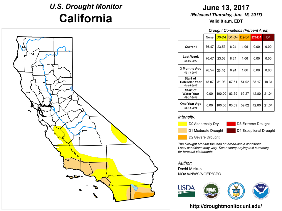
June is normally dry and warm across much of the West, especially in the Southwest between the end of the wet winter season (Dec-Apr) and before the onset of the southwest monsoon season (Jul-Sep). Farther to the north, however, unsettled weather brought unseasonably wet and cool conditions to the Northwest (1.5-4 inches of precipitation to coastal Oregon, southern Cascades, south-central Idaho, and southwestern Montana), northern Great Basin, and northern California, including measurable snow to the highest elevations of the Sierra Nevada. As of June 13, nearly all of the major California reservoirs were above their historic average capacities (except Perris and Cachuma in the south coast) while Sierra statewide average snow water equivalent was at 8.4 inches, or 169% of normal. In New Mexico, scattered showers (0.5-2 inches) in south-central portions were enough to trim back some of the D0 (also in southwestern Texas) north of the El Paso area. Elsewhere, no changes were made in the West.Alaska, Hawaii, and Puerto Rico
In Hawaii, despite persistent trade wind conditions during May, totals were rather low on Maui, thus D0 was added. Interestingly, the Upcountry (leeward) part of Maui received decent rains during May in contrast to the normally wetter windward side, thus no D0 was added there. On the Big Island, the Kona coffee belt has been receiving ample rain, therefore D1 was improved to D0. On the windward side, Hamakua and South Kohala Districts have received subnormal rainfall, so the existing D0 was expanded northeastward. The remaining islands were unchanged.In Alaska, there were several lightning-induced wild fires burning in southwestern sections. As of June 12, there were 13 active fires burning in the area which encompasses 88 million acres between McGrath and Dillingham. Fortunately, recent rains (0.5-1.5 inches) have quelled wildfire activity across the Interior, allowing for fire fighters to focus their attacks on the southwestern fires. With the summer months normally the wettest time of the year, hopefully the rains will continue. But for now, this week’s rains were enough to halt further deterioration, but not great enough to provide drought improvement. Therefore, no changes were made to Alaskan drought conditions.
Looking Ahead
During the next five days (June 15-19), WPC’s 5-day QPF forecasts widespread rainfall across most of the Midwest, Southeast, central Appalachians, and Great Lakes region, with the greatest totals (2-3 inches) from northern Missouri eastward into western Pennsylvania and southward into the Carolinas. Rain should also fall on coastal Washington and the northern Rockies. Dry weather should encompass the rest of the West, High Plains, Texas, and western Gulf Coast. Temperatures should average above-normal across the southern two-thirds of the U.S., with subnormal readings limited to the northern sections of the Rockies and Plains and upper Midwest.For the ensuing five-day period (June 20-24), odds favor sub-median precipitation in the Northwest, Rockies, northern three-quarters of the Plains, and western Corn Belt, while above-median rainfall is likely along the Atlantic and eastern Gulf Coast States, Great Lakes region, and the eastern half of Alaska. Above-normal temperatures are likely in the western half of the U.S., Florida, and the northern and southwestern coasts of Alaska, with subnormal readings in the Great Lakes region, Midwest, and southeastern Alaska.
Author(s):
David Miskus, NOAA/NWS/NCEP/CPC
Dryness Categories
D0 ... Abnormally Dry ... used for areas showing dryness but not yet in drought, or for areas recovering from drought.Drought Intensity Categories
D1 ... Moderate DroughtD2 ... Severe Drought
D3 ... Extreme Drought
D4 ... Exceptional Drought
Drought or Dryness Types
S ... Short-Term, typically <6 months (e.g. agricultural, grasslands)L ... Long-Term, typically >6 months (e.g. hydrology, ecology)
Source: National Drought Mitigation Center
