


California and National Drought Summary for August 1, 2017
Summary
August 3, 2017 - Rain fell in much of the country last week with the greatest amounts occurring in a band that extended from the Southwest to the Great Plains and across much of the eastern half of the country. Rainfall bypassed the Northwest, south-central U.S., and parts of the north-central U.S. Continued precipitation deficits combined with above normal temperatures resulted in an expansion of abnormal dryness and drought. Seasonal monsoon showers in the Southwest alleviated lingering short-term dryness and began to chip away at the long-term deficits. Rainfall in the Plains and Midwest brought relief to a few locations and staved off degradation in others.Northeast
The southern part of the region generally saw above normal rainfall this past week while much of the northern portion received below normal rainfall. In most locations the dry areas were a welcome break from the wet spring and summer. The exception was in eastern Maine where precipitation departures of 2 to 6 inches and low stream flow led to the expansion of abnormally dry areas and the introduction of moderate drought.Southeast
Cooler than normal temperatures prevailed over much of the southeast this past week with the exception of Florida where temperatures averaged more than 3 degrees above normal. Localized rainfall of 2 to 4 inches alleviated moderately dry conditions in western Virginia and northwest Alabama. Meanwhile, continued dryness across central North Carolina led to an expansion of abnormally dry conditions. Rainfall has been 2 to 4 inches below normal over the last 30 days accompanied by low stream flows and reports of heat and drought stress on crops, native trees and shrubs, and lawns. Below normal rainfall in Virginia led to the continuation of abnormally dry conditions.South
Rainfall of up to 4 inches was reported across the Texas and Oklahoma Panhandle resulting in improvements in these areas. Temperatures of 2 to 5 degrees above normal, combined with continued rainfall deficits led to an expansion of abnormally dry as well as moderate and severe drought conditions in south Texas. Eastern Oklahoma saw an expansion of abnormally dry conditions in response to growing precipitation deficits and reports of impacts to agriculture by local FSA offices. With the exception of a small pocket of lingering abnormal dryness in northwest Mississippi, the remainder of the regions remains free of abnormal dryness and drought.Midwest
Temperatures of 3 to 5 degrees above normal in northern Minnesota combined with continued precipitation shortfalls led to an expansion of abnormally dry and moderate drought conditions. Iowa had pockets of improvement and degradation contingent on where rainfall have fallen. In southwest Iowa, moderate and severe drought was expanded in response to rainfall departures of 4 to 10 inches over the last 90 days, low soil moisture, reports of stress on crops, and poor pasture growth. Despite locally heavy rains, pockets of dryness continue to exist in Illinois and Missouri. Moderate drought was introduced this week in an area extending to the southwest of the Illinois-Missouri border. Rainfall deficits of over 4 inches have occurred since June 1. USDA reports 42 percent of the topsoil is very short (significantly less than what is required for crop growth) in that reporting district with reports of poor pastures, supplemental feeding to cows, and the culling and selling herds.High Plains
Scattered showers in the Plains brought drought relief to a few isolated locations and merely stalled the deterioration in others. In North Dakota, temperatures in excess of 5 degrees above normal, combined with a continued lack of rainfall led to an expansion of abnormally dry, moderate drought, and severe drought in the east. A one category improvement, from severe to moderate drought, was made over the south-central part of the state near the South Dakota border in response to locally heavy rainfall that improved many of the drought indicators including stream flow, soil moisture, and evaporative demand. However, impacts to vegetation are generally set with the rainfall having come too late in the season to improve things. Conditions in the remainder of the state remain unchanged. USDA reports nearly three-quarters of the state’s topsoil is short to very short and reports of agricultural impacts are widespread. North Dakota Governor Doug Burgum has declared a drought disaster for most of the state.In South Dakota, two weeks of localized rainfall brought a mixture of improvements and degradations to the eastern half of the state. Moderate drought was reduced slightly in central South Dakota and a one-category improvement was made near the east-central border where reports of 12 inches of rainfall fell. The southeastern part of the state missed out on the heavy rains. Leading to the expansion of moderate drought into the area. The western part of the state remained status quo.
As with the Dakotas, patchy rainfall also occurred in Nebraska and Kansas. Nebraska saw a small reduction in abnormal dryness in the east-central part of the state where locally 3-5 inches were reported last week. Kansas saw a reduction in abnormally dry conditions in the southwest part of the state and an increase in the southeast.
West
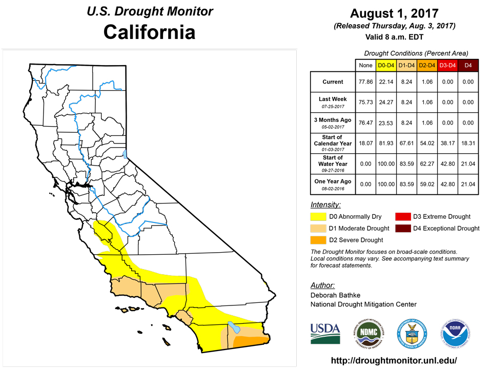
Last week, the west was marked by hot, dry conditions in Montana, the Northwest, and California. Meanwhile, cooler than normal temperatures and monsoonal rainfall in the southwest. Oregon, Washington, and Idaho all saw an expansion of abnormally dry conditions as temperatures of 4 to 8 degrees above average combined with persistent precipitation deficits dried out vegetation and stressed water supplies.Another week with little to no rainfall in Montana left western portions of the state with precipitation deficits of 2 to 4 inches and eastern portions with 4 to 8 inches. Severe drought was expanded slightly in the northeast part of the state and moderate drought was expanded in the northwest in response to the continued lack of rainfall, high evaporative demand, and widespread reports of impacts. USDA reports 96 percent of the state’s topsoil is short to very short and Governor Steve Bullock has signed an executive order declaring a statewide fire emergency.
Abundant rainfall in the southwest due to increased monsoonal moisture, led to the removal of many of the abnormally dry conditions in southern Nevada, central and southeastern Utah, western Colorado, eastern Arizona, and over much of New Mexico.
Alaska, Hawaii, and Puerto Rico
No changes were made in Hawaii on this week’s map. The Hawaiian Islands are currently experiencing moderate and severe drought. Rainfall over the last week has helped to stabilize conditions the conditions on the Big Island. In Alaska, abnormally dry and moderate conditions remain across much of the western portions of Alaska with precipitation in the interior and southcentral portions of the state at less than 25 percent of normal in many locations. A pocket of abnormal dryness was introduced over the Yukon Flats. In Puerto Rico, moderate drought was introduced along the southern coast. The National Weather Service office reports precipitation deficits of up to 6 inches in this area and decreasing well levels.Looking Ahead
In the two days since the Tuesday morning cutoff time for this week’s map, monsoon showers and thunderstorms have continued to bring precipitation to the southwestern U.S. For August 2nd to the 7th, the National Weather Service’s Weather Prediction Center forecasts rainfall across many of the drought afflicted regions of the country. The highest totals, up to 3 inches, of rain is forecast for Oklahoma and the upper Midwest. One to 1.5 inches is forecast for the eastern Great Plains and much of Texas, while the western half of the Great Plains, west and south Texas, and the long-term drought areas in southern California and Arizona could see about a half inch. The Pacific Northwest and western Montana are expected to see little or no precipitation and continued high temperatures ranging from 5 to 15 degrees above normal. Much of the rest of the country is expected to experience cooler than normal conditions.Author(s):
Deborah Bathke, National Drought Mitigation Center
Dryness Categories
D0 ... Abnormally Dry ... used for areas showing dryness but not yet in drought, or for areas recovering from drought.Drought Intensity Categories
D1 ... Moderate DroughtD2 ... Severe Drought
D3 ... Extreme Drought
D4 ... Exceptional Drought
Drought or Dryness Types
S ... Short-Term, typically <6 months (e.g. agricultural, grasslands)L ... Long-Term, typically >6 months (e.g. hydrology, ecology)
Source: National Drought Mitigation Center

