


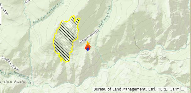
Approximate Location
37.55 latitude, -119.15 longitude
August 13, 2017 - The Butte Fire in the Sierra National Forest now at 630 acres and 40% contained as of Sunday morning.
The fire is located in the Ansel Adams Wilderness. Suppression resources are at scene and engaged. A Temporary Flight Restriction (TFR) is in place over the fire.
Moderating fire behavior allowed fire crews to make good progress yesterday. Smoke impact from area fires is a concern. Current imagery and information is available at the California Smoke Blog: http://californiasmokeinfo.blogspot.com/
Basic Information
| Current as of | 8/13/2017, 9:11:43 AM |
|---|---|
| Incident Type | Wildfire |
| Cause | Lightning |
| Date of Origin | Monday August 07th, 2017 approx. 12:00 AM |
| Location | Ansel Adams Wilderness |
| Incident Commander | Mark Smith |
Current Situation
| Total Personnel | 145 |
|---|---|
| Size | 630 Acres |
| Percent of Perimeter Contained | 40% |
| Fuels Involved | Mixed Conifer and Red Fir. Heavy dead and down fuels. |
Current Weather
| Weather Concerns | Continued warm and dry |
|---|
