


May 24, 2018 - Imagine boxes and cabinets stuffed with decades of paper annexation documents filed by property owners. Finding the history of a particular plot of land starts with a deep dive into parcel maps and assessor records just to discover 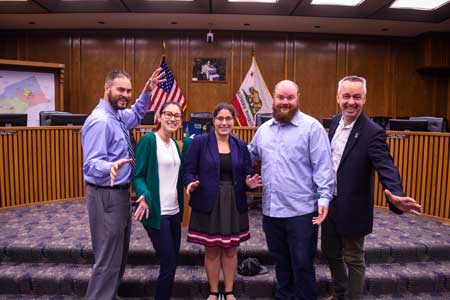 who that might have been.
Now envision calling up an aerial view of Merced County and clicking on the property of interest. A white box pops open with the annexation name and links to key documents that can be downloaded and printed instantly.
How-it’s-always-been-done, meet the Stan State upgrade.
Eight University students in a service learning geography class spent the spring semester piloting Merced County’s shift to user-friendly digital archiving. A second group in the same class started a project to map sites where first responders may need to accommodate special needs or language barriers.
The Planning Issues course (GEOG 4930) teamed student interns with county departments through guest instructor Gene Barrera, manager of the Merced County Geographic Information Systems (GIS) Division. Barrera holds a master’s degree in city and regional planning.
Merced County’s Local Agency Formation Commission (LAFCo) launched the county toward its digital future with an estimated 400 hours of student time. The students gained highly marketable skills in using Esri ArcGIS Online, field experience and a network of personal contacts and references. The software merges data analytics and GIS mapping with artistic display capabilities, a powerful next generation tool to showcase information.
The Stan State student geographers presented their project to LAFCo officials at a meeting on May 16, answering questions and demonstrating the online pilot. “I see the value in it,” said Commissioner Scott Silveira. “A whole warehouse we can fit on a computer.”
“This is information used by decision-makers. It is a powerful way to visualize data and statistics because it puts it in a map,” Barrera said.
“The amount of time saved by this project is astronomical,” said Stan State intern Logan Malavey. “The project is online. All you need is a smart phone to access it. One thing I thought about as we went through the actual boxes, these paper documents may just have been handled for the last time.”
All counties could benefit from the use GIS of data, from the tax collector to public works, said intern Chad Johnson, who also works in the Stanislaus County surveyor’s office. “I can say with confidence the simplicity and usability and instant access to information that has been created here is outstanding. I’ve worked with other counties’ GIS systems and been frustrated,” Johnson said. “It’s going to be a very valuable tool.”
The student team got through only a fraction of the records Merced County needs to upload, spending much of their time developing a workflow and online framework," said intern Amanda Leung. “We created a step-by-step workflow. Even beginners can do it,” she said.
“It’s brilliant that they came up with all this. They are hugely employable,” said Bill Nicholson, Merced LAFCo executive officer. Nicholson added he hopes there are more Stan State interns in Merced County’s future.
The second group of student interns working with the Office of Emergency Services demonstrated their project earlier in May at a workshop for county agencies. The students used block-by-block census data and county Public Health Department information to map sites where an emergency might call for extra manpower — such as nursing homes — or extra translators. Location data around extra needs can combine with other disaster preparedness maps — floodplains, for example — to help guide emergency planning.
“Mapping populations with functional needs can give greater insight into knowing where the community is most vulnerable,” Barrera said. “When a disaster strikes, knowing what you need and how to find it can be the key factor that saves lives, resources and critical infrastructure.”
Stan State students can point to their work on such projects with personal pride, professional acclaim and college credit, part of the Stan State focus on connecting curriculum to community needs.
“The Office of Service Learning (OSL) is proud of our faculty and students who develop and implement outstanding programs that expand the classroom into the community,” said Brett Forray, OSL administrative analyst. “These collaborations not only prepare our students to become leaders in their field, but their efforts also provide valuable contributions to our partner agencies in the region.”
Source: Stanislaus State

