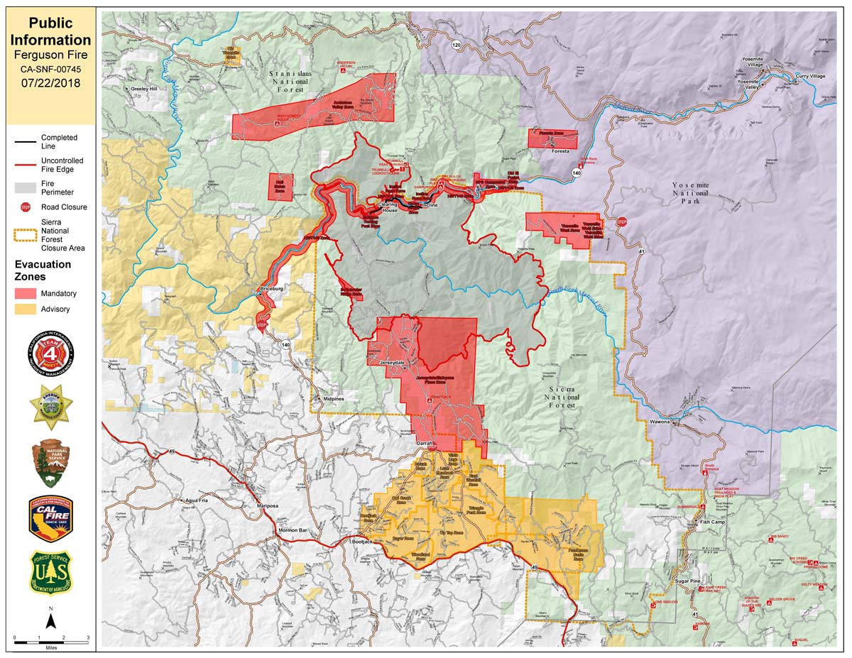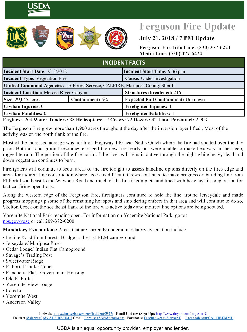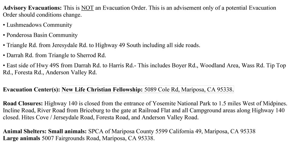
UPDATED: Sunday Map
CLICK HERE FOR A LARGE MAP (3,000 Pixels Wide and 2MB)
Click here for the Sierra Sun Times Scanner
Reminder: Scanner Information is NOT Official
Click here for Saturday's Information on the Ferguson Fire
Update: 9:26 P.M.
Basic Information
|
Current as of |
7/22/2018, 9:25:27 PM |
|
Incident Type |
Wildfire |
|
Cause |
Unknown |
|
Date of Origin |
Friday July 13th, 2018 approx. 08:30 PM |
|
Location |
Highway 140 and Savages Trading Post |
|
Incident Commander |
Jay Kurth, California Interagency Incident Management Team 4(CIIMT4) |
|
Coordinates |
37.652 latitude, -119.881 longitude |
Current Situation
|
Total Personnel |
3,066 |
|
Size |
32,484 Acres |
|
Percent of Perimeter Contained |
6% |
|
Fuels Involved |
Brush and timber, burning is steep inaccessible terrain. |
|
Significant Events |
Hwy 140 is closed from 1.9 miles east of Midpines to the Cedar Lodge area MOTORISTS ARE ADVISED TO USE AN ALTERNATE ROUTE |
Outlook
|
Remarks |
CAIMT4 (Kurth) is in unified command with Billy See, CALFIRE and Doug Binnewies, Mariposa County Sheriff |
Update: 7:00 P.M. Fire is now at 32,484 Acres, with 6% Containment
Update: 6:00 P.M. Fire is now at 30,493 Acres, with 6% Containment
Basic Information
|
Current as of |
7/22/2018, 6:00:55 PM |
|
Incident Type |
Wildfire |
|
Cause |
Unknown |
|
Date of Origin |
Friday July 13th, 2018 approx. 08:30 PM |
|
Location |
Highway 140 and Savages Trading Post |
|
Incident Commander |
Jay Kurth, California Interagency Incident Management Team 4(CIIMT4) |
|
Coordinates |
37.652 latitude, -119.881 longitude |
Current Situation
|
Total Personnel |
2,903 |
|
Size |
30,493 Acres |
|
Percent of Perimeter Contained |
6% |
|
Fuels Involved |
Brush and timber, burning is steep inaccessible terrain. |
|
Significant Events |
Hwy 140 is closed from 1.9 miles east of Midpines to the Cedar Lodge area MOTORISTS ARE ADVISED TO USE AN ALTERNATE ROUTE |
Outlook
|
Remarks |
CAIMT4 (Kurth) is in unified command with Billy See,CALFIRE and Doug Binnewies,Mariposa County Sheriff |
Update: 5:50 P.M. Sierra National Forest Afternoon Operational Update Video for the Ferguson Fire on July 22, 2018
Update: 3:50 P.M. Mariposa County Sheriff's Office Issues a Mandatory Evacuation Order for Old Yosemite Road due to the Ferguson Fire
Update: 11:20 A.M. The original maps at the top of this page were incorrect this morning from the map makers. A new map with the corrected evacuation advisement area has been posted.
Update: 9:50 A.M. Forest Service Wildland Fire Air Quality Outlook for the Southern Sierra for Sunday - Includes Mariposa, Oakhurst and Yosemite
Update: 6:40 A.M. Ferguson Fire Near Yosemite National Park in Mariposa County Sunday Morning, July 22, 2018 Update: 30,493 Acres with 6% Containment
Update: 4:30 A.M. Sunday Infrared Map of the Ferguson Fire in Mariposa County Near Yosemite National Park - Estimated Acreage 30,493
July 22, 2018 - The Ferguson Fire is burning on the Sierra National Forest near Yosemite National Park in Mariposa County.
Acreage - Estimated Acreage: 30,493
Note: USDA Recommendations for When You Want to Help Firefighters During Wildfire Season


