


Update: 7:07 A.M. 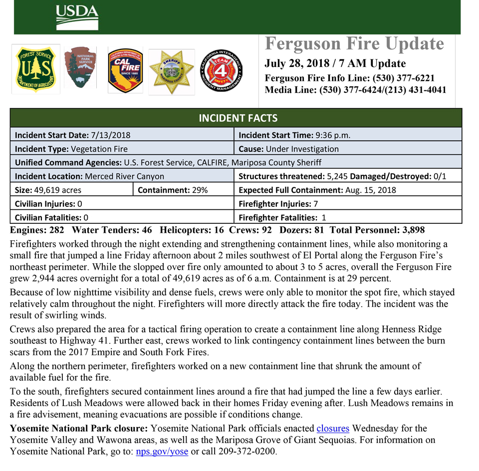

July 28, 2018 - Awahanee, CA. - Yosemite National Park announces Yosemite Valley will reopen to all visitors at 4:00 pm on Friday, August 3, 2018. Limited visitor services will be available inside Yosemite Valley, including campgrounds, lodging, and food service operations.
Due to continuing firefighting operations along the Wawona Road, the Mariposa Grove of Giant Sequoias and the Wawona Road (Highway 41) from the South Entrance of Yosemite National Park to Tunnel View will remain closed until further notice.For information on Yosemite National Park, go to: nps.gov/yose or call 209-372-0200.
Evacuation orders for the Lushmeadows Subdivision have been lifted. These areas
remain under a Fire Advisement.
The Ferguson Fire now in its 16th day, started July 13 on the Sierra National Forest and is managed under unified command between the United States Forest Service, California Interagency Incident Management Team 4, CALFIRE and the Mariposa County Sheriff’s Office. Much of the fire is burning in steep, rugged terrain with little to no access roads. Mandatory and advisory evacuations are in place in several areas but no homes have been damaged or destroyed.
The fire is now 49,619 acres with 29% containment and 3,898 personnel that are currently engaged on the fire which include 282 engines, 46 water tenders, 16 helicopters, 92 crews, 5 masticators and 81 dozers. There has been 1 fatality and 7 injuries to date. 1 structure has been destroyed.
Updates: Evening update,Morning's update and Informe de Incendio
Smoke Report: Southern Sierra and Yosemite
Today’s weather : A heat advisory remains in effect until 9:00 p.m. Sunday
Maps: Public Information map, progression map, operations map and fire history map


Social Media:
Sierra National Forest Facebook and Twitter
Stanislaus National Forest Facebook and Twitter
Yosemite National Park Facebook and Twitter
CALFIRE Facebook and Twitter
Story map of the Ferguson Fire
Road Closures:
Triangle Road, from Darrah Road to Hwy 49 south Chowchilla Mountain Road, at Hwy 49 south
Harris Road, at Hwy 49 south
Tip Top Road, from Triangle Road to Gunther Road
All roads inside Lushmeadows Subdivision
All roads inside Ponderosa Basin Subdivision
Hwy 140 is closed from 1.9 miles east of Midpines to the Cedar Lodge area MOTORISTS ARE ADVISED TO USE AN ALTERNATE ROUTE
Repopulations: Mariposa Pines
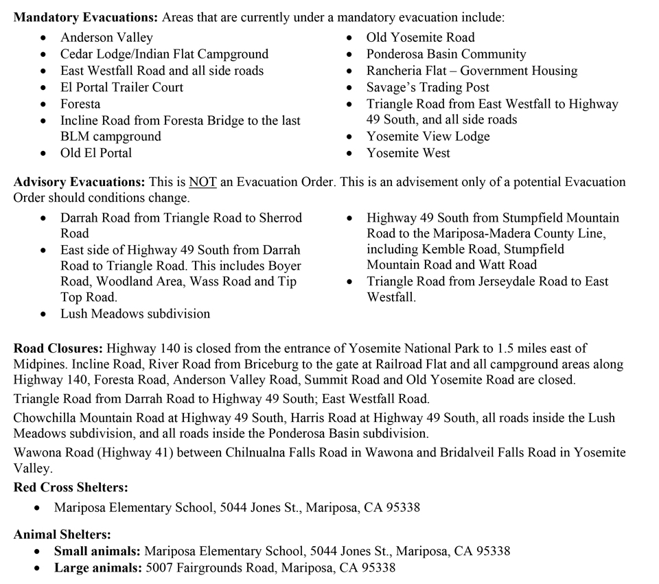
Mandatory Evacuations:
Anderson Valley
Cedar Lodge/Indian Flat Campground
East Westfall Road to Chowchilla mountain Road, and all side roads
El Portal Trailer Court
Foresta
Incline Road from Foresta Bridge to the last BLM campground
Lushmeadows Community
Old El Portal
Old Yosemite Road
Ponderosa Basin Community
Rancheria Flat – Government Housing
Savage’s Trading Post
Tip Top Road from Triangle Road to Gunther Road, including Gunther Road
Triangle Road from Darrah Road in the Lushmeadows area to Highway 49 South, and all side roads
Yosemite View Lodge
Yosemite West
Evacuation Advisory:
This is NOT an Evacuation Order. This is an advisement only of a potential Evacuation Order should conditions change.
East side of Highway 49 South from Darrah Road to Triangle Road. This includes Boyer Road, Woodland Area, Wass Road and Tip Top Road.
Highway 49 South from Stumpfield Mountain Road to the Mariposa-Madera County Line, including Kemble Road, Stumpfield Mountain Road and Watt Road
Mariposa Pines/Jerseydale Road
Triangle Road from Jerseydale Road to Highway 49 South, including all side roads.
Mariposa Pines
Triangle Road from Darrah Road to East Westfall
Road Closures: Highway 140 is closed from the entrance of Yosemite National Park to 1.5 miles east of Midpines. Incline Road, River Road from Briceburg to the gate at Railroad Flat and all Campground areas along Highway 140 closed. Hites Cove/Jerseydale Road, Foresta Road, Anderson Valley Road, Summit Road and Old Yosemite Road.
Triangle Road from Darrah Road to Highway 49 South; East Westfall Road.
Chowchilla Mountain Road at Highway 49 South, Harris Road at Highway 49 South, Tip Top Road from Triangle Road to Gunther Road, all roads inside the Lushmeadows subdivision, and all roads inside the Ponderosa Basin subdivision.
Wawona Road (Highway 41) between Chilnualna Falls Road in Wawona and Bridalveil Falls Road in Yosemite Valley.
Red Cross Evacuation Center:
Mariposa Elementary School 5044 Jones St, Mariposa, CA 95338
Mariposa Sheriff’s Office Emergency Alert System: To sign up for the go to: https://local.nixle.com/register/
Animal Shelters: Small animals, SPCA, 5599 California 49, Mariposa, CA 95338 and large animals, Mariposa County Fairgrounds, 5007Fairgrounds Road, Mariposa, CA 95338
Donations: When you want to help

Temporary Flight Restrictions: Temporary flight restrictions
Incident Command Post (ICP): The incident command post for the Ferguson Fire is located at the Awahanee Regional Park. An additional camp has been established at Badger Pass.
Cooperators: California Highway Patrol, CalTrans, Pacific Gas and Electric, California Conservation Corps, Mariposa County Public Works and the American Red Cross
