


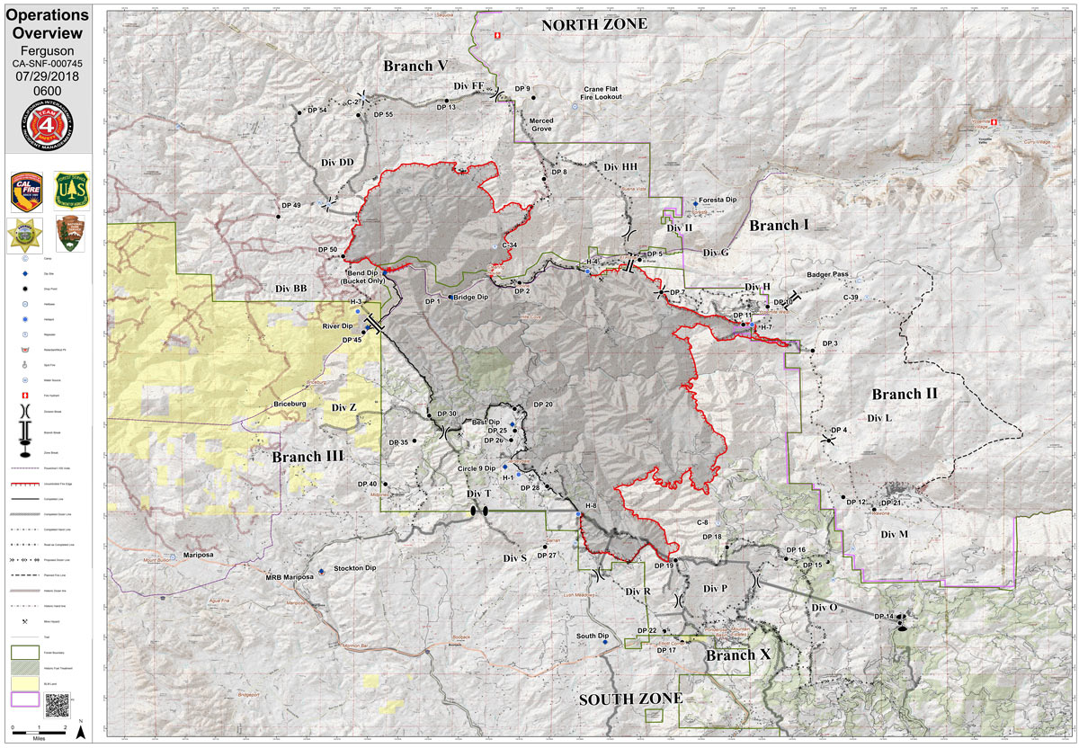
Sunday Operations Map
CLICK HERE FOR A LARGE MAP (3,000 Pixels Wide and 3MB)
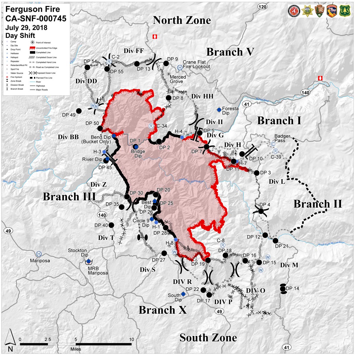
CLICK HERE FOR A LARGE MAP (3,000 Pixels Wide and 2MB)
July 29, 2018 - Sunday Operations Map of the Ferguson Fire in Mariposa County near Yosemite National Park.
Saturday Evening Information
Engines: 272 Water Tenders: 45 Helicopters: 16 Crews: 93 Dozers: 78 Total Personnel: 3,861
As firefighters work toward full suppression of the Ferguson Fire, tactical firing operations were conducted across three sides of the fire today to reduce fuel loads and widen containment lines. As of 6:00 P.M., the Ferguson Fire was at 51,671 acres, a growth of 2,052 acres from this morning. Containment is at 30 percent.
While residents might notice more smoke, tactical firing operations oftentimes reduce the duration and intensity of wildfires. Crews also maintain a presence within evacuated communities during these operations to ensure homes remain safe.
To the north along Montgomery Ridge, firefighters engaged in. In the east, crews fired a line from Henness Ridge southeast toward Highway 41/Wawona Road. And in the south, tactical firing continued off Footman Ridge toward Roundtree Saddle.
Firefighters completed containment lines and were mopping up a small fire 2 miles southwest of El Portal that had jumped a containment line Friday afternoon.
During tonight’s shift, crews will continue firing operations around the fire where conditions allow.
Yosemite National Park closure: Yosemite National Park officials enacted closures Wednesday for the Yosemite Valley and Wawona areas, as well as the Mariposa Grove of Giant Sequoias. The park is expected to reopen Aug. 3, conditions permitting. For information on Yosemite National Park, go to: nps.gov/yose or call 209-372-0200.
