


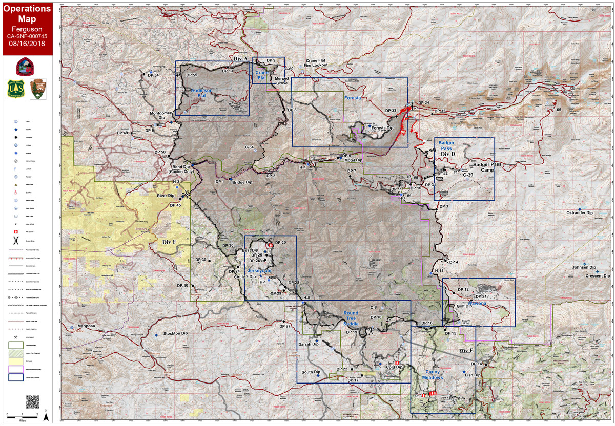
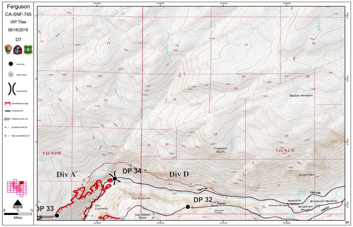
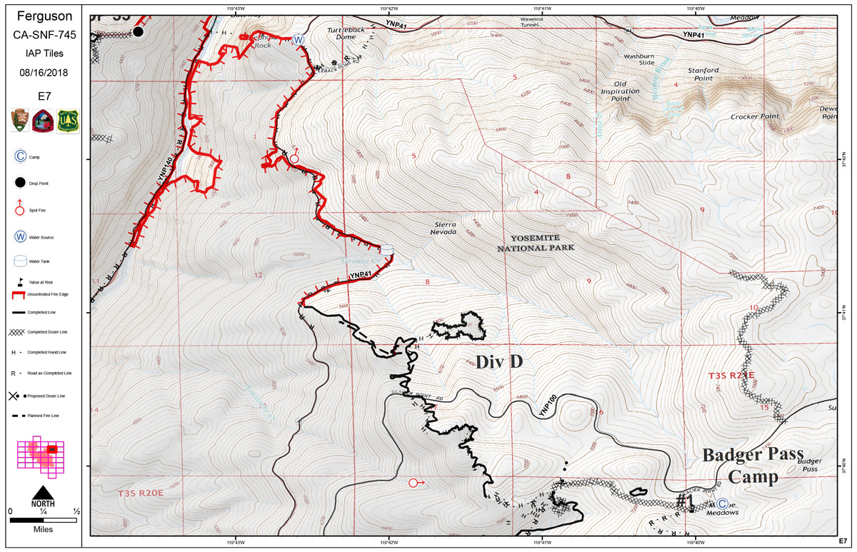
Thursday Operations Map
CLICK HERE FOR A LARGE MAP (3,000 Pixels Wide and 3MB)
CLICK HERE FOR A LARGE MAP (3,000 Pixels Wide and 2MB)
CLICK HERE FOR A LARGE MAP (3,000 Pixels Wide and 2MB)
August 16, 2018 - Thursday Operations Map of the Ferguson Fire in Mariposa County near Yosemite National Park.
Wednesday Evening Information: 96,810 acres and 87% containment
Planned Actions:
Crews continue suppression efforts on Elephant Rock to Turtleback Back Dome on the northeast flank, of the fire in Divisions D.
The fire east of El Portal and north of Highway 140 is in patrol status.
Crews continue to monitor the fire along FS Road 2S20 and on the 13 Ridge, Resources are addressing hazard trees along roads and containment lines, while monitoring and securing the area.

