High-Country Health Food and Cafe in Mariposa California

CASA
'Click' Here to Visit: 'Yosemite Bug Health Spa', Now Open.
'Click' Here to Visit: 'Yosemite Bug Health Spa', Now Open. "We provide a beautiful and relaxing atmosphere. Come in and let us help You Relax"
'Click' for More Info: 'Chocolate Soup', Fine Home Accessories and Gifts, Located in Mariposa, California
'Click' Here to Visit Happy Burger Diner in Mariposa... "We have FREE Wi-Fi, we're Eco-Friendly & have the Largest Menu in the Sierra"
'Click' for More Info: Inter-County Title Company Located in Mariposa, California

yosemite 2008 october rockfall GEDC0151 sierra sun times
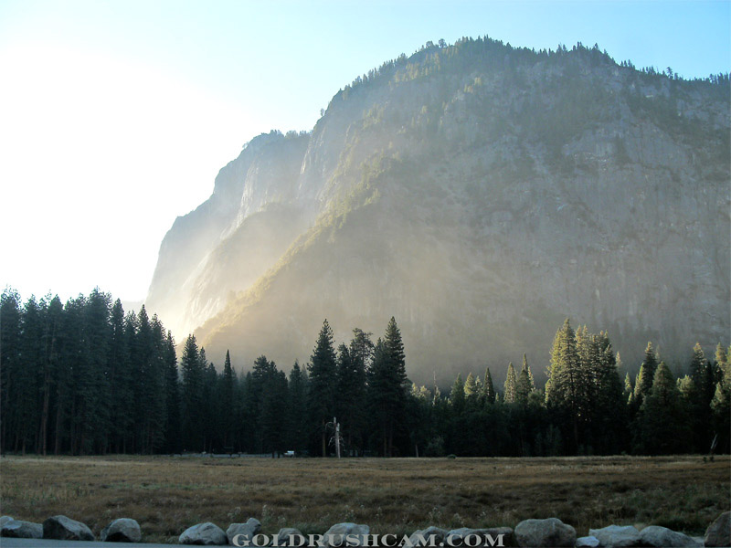
Hours after the morning rockfall in Yosemite National Park on October 8, dust from crushed, broken rock and dirt was still visible in the Valley air. 
This photo is looking towards Curry Village. 
Credit: Yosemite Traveler/Sierra Sun TImes file photo.

October 9, 2018 - Monday, October 8th, marked the 10-year anniversary of the most damaging rockfall in Yosemite’s recent history. Following a smaller rockfall the previous day, at 6:55 am on October 8th, 2008, a rock slab totaling 4,530 cubic meters (13,480 tons) fell from Glacier Point, impacting the Ledge Trail and sending thousands of boulders tumbling down the talus slope into Curry Village.Twenty-five structures, including both canvas tents and wooden cabins, were damaged or destroyed. Fortunately, most of these cabins were empty, as the Yosemite Institute students who had been sleeping in them overnight were eating breakfast in the Curry Pavilion when the rockfall occurred.  Although there were only three minor injuries, it was a chaotic and very nearly tragic event.

A scientific paper describing the 2008 events and establishing the park’s now-standard methods for documenting rockfalls can be found at http://www.nps.gov/yose/learn/ nature/upload/Stock-et-al-2011 -Geosphere.pdf.
 
The October 8th, 2008 rockfall proved pivotal in changing Yosemite’s approach to managing rockfall hazard and risk. Rather than continuing a reactive approach, the 2008 Glacier Point rockfalls compelled the park to take a more proactive approach that would ensure that the same situation wouldn’t play out again. After a multi-year effort involving scientists from the NPS, USGS, and academic institutions, the park established a rockfall hazard line throughout Yosemite Valley. That report can be found at http://pubs.usgs.gov/sir/2014/ 5129.
 
Based on the results of the rockfall hazard study, the park took actions to reduce rockfall risk to structures by 95%. All of the cabins within the area affected by the 2008 rockfalls were removed in 2012. The following year, another smaller rockfall sent boulders into that exact area, with one boulder landing in the footprint of a cabin that had been removed. A short paper explaining the risk reduction efforts can be found at http://www.nps.gov/yose/learn/ nature/upload/Stock-Collins-20 14-EOS.pdf
 

The October 8th, 2008, rockfall was also notable in that it occurred as the Park Geologist was midway up El Capitan, allowing him to join a select group of people who have been “rescued” from El Capitan uninjured! 
yosemite rockfall 2008
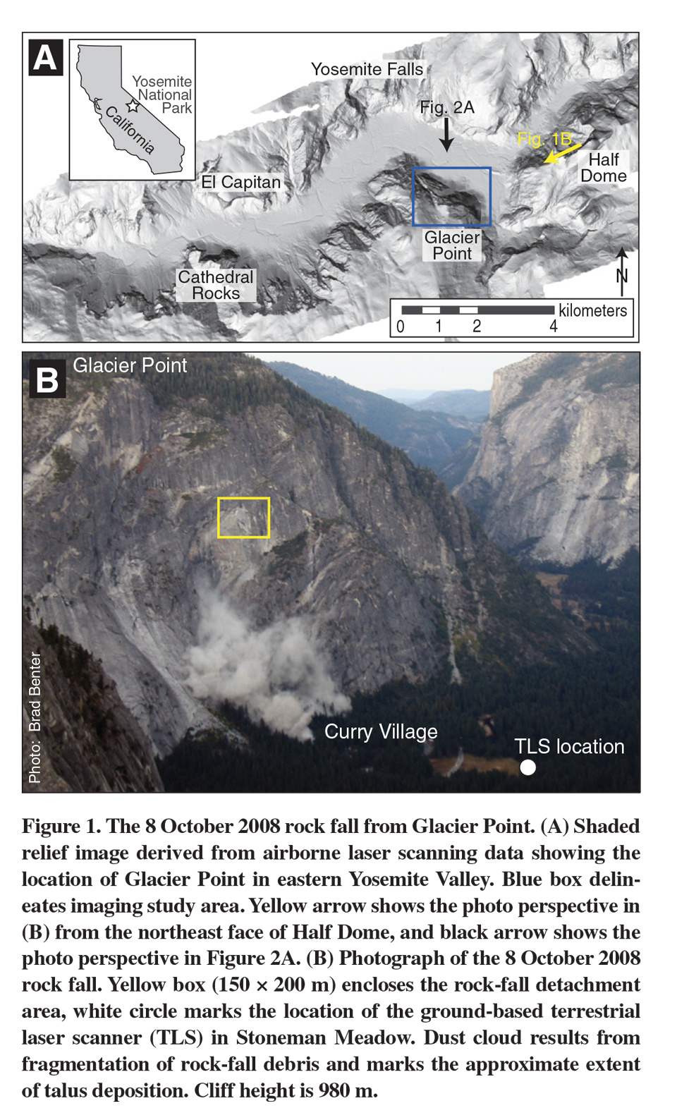
Source: G. Stock, NPS