


A trough of low pressure moving southward through the Great Basin this evening and early Monday morning will be responsible for strong, gusty winds in portions of the Sierra Nevada and Kern County mountains. The air can flow down the western slopes of the Sierra Nevada off the crest and down the San Joaquin Valley-facing slopes of the Tehachapi Mountains, with stronger gusts funneled through the canyons. Wind speed may be strong enough to down trees in affected tree mortality areas.
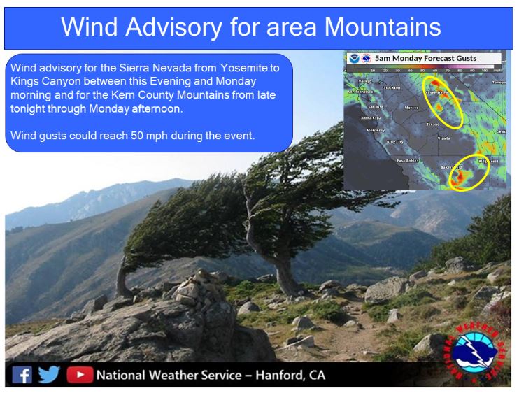
October 14, 2018 - The National Weather Service Hanford office has issued a Wind Advisory for the Sierra Nevada in effect from 11:00 P.M. this evening until Monday morning at 5:00 A.M.
Models are in good agreement in dropping the mentioned trough of
  low pressure southward across the Great Basin today and then
  forming a closed low over the Colorado River Valley on Monday. In
  the upper levels, as colder air pushes into the Rockies, a jet
  stream will push southwest into the region and this set up is
  pretty classic for northeast winds across the Sierra. Although not
  extremely strong, mid level winds of 55 knots from the northeast
  are progged to reach the Sierra by late evening and persist
  through much of the nighttime hours. Model cross sections indicate
  downward momentum as the air is forced over the crest and down
  major drainages like the San Joaquin River will create conditions
  for local gusts to over 50 mph in normally prone to Mono Wind
  areas such as Bass Lake, Northfork, Oakhurst and others. The
  strongest winds will most likely occur over higher elevations just
  to the east of the lower valleys.
Wind Advisory
URGENT - WEATHER MESSAGE
National Weather Service Hanford CA
156 AM PDT Sun Oct 14 2018

Sierra Nevada from Yosemite to Kings Canyon-
156 AM PDT Sun Oct 14 2018

...WIND ADVISORY IN EFFECT FROM 11 PM THIS EVENING TO 5 AM PDT
MONDAY...

The National Weather Service in Hanford has issued a Wind
Advisory, which is in effect from 11 PM this evening to 5 AM PDT
Monday.

* WINDS...Northeast 10 to 20 mph with gusts up to 50 mph through
  wind favored drainages and over ridges.

* TIMING...Winds will develop during the evening hours and reach
  maximum speeds after midnight.

* IMPACTS...Gusty winds will blow around unsecured objects. Tree
  limbs could be blown down and a few power outages may result.

PRECAUTIONARY/PREPAREDNESS ACTIONS...

A Wind Advisory means that winds of 35 mph are expected. Winds
this strong can make driving difficult, especially for high
profile vehicles. Use extra caution.
Source: NWS

