


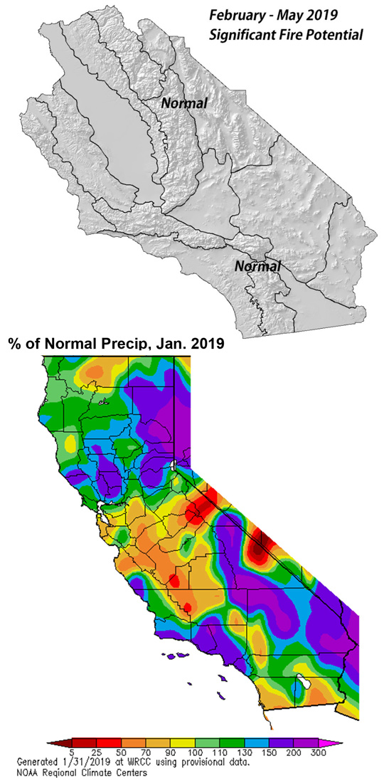
Near to slightly below normal precipitation late winter into spring.
Near normal number of offshore wind events February and March.
Warmer than normal temperatures next 4 months.
Potential for an active grass fire season May/June.
Weather Discussion
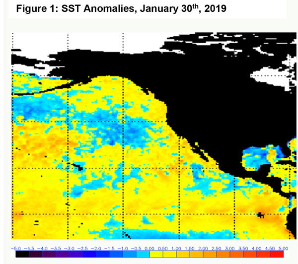
February 4, 2019 - A much wetter pattern developed in January as a series of strong Pacific storms marched through the state. These systems, many of which had subtropical moisture taps,
 brought widespread and significant wetting rains during the first week of the month. The rainfall arrived just in time to alleviate fire concerns over Southern California. Fuels had been quite dry at the end of December, but the timeliness of the rains have allowed an extended break from fire activity.
There were a pair of moderate offshore wind events during the past 30 days – one which occurred prior to the rainfall and one which followed the storms. But, in general, offshore wind events after the rainfall were not of long duration nor intense enough to warrant any risk of large fires.
Models back in November and December were forecasting a dry and warm period in January, which obviously, did not come to fruition. Long wave pattern were expected to favor the West with warm/dry conditions while the east coast suffered a cold and wet winter. This pattern did briefly become established during the arctic blast of late January, but strong westerlies are expected to bring a return of wet, zonal flow at the beginning of February.
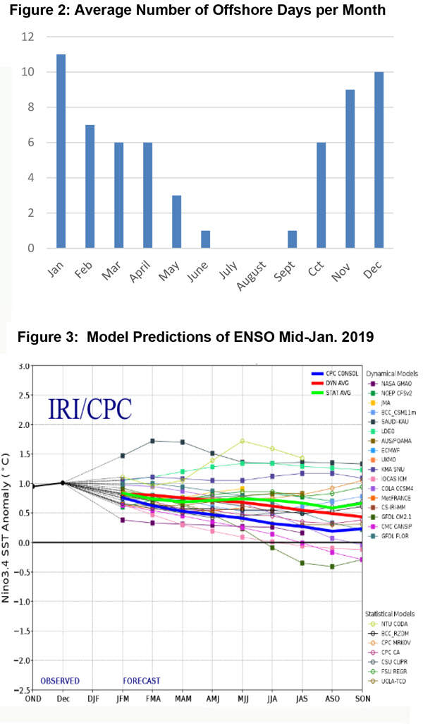
At the current time, a weak El Niño covers the equatorial eastern Pacific. But its influence is rapidly waning as sea surface temperature anomalies (SST) are trending toward neutral conditions in both the Niño 3.4 and 1+2 regions. There will likely be a lag in the atmosphere’s response to the changing SST’s and it may be several more weeks before the jet begins to weaken to more normal speeds and orientation. Until then, precipitation may remain near to slightly above normal, but precipitation may trend closer to normal in late March or April. This timing may correspond with the typical precipitation decrease seen at the end of the winter “rainy season.”
All available model guidance points to above normal temperatures this spring. But with the expectation of the westerlies remaining strong the next 30-60 days, daily temperatures anomalies may only be slightly above normal. The greatest departures in average temperatures in this scenario would be further east this spring – perhaps centered over the Southwest and Great Basin.
Offshore wind events are expected to occur at a near to slightly below normal rate of occurrence though February and March. The Pacific Decadal Oscillation continues to track toward near neutral, and should this trend continue, expect Santa Ana wind events to remain near normal in terms of frequency and severity.
Fuels and Drought Outlook
Widespread heavy rainfall during the past 30 days continues to drive rapid growth of fine fuels at lower elevations. It has been several years since heavy rains have coincided with the shortest days of the year and these rains will have an excellent opportunity to penetrate far into the subsoil. This will go a long way to maintaining robust growth of seasonal grasses as well as brush and shrubs below 3,000 feet.
As a result of the fine fuel growth, there may be substantial fuel loading across many fuel beds this spring, which may pose a problem once these fuels begin to cure toward May. Therefore, there may be a spike in grass fire activity compared to most years since 2011. Once the heavier dead fuels dry out, fires may transition into the ladder fuels such as the bug killed timber of the Sierras Foothills. This area in particular will have to be monitored closely this spring for there is a potential for a high amount of fire activity there late this spring into the early summer due to heavy fine fuel loading.
The Sierras are expected to continue to see heavy snow in February which should keep snowpack totals near or above normal well into March and April. Meltout may be several weeks late this year which should keep large fire potential low above 8,000 this spring. However, it is too early to make a prediction regarding the summer monsoon and whether there will be much lightning activity this summer.
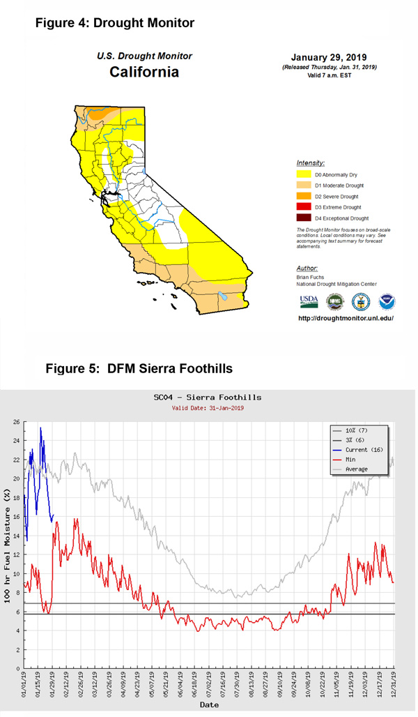
Expect drought conditions to continue to moderate over the southern half of the state in February. However, the northern part of the state into the Pacific Northwest may see some drought expansion this spring into the summer months as the storm track may favor areas further south the next few weeks.
Source: Predictive Services

