


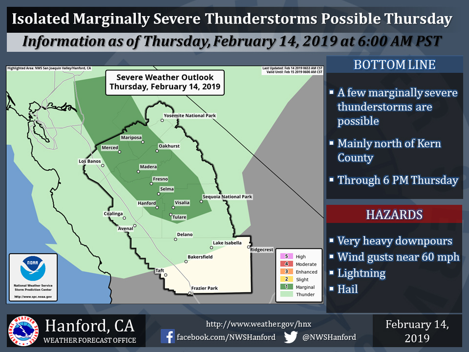
February 14, 2019 - The National Weather Service Hanford Office reports a Winter Storm Warning continues for the southern Sierra Nevada until 10:00 P.M. Thursday.
Snow levels are now expected to remain above 8000 feet through Thursday afternoon and will lower to around 5500 feet by Thursday evening.
Strong, gusty winds are likely on exposed ridgetops and near the crest and could cause extensive tree damage.
Travel could be very difficult to impossible. If you must travel, keep an extra flashlight, food and water in your vehicle in case of an emergency.
The latest road conditions for the state you are calling from can be obtained by calling 5 1 1.
Winter Storm Warning
URGENT - WINTER WEATHER MESSAGE
National Weather Service Hanford CA
959 PM PST Wed Feb 13 2019


Sierra Nevada from Yosemite to Kings Canyon-
Tulare County Mountains-
Including the cities of Camp Nelson, Giant Forest, and Lodgepole
959 PM PST Wed Feb 13 2019

...WINTER STORM WARNING REMAINS IN EFFECT UNTIL 10 PM PST
THURSDAY ABOVE 5000 FEET...

* WHAT...Snow levels will lower overnight to near 6000 feet buy
  are expected to remain above 8000 feet on Thursday. Snow levels
  will lower again to around 5500 feet by Thursday evening. Total
  snow accumulation for the period will range to almost 1 foot
  above 7000 feet, 2 to 4 feet above 8000 feet with amounts up to
  6 feet above 9000 feet. Winds could gust as high as 70 mph above
  9000 feet.

* WHERE...Sierra Nevada from Yosemite to Kings Canyon and Tulare
  County Mountains.

* WHEN...Through 10 PM PST Thursday.

* ADDITIONAL DETAILS...Travel could be very difficult to
  impossible. The hazardous conditions could impact the morning
  or evening commute. Very strong winds could cause extensive
  tree damage.

PRECAUTIONARY/PREPAREDNESS ACTIONS...

A Winter Storm Warning for snow means severe winter weather
conditions will make travel very hazardous or impossible. If you
must travel, keep an extra flashlight, food and water in your
vehicle in case of an emergency.

The latest road conditions for the state you are calling from can
be obtained by calling 5 1 1.
Source: NWS

