


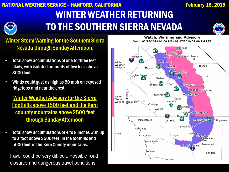
February 15, 2019 - The National Weather Service Hanford Office reports a couple of storm systems will impact Central California this weekend.
As a result, a Winter Storm Warning is in effect for the Southern Sierra Nevada from this afternoon through Sunday afternoon.
There may be a break in snowfall Saturday night.
Snow levels should be 1,500 north to 2,500 feet south, so a few inches of accumulating snow is possible in the Southern Sierra Nevada foothills and at pass level in Kern county.
Winter Storm Warning
URGENT - WINTER WEATHER MESSAGE...UPDATED
National Weather Service Hanford CA
320 AM PST Fri Feb 15 2019

Sierra Nevada from Yosemite to Kings Canyon-
Tulare County Mountains-
Including the cities of Camp Nelson, Giant Forest, Lodgepole,
and Johnsondale
320 AM PST Fri Feb 15 2019

...WINTER STORM WARNING IS NOW IN EFFECT UNTIL 4 PM PST SUNDAY...

* WHAT...Heavy snow. New snow accumulations of 1 to 3 feet with up
  to 5 feet in the high country. Winds gusting as high as 50 mph
  in the high country above 7000 feet.

* WHERE...Sierra Nevada from Yosemite to Kings Canyon and Tulare
  County Mountains.

* WHEN...Snow will move in this morning and continue through
  tonight. Snow will be heavy at times. Snow will taper off by
  Saturday afternoon and be light through Saturday night. Snow
  will increase again on Sunday morning before ending Sunday
  afternoon.

* ADDITIONAL DETAILS...Travel could be very difficult to nearly
  impossible. Road closures and chain controls are expected. Gusty
  winds could bring down tree branches.


PRECAUTIONARY/PREPAREDNESS ACTIONS...

A Winter Storm Warning for snow means severe winter weather
conditions will make travel very hazardous or impossible. If you
must travel, keep an extra flashlight, food and water in your
vehicle in case of an emergency.

The latest road conditions for the state you are calling from can
be obtained by calling 5 1 1.
Source: NWS

