


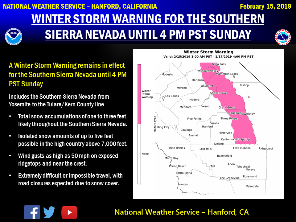
February 16, 2019 - The National Weather Service Hanford Office reports a Winter Storm Warning remains in effect for the Southern Sierra Nevada until 4:00 PM Sunday.
The heaviest snow will begin Saturday afternoon and persist into Saturday night.
Storm total snow amounts of up to a five feet possible above 7,000 feet.
Winter Storm Warning
URGENT - WINTER WEATHER MESSAGE
National Weather Service Hanford CA
357 AM PST Sat Feb 16 2019

CAZ096-097-162000-
/O.CON.KHNX.WS.W.0007.000000T0000Z-190218T0000Z/
Sierra Nevada from Yosemite to Kings Canyon-
Tulare County Mountains-
Including the cities of Camp Nelson, Giant Forest, Lodgepole,
and Johnsondale
357 AM PST Sat Feb 16 2019

...WINTER STORM WARNING REMAINS IN EFFECT UNTIL 4 PM PST SUNDAY...

* WHAT...Heavy snow. New snow accumulations of 1 to 3 feet with
  up to 4 feet in the high country. Winds gusting as high as 50
  mph in the high country above 7000 feet.

* WHERE...Sierra Nevada from Yosemite to Kings Canyon and Tulare
  County Mountains.

* WHEN...Snow moving in again this morning and continuing through
  the day. Snow will be heavy at times. Snow may taper off
  Saturday night but then increase again on Sunday morning before
  ending Sunday evening.

* ADDITIONAL DETAILS...Travel could be very difficult. Strong
  winds could cause tree damage. The cold wind chills as low as
  25 below zero could cause frostbite on exposed skin in as
  little as 30 minutes.

PRECAUTIONARY/PREPAREDNESS ACTIONS...

A Winter Storm Warning for snow means severe winter weather
conditions will make travel very hazardous or impossible. If you
must travel, keep an extra flashlight, food and water in your
vehicle in case of an emergency.

The latest road conditions for the state you are calling from can
be obtained by calling 5 1 1.
Source: NWS

