


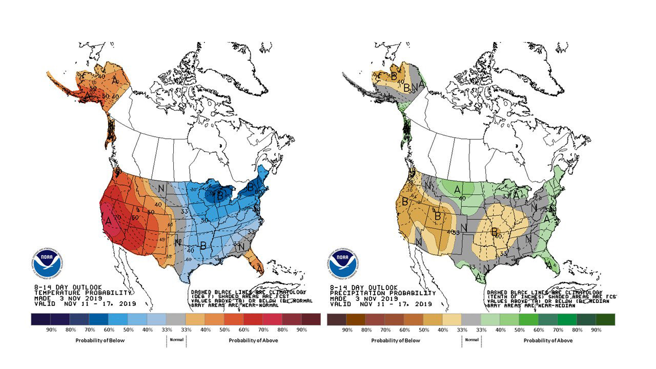
November 4, 2019 - The National Weather Service Hanford Office reports in addition to the warm and dry forecast for the next 7 days, the 8 to 14 day forecast calls for above normal temperatures and below normal precipitation for central California through the middle of November.
  Area Forecast Discussion
  National Weather Service Hanford CA
  313 AM PST Mon Nov 4 2019


  .SYNOPSIS...A very stable pattern due to high pressure off the
  West Coast will remain for the next several days keeping mild
  temperatures and dry weather conditions.

  &&

  .DISCUSSION...
  Clear and dry conditions across central California this morning.
  Little day to day change in weather conditions as a very stable
  pattern persists next couple of days. A rex block with a weak
  trough off the SCal coast and a ridge along the coast north of
  the low. The ridge will provide above normal day time
  temperatures, but overnight lows may be on the chilly side with a
  dry airmass over central CA. The SCal trough will move inland
  Wednesday through the Sonoran Desert as an upstream disturbance
  moves SE through the the Great Basin. Winds should turn north and
  bring a slight cooling trend for mid week. However this will be
  short live as models prog for the ridge to build further inland
  along the west coast for the end of the workweek. Thus dry
  conditions with above normal mild temperatures should continue
  through next weekend. Winds should be light offshore for much of
  the period with little day to day change. No significant strong
  wind events expected.
Source: NWS

