


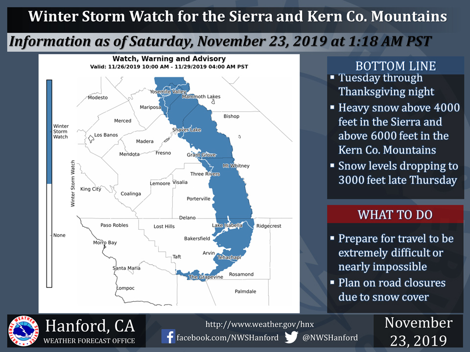
November 23, 2019 - The National Weather Service Hanford Office reports a Winter Storm Watch is in effect for the Southern Sierra Nevada and Kern County Mountains above 4,000 feet late Tuesday night through Thursday afternoon.
A Winter Storm Watch means there is potential for significant snow accumulations that may impact travel.
Travel could be extremely difficult or impossible.
If you plan to travel, consider alternate strategies.
If you must travel, remember to carry tire chains, plenty of food, a good deal of water, and warm clothing in your vehicle.
For information on road conditions, including closures or delays, call Caltrans at 1-800-427-7623 or visit http://www.dot.ca.gov/cgi-bin/roads.cgi.
Winter Storm Watch
URGENT - WINTER WEATHER MESSAGE
National Weather Service Hanford CA
106 AM PST Sat Nov 23 2019


Central Sierra-North Kings River-Sequoia Kings-Lake Isabella-
Tehachapi Area-Fort Tejon-
Including the cities of Devils Postpile, Florence Lake,
Lake Thomas Edison, Tuolumne Meadows, Bass Lake, Fish Camp,
Wawona, Shaver Lake, Camp Nelson, Giant Forest, Lodgepole,
Grant Grove, Johnsondale, and Tehachapi
106 AM PST Sat Nov 23 2019

...WINTER STORM WATCH IN EFFECT FROM TUESDAY MORNING THROUGH LATE
THURSDAY NIGHT ABOVE 3000 FEET...

* WHAT...Heavy snow possible. Several feet of snow in the Sierra
  Nevada will be possible above 4,000 feet and the Kern County
  Mountains above 6,000 feet. Accumulating snow possible down as
  low as 3,000 feet.

* WHERE...Sierra Nevada and Kern County Mountains.

* WHEN...From midday Tuesday through late Thursday night.

* IMPACTS...Travel will likely be very difficult. The hazardous
  conditions could impact holiday travels as well as commutes.

* ADDITIONAL DETAILS...Significant reductions in visibilities are
  possible. Downed trees and power outages possible.

PRECAUTIONARY/PREPAREDNESS ACTIONS...

Monitor the latest forecasts for updates on this situation.
Source: NWS

