


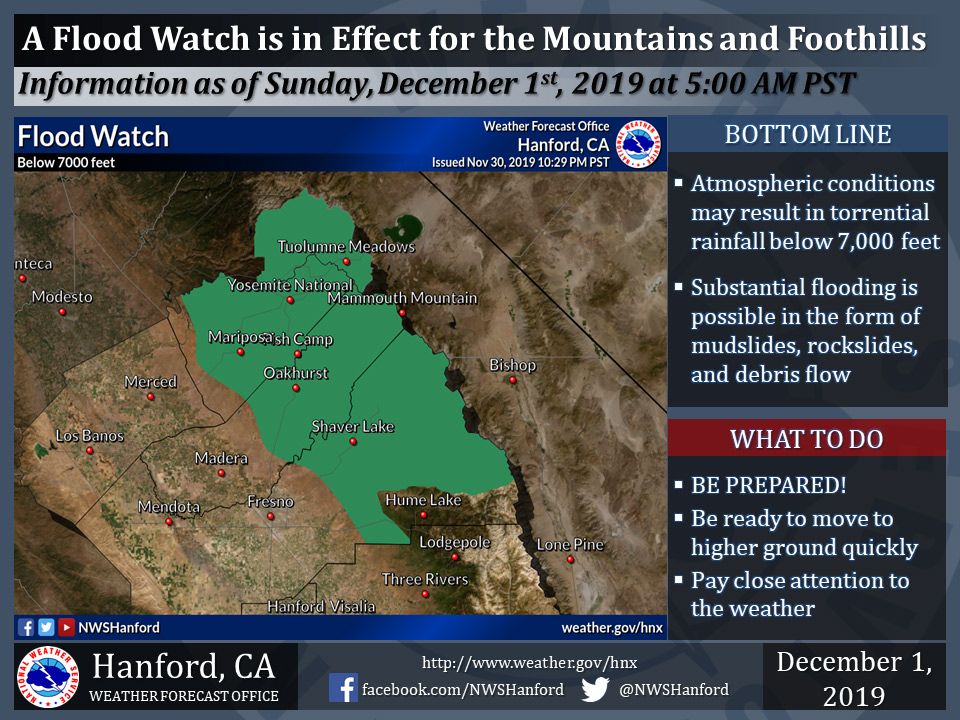
December 1, 2019 - The National Weather Service Hanford Office reports a Flood Watch is in effect for a portion of the Southern Sierra Nevada foothills and Southern Sierra Nevada below 7,000 feet through Monday afternoon.
A Flood Watch means there is potential for flooding based on current forecasts.
Rainfall amounts of two to four inches are possible.
Some roads may become impassible or washed out, resulting in road closures.
Flood Watch
Flood Watch
National Weather Service Hanford CA
404 AM PST Sun Dec 1 2019

...Elevated flood threat today into Monday...

.Periods of heavy rainfall are expected in the Southern Sierra
Nevada foothills and in the Southern Sierra Nevada below
7000 feet today into Monday. Substantial flooding is possible in
the form of mudslides, rockslides, and debris flow.


Central Sierra Foothills-Central Sierra-North Kings River-
Including the cities of Coarsegold, Oakhurst, Squaw Valley,
Auberry, North Fork, Mariposa, Devils Postpile, Florence Lake,
Lake Thomas Edison, Tuolumne Meadows, Bass Lake, Fish Camp,
Wawona, Lake Wishon, Huntington Lake, and Shaver Lake
404 AM PST Sun Dec 1 2019

...A FLOOD WATCH REMAINS IN EFFECT THROUGH MONDAY AFTERNOON...

The Flood Watch continues for

* A portion of central California, including the following areas,
  the Mariposa, Madera, and Fresno County foothills and the
  Southern Sierra Nevada north of Tulare County below 7000 feet.

* Through Monday afternoon

* Atmospheric conditions may support torrential rainfall below
  7000 feet. Rain amounts of two to four inches are conceivable.

* Some roads may become impassible or washed out, resulting in
  road closures.

PRECAUTIONARY/PREPAREDNESS ACTIONS...

A Flood Watch means there is a potential for flooding based on
current forecasts.

You should monitor later forecasts and be alert for possible
Flood Warnings. Those living in areas prone to flooding should be
prepared to take action should flooding develop.
Source: NWS

