


Temperatures Above Normal through early 2020.
Near normal large fire potential through winter.
Winter precipitation expected to be below normal with the greatest deficits occurring in January - Feb.
Early onset of spring “grassfire season” possible by April.
Weather Discussion
December 2, 2019 - A string of offshore wind events which began in late October continued to buffet the district during the first few days of November. While wind speeds didn’t quite match the strength of the event of October 30th and other such events, very warm and dry weather conditions remained in place through the middle of the month. Widespread 90 degree readings occurred around the 7th and
 again around the 17th and 18th which kept large fire potential unseasonably high due to record dry fuel conditions in dead fuels.
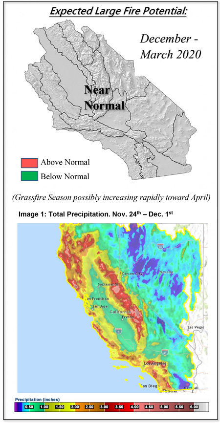
However, the strong ridge over the Eastern Pacific, which had kept storms deflected to the north, slipped a bit further west at the end of November. This change allowed several cold-core storm systems to bring much needed rain to the state. One such storm at the end of November produced snow levels as low at 1,500 feet. Subsequent systems resulted in widespread, meaningful rainfall across all of California but the far northeastern corner. (Image 1 left). Subtropical moisture over northern Mexico also served to enhance precipitation over San Diego County and portions of the low desert near the Arizona border. Additional moisture will likely be available in early December as an atmospheric river-type pattern is expected to impact the state with steady moderate rain with high elevation snow (Image 4, Below).
Such an abrupt change from record high temperatures to cool, wet conditions indicates how subtle shifts of a ridge axis can have dramatic implications on California’s weather. The ridge that has been the underlying feature of the hot autumn conditions didn’t dissipate – in fact, hemispheric scale models are showing it amplifying in coming days – it has merely shifted into a position far enough west to allow split flow to occur.
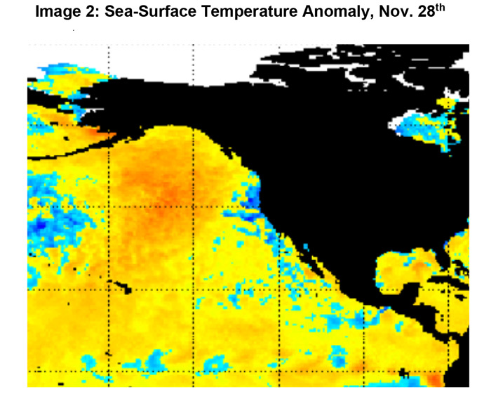
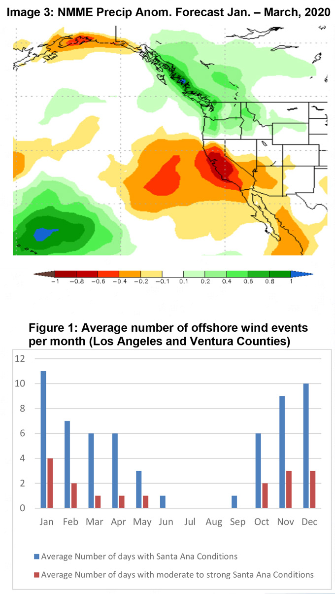
The underlying conditions which may be responsible for the Eastern Pacific ridge remain – namely the above normal sea surface temperatures extending from the Gulf of Alaska southward (Image 2, above). This SST distribution along with the possible appearance of a Modoki El Niño may result in an eventual return to drier weather along with warmer than normal conditions. The North American Multi-Model Ensemble (NMME) has been consistent with several other long range models which are indicating drier than normal weather next January through March (Image 3, below).
Offshore wind events are currently expected to continue at a near normal rate through December (Figure 1, below). However, if the strong ridge returns to its October position, there may be noticeable increase in wind events in late December and into January. There is a near-unanimous agreement in long range models that this winter and early spring will be warmer than normal.
Thus, there is a strong likelihood of below normal precipitation and above normal temperatures during the “winter rainy season” of 2019-2020. The greatest precipitation deficits this winter may occur during the normal peak of the rainy season in January - February. A lack of precipitation during those months may lead to a worsening of the drought and below normal snowpack across important watersheds in Central California.
FUELS AND DROUGHT OUTLOOK
Wet weather occurring during the short daylight hours and low solar angle of November and December should go a long way toward keeping fire danger low for several weeks. Evaporation and drying conditions are typically at a minimum this time of year. Additionally, the steady nature of the rainfall which occurred in November will be efficient in recharging subsoil moisture in coming weeks. This should allow for seasonal grasses to begin to grow in December which should limit ignition and spread potential for several weeks. High elevation snows should keep fire potential near zero over the high country into middle of winter.
But the expected return of warm/dry weather in early 2020 may allow for dead fuel moisture to drop to below normal levels early next year. These fuels may be available for ignition and fire growth during peak heating hours, or during windy conditions. Should this winter end on a dry note as forecast by several long range models, there may be an early start to the spring grassfire season. Grasses may cure several weeks early and there may be elevated large fire potential at lower elevations by April. Out of region demand may also occur early this year over the Southern Plains and the Southwest.
Large fire potential may return to above normal levels in April beginning with the Central Coast interior and the foothills of Southern California. From there, the highest potential may spread into the Sierra Foothills by May and June due to a moderate grass crop and a high amount of dead fuel loading. Resource demand is expected to remain light through early next year, but there may be a sudden increase in initial attack by next April corresponding to the time of grasses curing.
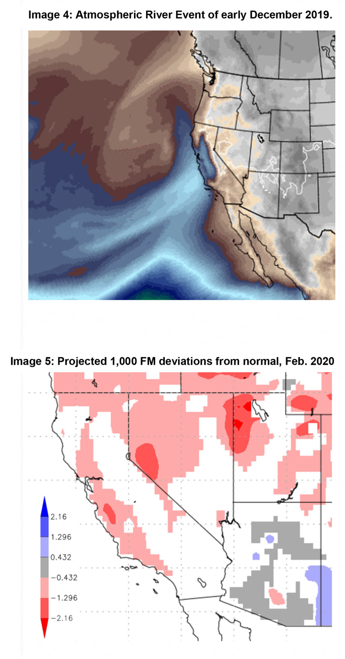
Image Credits: 1 -CNRFC, NOAA ;2 and 3 –CPC, NOAA; 4 – Climate Reanalyzer, CCI/U of Maine, 5 - PSW Fire Lab, USFS
Source: Predictive Services

