


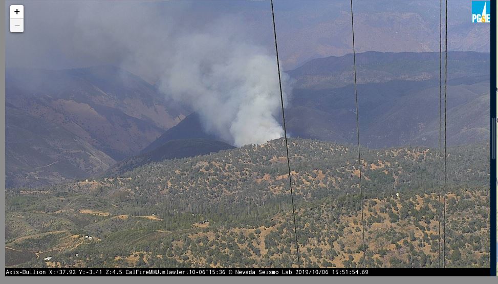
2019 Briceburg Fire in Mariposa County PG&E Live Camera view from Mount Bullion
File photo
More than 600 weather stations, 130 HD cameras now installed across Northern and Central California
December 12, 2019 - SAN FRANCISCO, Calif. — As part of its Community Wildfire Safety Program (CWSP), Pacific Gas and Electric Company (PG&E) has now installed more than 600 weather stations and 130 high-definition (HD) cameras across its service area. PG&E will continue to expand these networks in high fire-threat areas to enhance weather forecasting and modeling and improve the company's ability to predict and respond to extreme wildfire danger.
"The station observations allow our meteorologists to analyze critical fire weather elements like extreme wind, temperature and low humidity," said Ashley Helmetag, a PG&E senior meteorologist. "The stations and cameras are a part of our real-time situational awareness tools that assist us as we make decisions on Public Safety Power Shutoffs to protect our communities."
This data is also critical information for PG&E's analysts in the Wildfire Safety Operations Center, the "hub" from where the company monitors threats across its service territory and coordinates with first responders and public safety officials to respond to emerging threats.
Station observations are available to state and local agencies as well as the public, through online sources such as PG&E's website, the National Weather Service and MesoWest.
The HD cameras are part of the ALERTWildfire Camera Network, a situational awareness tool built by the University of California San Diego, the University of Nevada, Reno and the University of Oregon. The high-definition, pan-tilt-zoom cameras have near-infrared capabilities
that allow firefighters, first responders and companies such as PG&E to confirm and monitor wildfires.
More Planned
By 2022, PG&E plans to have installed 1,300 weather stations and 600 HD cameras – a density of one weather station roughly every 20 circuit-miles and video coverage of roughly 90 percent within the highest fire-risk areas.
Meteorology Information at your Fingertips
All of this information can be found at PG&E's new weather webpage at pge.com/weather.
The weather webpage also provides:
- Seven-day forecast updated daily by a PG&E meteorologist or fire scientist
- Detailed, localized weather conditions
- Maps that show whether the National Weather Service has called a Red Flag Warning and where
- Access to the thousands of weather stations and dozens of HD cameras in use by PG&E
- Daily sunrise and sunset timetable
For information about fire conditions in California, go to CAL FIRE's website, www.fire.ca.gov.
For more information about the Community Wildfire Safety Program, including links to update contact information, resources for Public Safety Power Shutoffs and a schedule of upcoming regional open houses and webinars, visit PG&E's website at pge.com/wildfiresafety.
Source: PG&E

