


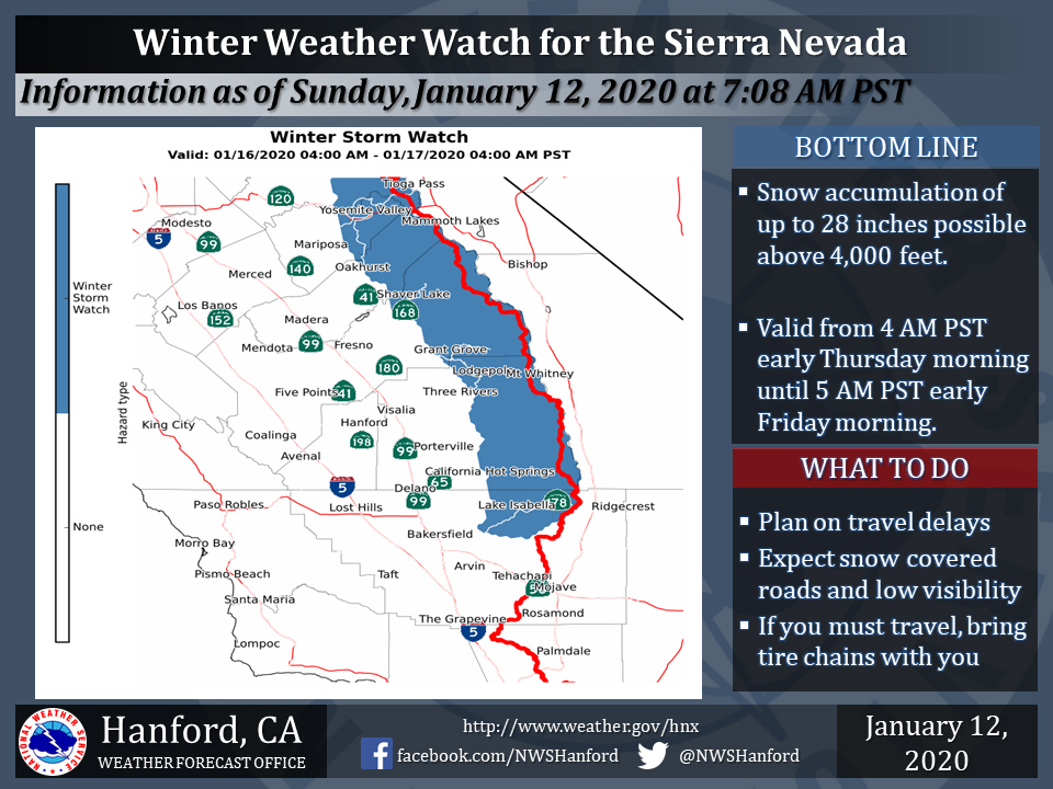
January 12, 2020 - The National Weather Service Hanford Office reports a Winter Weather Watch is in effect for the Central and Southern Sierra Nevada above 4,000 feet from 4:00 A.M. early Thursday morning until 4:00 A.M. early Friday morning.
A Winter Storm Watch means there is potential for significant snow, sleet or ice accumulations that may impact travel.
Continue to monitor the latest forecasts.
Snow levels may drop to as low as 3,500 feet Thursday night.
The majority of this snow will fall Thursday afternoon.
Winds will gust as high as 45 mph on exposed ridgetops and near the crest.
Motorists should anticipate travel delays and slick, hazardous road conditions, as well as the potential for road closures.
If you plan to travel, consider alternate strategies.
If you must travel, remember to carry tire chains, plenty of food, a good deal of water, and warm clothing in your vehicle.
For information on road conditions, including closures or delays, call Caltrans at 1-800-427-7623 or visit http://www.dot.ca.gov/cgi-bin/roads.cgi.
Winter Storm Watch
URGENT - WINTER WEATHER MESSAGE
National Weather Service Hanford CA
420 AM PST Sun Jan 12 2020


Central Sierra-North Kings River-Sequoia Kings-Lake Isabella-
Including the cities of Devils Postpile, Florence Lake,
Lake Thomas Edison, Tuolumne Meadows, Bass Lake, Fish Camp,
Wawona, Shaver Lake, Camp Nelson, Giant Forest, Lodgepole,
Grant Grove, Johnsondale, and Lake Isabella
420 AM PST Sun Jan 12 2020

...WINTER STORM WATCH IN EFFECT FROM LATE WEDNESDAY NIGHT THROUGH
LATE THURSDAY NIGHT...

* WHAT...Snow accumulation with heavy amounts possible. Total snow
  accumulations of up to 2 feet possible. Winds could gust as
  high as 40 mph.

* WHERE...Central and Southern Sierra from Yosemite to Sequoia
  Kings and down to near the Lake Isabella area.

* WHEN...From late Wednesday night through late Thursday night.

* IMPACTS...Travel could be very difficult to impossible. Plan on
  snow covered or slippery road conditions. The hazardous
  conditions could impact the morning or evening commute.


PRECAUTIONARY/PREPAREDNESS ACTIONS...

Monitor the latest forecasts for updates on this situation.
Source: NWS

