


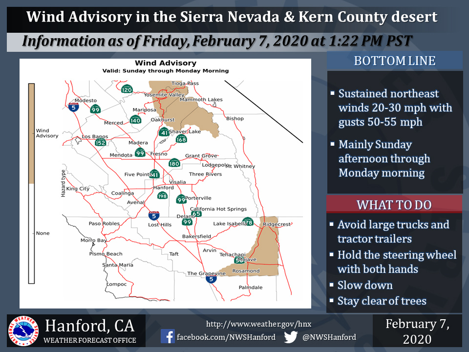
February 8, 2020 - The National Weather Service Hanford Office reports a Wind Advisory due to strong northeast winds is in effect for the Kern County Desert and a portion of the Sierra Nevada, mainly from Yosemite to northeastern Fresno County, during Sunday afternoon through Monday morning.
Winds could blow around unsecured objects.
Tree limbs and small trees could be blown down. Scattered power outages are possible. Travel will be potentially hazardous for high profile vehicles.
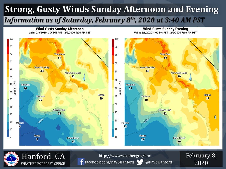
Strong, gusty northeast winds will develop over the Southern Sierra Nevada portion of Mariposa and Madera Counties Sunday afternoon.
Wind gusts as high as 60 mph are possible Sunday afternoon and Sunday evening. These damaging wind gusts may blow down trees.
Wind Advisory
URGENT - WEATHER MESSAGE
National Weather Service Hanford CA
933 PM PST Fri Feb 7 2020


Central Sierra-
Including the cities of Devils Postpile, Florence Lake,
Lake Thomas Edison, Tuolumne Meadows, Bass Lake, Fish Camp,
and Wawona
933 PM PST Fri Feb 7 2020

...WIND ADVISORY REMAINS IN EFFECT FROM 10 AM SUNDAY TO 10 AM PST
MONDAY...

* WHAT...Strong winds gusting to 45 to 55 mph.

* WHERE...The higher elevations of the Sierra.

* WHEN...From 10 AM Sunday to 10 AM PST Monday.

* TIMING...Gusty northeast winds developing Sunday afternoon.
  Stronger Mono winds possible Sunday night.

* WINDS...Northeast at 20 to 30 mph. Strongest winds are likely
  over exposed ridges and in some of the canyons, especially
  Sunday evening into Monday morning.

* IMPACTS...Gusty winds could blow around unsecured objects.
  Tree limbs could be blown down and a few power outages may
  result.

PRECAUTIONARY/PREPAREDNESS ACTIONS...

Use extra caution when driving, especially if operating a high
profile vehicle. Secure outdoor objects.
Source: NWS

