


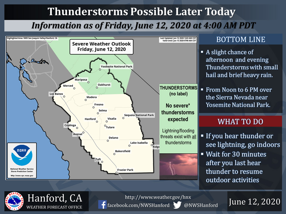
Possible Thunderstorms Today for Mariposa, Oakhurst and Yosemite National Park
June 12, 2020 - The National Weather Service Hanford Office reports a few strong thunderstorms are possible in parts of the Sierra Nevada near Yosemite National Park this afternoon and evening.
Small hail, brief heavy rain and wind gusts near 45 miles per hour are some of the hazards associated with strong thunderstorms.
In addition to dangerous cloud to ground lightning strikes, any thunderstorm can produce localized flooding.
  Area Forecast Discussion
  National Weather Service Hanford CA
  419 AM PDT Fri Jun 12 2020


  .SYNOPSIS...
  A low pressure system will bring cooler temperatures through the
  weekend with a few showers and possible thunderstorms over the Sierra
  from Fresno County northward Friday afternoon and evening. Gusty
  winds will also accompany the system as it moves through Friday.
  Temperatures will then warm to several degrees above seasonal
  values by the middle of next week.

  &&

  .DISCUSSION...
  High pressure which produced temperatures around 10 degrees above
  climo Thursday is weakening and shifting eastward as a low
  pressure trough pushes into the west coast. Low pressure is
  progged to swing across northern California later this afternoon
  and tonight. The incoming system will bring cooler temperatures
  beginning today, with afternoon highs dropping to around seasonal
  normals. Increased gusty winds will accompany the passing system
  this afternoon and evening but generally expected to remain below
  advisory levels. Main energy of the system will pass to the north
  but there will be enough instability for some showers and possibly
  a few thunderstorms over the Sierra and adjacent foothills from
  Fresno County northward this afternoon and evening.

  Temperatures will remain below normal through the weekend under a
  continued troughy pattern over the region. Heights will then
  increase over the region as the low pressure center lifts out.
  This will bring a warming trend for next week, with highs reaching
  several degrees above normal by midweek.
Source: NWS

