


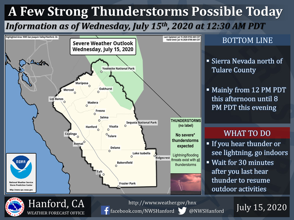
Includes Yosemite National Park
July 15, 2020 - The National Weather Service Hanford Office reports a few strong thunderstorms are possible in the Sierra Nevada north of Tulare County today.
Small hail, funnel clouds, and wind gusts near 40 miles per hour are some of the hazards associated with strong thunderstorms.
In addition to dangerous cloud to ground lightning strikes, any thunderstorm can produce intense rainfall rates, leading to localized flooding.
  Area Forecast Discussion
  National Weather Service Hanford CA
  219 AM PDT Wed Jul 15 2020


  .SYNOPSIS...Weak low pressure off the California Coast will allow
  for easterly flow aloft and a small threat of afternoon and
  evening thunderstorms along the Sierra Nevada crest until Friday.
  Over the weekend, high pressure ridging will strengthen over the
  Great Basin with dry and slightly warmer weather.

  &&

  .DISCUSSION...The weather pattern, including weak low pressure
  along the coast, will continue generally quiet, except for
  afternoon and evening showers with isolated thunderstorms over the
  Sierra Nevada crest from Yosemite to Kings Canyon NP each day
  from today until Friday. Marine layer remains at around 2500 feet
  deep, per latest Ft. Ord profiler data. So, we will be on track
  for this afternoon`s high temperatures to remain near seasonal
  averages or in the mid to upper-90s in the San Joaquin Valley.
  Elsewhere, including in the mountains and desert, temperatures
  will remain above average today and through the remainder of this
  week. In addition, expect patchy smoke over the Central Valley
  each night and morning due to the ongoing Mineral Fire west of
  Coalinga for at least the next couple of days. The seasonal
  temperatures in the Central Valley will likely be short-lived
  once the marine air in the Central Valley mixes out and warms back
  up. Thus, highs near the century mark will return to the SJ
  Valley by Thursday. Triple digits will likely continue for the
  next several days.

  Over the weekend, high pressure will gradually shift westward
  back into our region, while the weak upper low moves further
  offshore. So, a further rise in temperatures is likely, though not
  a major change. Temperatures are projected to reach at least 3-5
  degrees above average during this period; widespread triple
  digits are likely for this weekend.

  As for the first half of next week, it is possible some intrusion
  of moisture from the southeast could impact our region, at least
  over the Sierra Nevada and the Kern County desert. Details remain
  uncertain regarding how much moisture will flow into these areas
  at this time; though we cannot rule out the possibility of
  thunderstorms in these areas for this period. For now, the
  forecast remains dry for Monday through next Wednesday. Otherwise,
  it appears warmer than average temperatures will persist, as
  highs remain in the triple digits in much of the San Joaquin
  Valley and the Kern County desert areas.
  Source: NWS

