


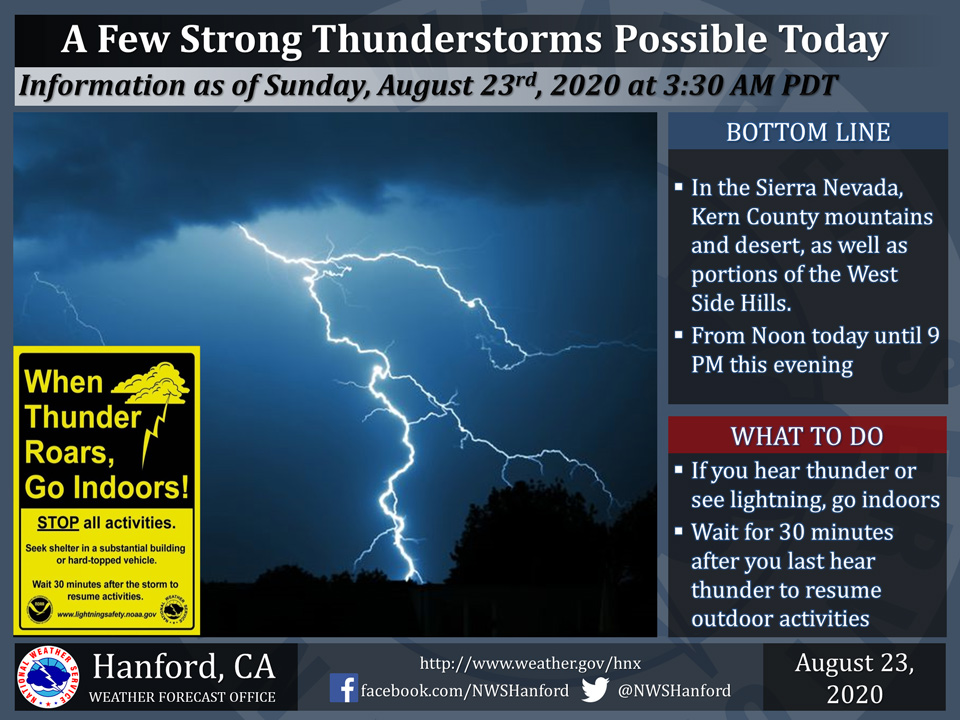
August 23, 2020 - The National Weather Service Hanford Office reports a few strong thunderstorms are possible in the Sierra Nevada, Kern County mountains and desert, as well as the higher terrain adjacent to the west side of the San Joaquin Valley this afternoon and evening.
Dangerous cloud to ground lightning strikes, wind gusts near 50 mph, and small hail are some hazards associated with strong thunderstorms.
In addition, any thunderstorm can produce intense rainfall rates that could lead to localized flooding.
  Area Forecast Discussion
  National Weather Service Hanford CA
  213 AM PDT Sun Aug 23 2020


  .SYNOPSIS... Smoke from surrounding fires will continue to
  produce poor air quality through at least early this week. A
  northerly influx of tropical moisture will bring an increasing
  chance of thunderstorms to mainly the higher elevations through
  Monday. Otherwise, temperatures will average close to normal
  through the period.

  &&

  .DISCUSSION...Some mid-level moisture continues to bring some clouds
  at times tonight. Hazy skies will continue for much of today due
  to smoke from ongoing wildfires. Temperatures will remain at or
  slightly above average with somewhat warm overnight lows, though
  not as warm as what occurred during last week. Moisture from the
  remnants of Genevieve will push mainly along the Central CA coast
  later today into Monday with some moisture that could produce
  isolated thunderstorms over the higher terrain. The best chances
  will be during this afternoon and evening over the Sierra Nevada
  and Kern County mountains, though some isolated thunderstorms
  cannot be ruled out over the West Side Hills, mainly over the
  highest peaks. Any thunderstorm that develops is capable of
  producing frequent lightning, as well as brief heavy rain along
  with gusty winds. On Monday afternoon and evening, a renewed
  threat of thunderstorms is expected over the higher elevations of
  the Sierra Nevada due to residual moisture. During Monday
  evening, the remnants of Genevieve will be caught in the southerly
  flow around the upper-level ridge that remains parked over much of
  the southern U.S., and the moisture will be transported
  northeastward into the Great Basin.

  Unfortunately, smoke from the surrounding wildfires will continue
  to impact much of Central California with unhealthy air quality
  for at least the next couple of days and perhaps longer. We will
  continue to coordinate with the local air pollution control
  districts regarding this situation. Visibility of around a couple
  of miles, and possibly lower at times, will likely last for the
  early part of this week, due to this smoke. Until these fires are
  extinguished, expect at least some hazy skies to persist beyond
  this period, especially over the Central Valley. Winds will be
  generally light through at least Monday, as we are situated under
  the western edge of the upper-level high pressure.

  By Tuesday, the flow aloft will likely turn more southwesterly,
  which is a typical dry pattern for this time of year. Relatively
  warm weather with mainly clear skies are in store for Tuesday and
  likely for the remainder of August. The high pressure ridge will
  be mainly over AZ and the Four Corners region, but is projected
  to weaken a bit and shift southward by late in the week. Some
  moderation in temperatures is possible over our forecast area by
  the following weekend, though with little noticeable change likely
  at this time.
Source: NWS

