


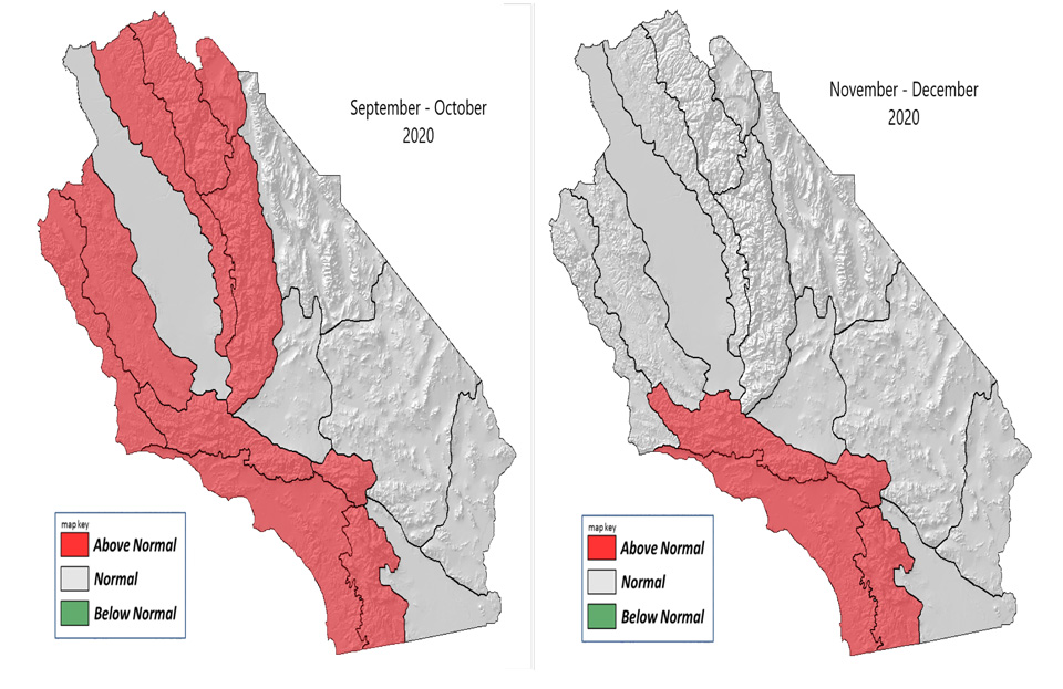
September - December 2020 Highlights
- Temperatures above normal through December.
- Below normal rainfall through December.
- Above normal offshore wind events October through December.
Weather and Fuels Discussion
September 2, 2020 - A trough over the Pacific Northwest caused strong high pressure to be centered over Texas bringing near to below normal temperatures to the area August 1st – August 11th. The high pressure over Texas moved west to Arizona and the Southern Great Basin causing the first prolonged heat wave of the summer from August 12th – August 21st. Many locations received record or near record heat from August 14th – August 19th. The strong high weakened bringing near to a little above normal temperatures August 22nd through the end of the month. Overall, most locations received well above normal temperatures for August due to the long period of hot weather during the middle of the month (Fig 1).
An area of low pressure off the Central California Coast brought daily isolated afternoon thunderstorms to the Sierra Crest from August 7th – August 11th. The remnants of Hurricane Elida brought isolated showers and thunderstorms to the southern half of Central California August 13th. Isolated to scattered daily afternoon monsoonal showers and thunderstorms formed over the Sierra and over the mountains and deserts of Southern California August 14th – August 24th. This was the first period of monsoonal shower and thunderstorm activity this summer. Moisture from the remnants of Hurricane Fausto brought numerous thunderstorms to the Central Coast August 15th into the early morning hours of August 16th. Most locations received well below normal rainfall for August, but some mountain locations and much of the Central Coast received well above normal rainfall (Fig 2). Most of the desert became abnormally dry, with some moderate drought over the far eastern deserts bordering Nevada (Fig 3). Otherwise, there was no change to the drought situation this month.
Since there were no monsoonal showers and thunderstorms until August 14th, the 1000 hour dead fuel moisture lowered to near the 3rd percentile across many areas (Fig 4). Hot and dry conditions also brought the 100 hour dead fuel moisture to the 3rd percentile toward the middle of the month (Fig 5 ). The live fuel moisture has lowered to mainly between 60% and 80%, but some of the old growth fuel moisture is between 50% and 60% (Fig 6 next page). These values are near normal for this time of year.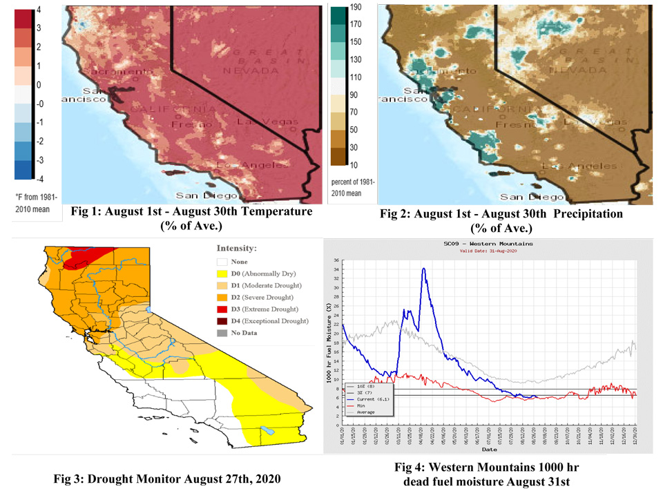
South OPS Outlook
Sea surface temperatures have warmed significantly along the West Coast during August (Fig 7). This warming of the water off the West Coast will cause the area of high pressure over the southwestern States to remain stronger than normal into the middle part of September. Thus, expect above normal temperatures through the middle of September. Sea surface temperatures in the Gulf of Alaska remain well above normal and little change is expected through the end of fall (Fig 7). Due to these above normal sea surface temperatures in the Gulf of Alaska, a dominant high is expected to form off the California Coast from the middle of September through December. This strong area of high pressure is expected to force troughs inland into the Pacific Northwest.
Some of these troughs will then be shunted to the southeast over the Great Basin bringing an above normal amount of Santa Ana wind events to Southern California. The high pressure off the California Coast will also continue to bring above normal temperatures to the area through December. Below normal sea surface temperatures across the Equatorial Pacific will cause Pacific Storms to have less available moisture to work with than usual (Fig 7). Both the blocking high off the California Coast and the below normal sea surface temperatures across the Equatorial Pacific will cause rainfall to be below normal across Central and Southern California through December.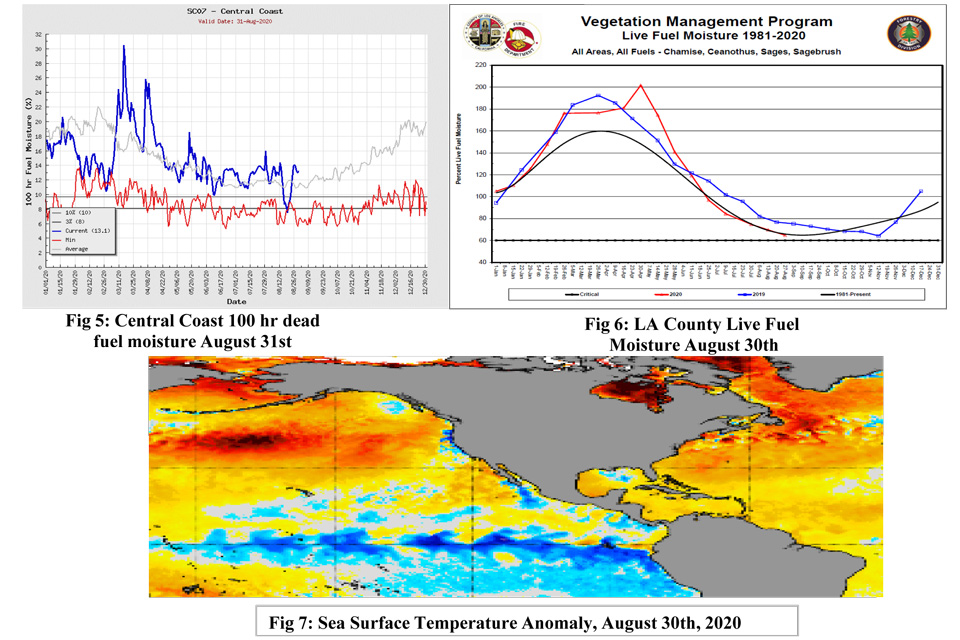
Source: Predictive Services

