


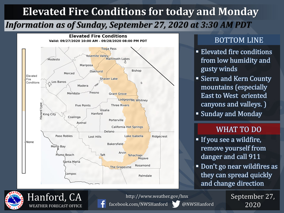
September 27, 2020 - The National Weather Service Hanford Office reports the combination of very dry fuels, gusty winds and low relative humidity can contribute to increased fire behavior for the next couple of days.
We are not expecting Critical Fire Conditions, however we are forecasting conditions to become more favorable for increased fire behavior.
East winds 10-15 mph with gusts to 25 mph and RH values getting down to 20 to 30 percent.
Outdoor burning is not recommended.
For more information please click on: https://www.spc.noaa.gov/products/fire_wx/
  Area Forecast Discussion
  National Weather Service Hanford CA
  150 AM PDT Sun Sep 27 2020

  .SYNOPSIS...Dry weather will continue over area for the next
  several days. High temperatures will rise to well average by
  Monday and remain above normal through the end of the week.

  &&

  .DISCUSSION...IR imagery showing some high clouds pushing
  southward through our CWFA this morning. These clouds will
  continue to push slowly southward today and should push south of
  our area this evening giving way to clearing skies tonight.

  Meanwhile, an upper ridge is amplifying off the western CONUS
  coast near 135W. The ridge is progged to propagate eastward today
  and build inland tonight and Monday. The ridge will turn the upper
  flow offshore tonight and may produce some gusty easterly winds
  over the ridge tops in the Sierra Nevada and Kern County Mountains
  this afternoon through early Tuesday which might result in some
  smoke from the large fires in the Sierra Nevada being blown into
  the San Joaquin Valley on Monday. It will also result in elevated
  fire weather concerns this afternoon through early Tuesday along
  the Sierra Nevada crest and along ridge tops in the Kern County
  Mountains. The ridge building inland will also produce rises in
  heights and diurnal thicknesses and as a result temperatures will
  rise to well above normal levels on Monday with afternoon highs
  in the San Joaquin Valley expected to be in the mid to upper 90s.

  The ridge is progged to strengthen over our area on Tuesday which
  will likely result in additional warming for our area. The winds
  aloft will turn more southerly which end the elevated fire weather
  concerns for the mountains. Winds will generally become terrain
  driven from Tuesday afternoon through the remainder of the week.

  The medium range models are in fairly good agreement with
  maintaining the upper ridge over the western CONUS through the
  end of the work week with dry conditions and much above normal
  temepratures continuing through at least the end of the week. The
  one uncertainty that exists for temepratures forecast this week
  is how much impact will smoke from the large fires in the Sierra
  Nevada have on daytime temperatures.

  Progs are indicating the ridge will weaken some next weekend as
  an upper trough deepens off the western CONUS coast. Temepratures
  will lower some next weekend in response to lowering heights and
  thicknesses, but remain well above seasonal averages. Dry
  conditions will prevail across our area at least through next
  weekend with no signs of precipitation.
Source: NWS

