


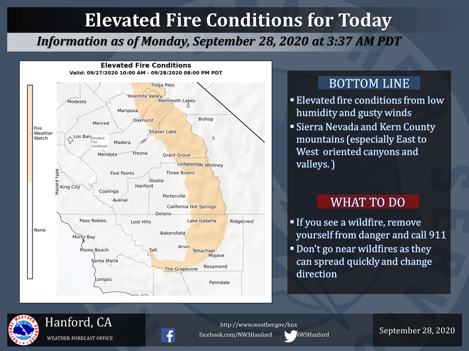
September 28, 2020 - The National Weather Service Hanford Office reports the combination of very dry fuels, gusty winds and low relative humidity is expected to contribute to increased fire behavior through today.
We are not expecting Critical Fire Conditions, however we are forecasting conditions to become more favorable for increased fire behavior.
East winds 10-15 mph with gusts to 25 mph and RH values falling to around 10 to 15 percent by the afternoon.
Outdoor burning is not recommended.
For more information please click on: https://www.spc.noaa.gov/products/fire_wx/
  Area Forecast Discussion
  National Weather Service Hanford CA
  337 AM PDT Mon Sep 28 2020


  .SYNOPSIS...
  Dry weather will continue over the area for the next several days.
  High temperatures will remain well above normal through the end
  of the week.

  &&

  .DISCUSSION...
  An upper level ridge of high pressure is amplifying along the
  west coast while surface high pressure is building into the Great
  Basin region. Surface pressure gradients have strengthened and
  turned offshore while upper level flow is increasing out of the
  east around the building upper ridge. Temperatures continued an
  upward trend Sunday beneath the building ridge, with afternoon
  highs topping out a few degrees above normal.

  The upper ridge is progged to slowly migrate inland during the
  next couple of days. Temperatures will continue to trend upward
  under the incoming ridge, with highs today and Tuesday expected
  to be as much as 8 to 12 degrees above normal for the end of
  September. Gusty easterly flow around the ridge along with the low
  humidities and hot temperatures will lead to elevated fire
  weather concerns from today through Tuesday morning for the
  higher elevations of the Sierra Nevada and Kern County Mountains.
  The unseasonably hot temperatures for late September will also
  create a moderate risk of heat related illness in the San Joaquin
  Valley for those who are sensitive to the heat.

  After Tuesday, expect little change in the dry and hotter than
  normal conditions for a few days, as the ridge remains over the
  western US, though highs could lower just a couple of degrees as
  a weak impulse tracks slowly northwestward off the west coast.
  High temperatures will still remain well above normal through
  Friday. Smoke from area fires will continue to plague the region
  throughout the week and could affect temperature forecasts in
  areas where it is thick enough to filter out sunlight.

  By Saturday and Sunday. models swing a weak low pressure system
  toward the northern/central California coast and temperatures will
  trend back downward. Highs will be back to around seasonal
  averages for the start of next week. The forecast remains free of
  precipitation into early next week.
Source: NWS

