


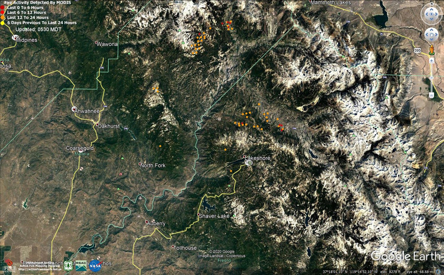
MODIS map of the Creek Fire on Thursday at 4:30 A.M. PST
Note: 1,500 Wide and older yellow detections removed
MODIS Active Fire Mapping Program Frequently Asked Questions
Update 8:30 P.M.: CAL FIRE evening Creek Fire update: 309,796 acres and 44% containment.
'Click' here to view 5 page PDF With Evacuations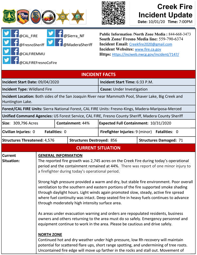
Update 5:15 P.M.: Sierra National Forest Creek Fire North Zone Operations Briefing Video for Thursday, October 1, 2020
Update 2:55 P.M.: Sierra National Forest Creek Fire Operations South Zone Briefing Video for Thursday, October 1, 2020
Update 10:45 A.M. CAL FIRE Evacuation Orders are Lifted on the Creek Fire: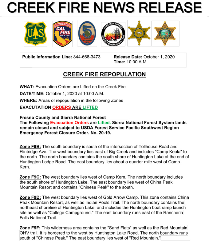

Update 10:30 A.M.: CAL FIRE morning update: 309,033 acres and 44% containment, with 4,576 structures threatened.
'Click' here to view 6 page PDF With Evacuations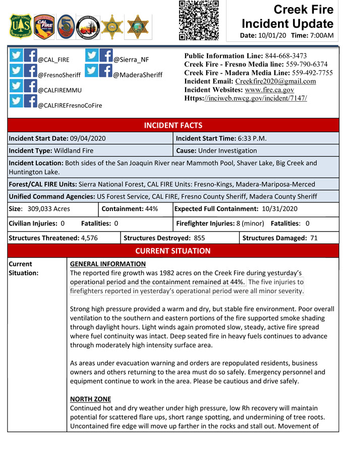
Update: 8:30 A.M. Forest Service Wildland Fire Smoke/Air Quality Outlook Due to the Creek Fire in the Yosemite Area for October 1 &2, 2020
Update 5:15 A.M.: Sierra National Forest Creek Fire Operations Map for Thursday, October 1, 2020 - Shows Divisions, Uncontrolled Fire Edge, Completed Dozer Lines, Proposed Dozer Lines
October 1, 2020 - Overnight infrared mapping has the Creek Fire at 309,033 Interpreted Acres.
Comments and notes on flight:
No data was received for the southern two thirds of the Creek Fire. The perimeter in that area is indicated as estimated.
Moderate areas of creeping growth were noted along the northern portion of the perimeter.
Moderate areas of intense fire were detected along the northern portion of the fire.
Isolated fires were generally within fairly close proximity to the main perimeters.
The fire within the perimeter was highly scattered.
Wednesday Evening Update: 307,051 acres and 44% containment.
Sierra National Forest Creek Fire Updates for Wednesday, September 30, 2020
