


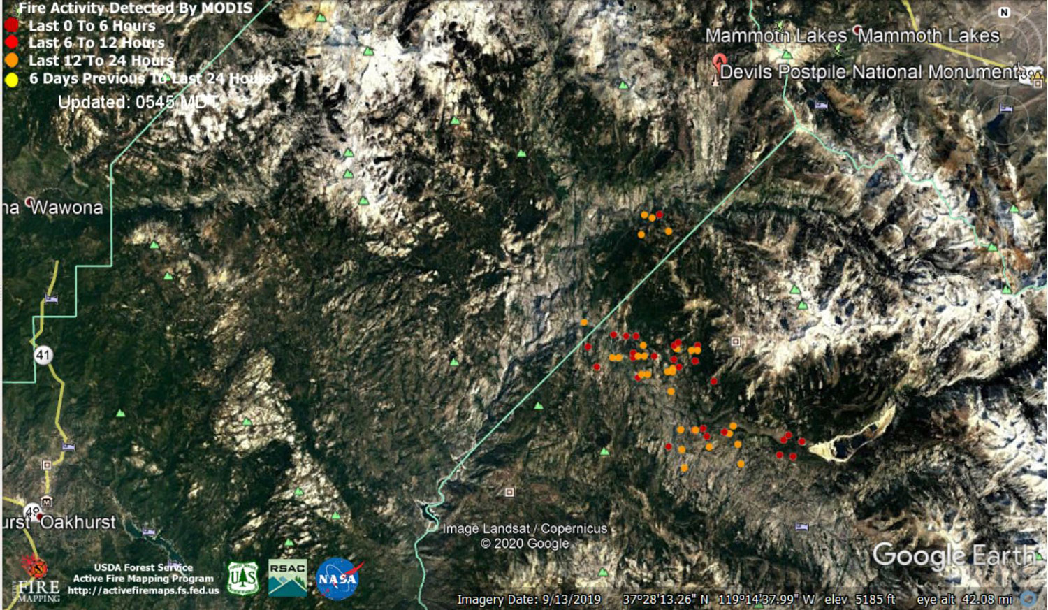
MODIS map of the Creek Fire on Tuesday at 4:45 A.M. PST
Note: 1,500 Wide and older yellow detections removed
MODIS Active Fire Mapping Program Frequently Asked Questions
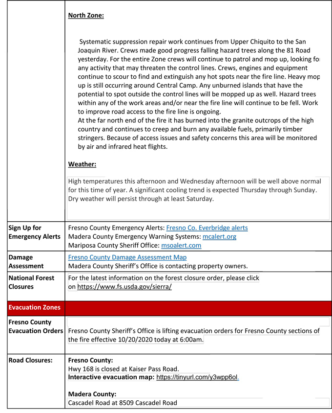
Update for 7:00 P.M. CAL FIRE Evening Update for the Creek Fire: fire remains at 352,339 acres and 61% containment.
'Click' here to view 3 page PDF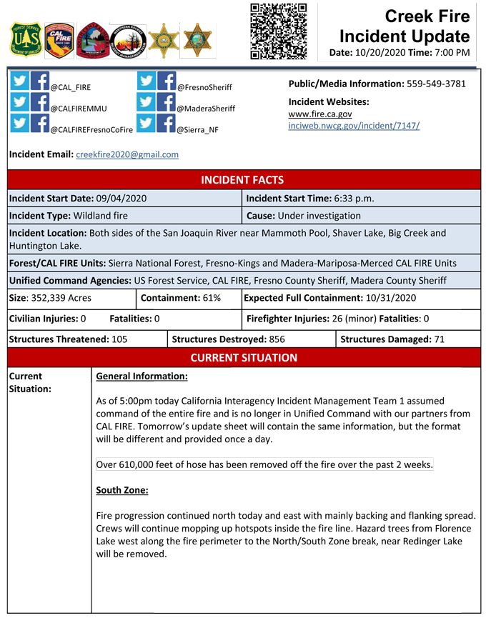
Update 11:00 A.M.: Sierra National Forest Creek Fire North Zone Operations Briefing Video for Tuesday, October 20, 2020
Update 10:00 A.M.: Sierra National Forest Creek Fire South Zone Operations Briefing Video for Tuesday, October 20, 2020
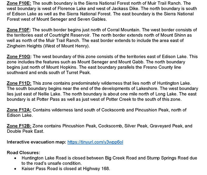
Update 9:45 A.M.: Fresno County Sheriff's Office has lifted evacuation orders in the remaining 11 evacuation zones in the fire area as of 6:00 am this morning.
Road closures and forest closures remain in effect.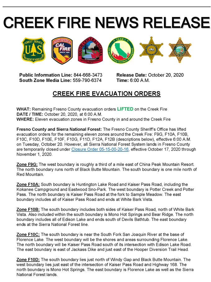
Update 9:40 A.M.: Forest Service Wildland Fire Smoke/Air Quality Outlook Due to the Creek Fire in the Yosemite Area for October 20 & 21, 2020
Update 8:00 A.M. CAL FIRE Morning Update for the Creek Fire: 352,339 acres and 61% containment.
Note: No PDF File

Update 5:50 A.M.: Sierra National Forest Creek Fire Public Information Map for Tuesday, October 20, 2020 - Shows Contained Line and Uncontrolled Fire Edge
October 20, 2020 - Overnight infrared mapping has the Creek Fire at 352,339 Interpreted Acres.
Comments and notes on flight:
All significant growth observed is on the eastern side with the two portions of the perimeter growing towards each other.
Multiple isolated heat spots observed outside of those same portions, the furthest showing about 6500 ft out.
Monday Evening Update: 350,331 acres and 61% containment.
Sierra National Forest Creek Fire Updates for Monday, October 19, 2020
