


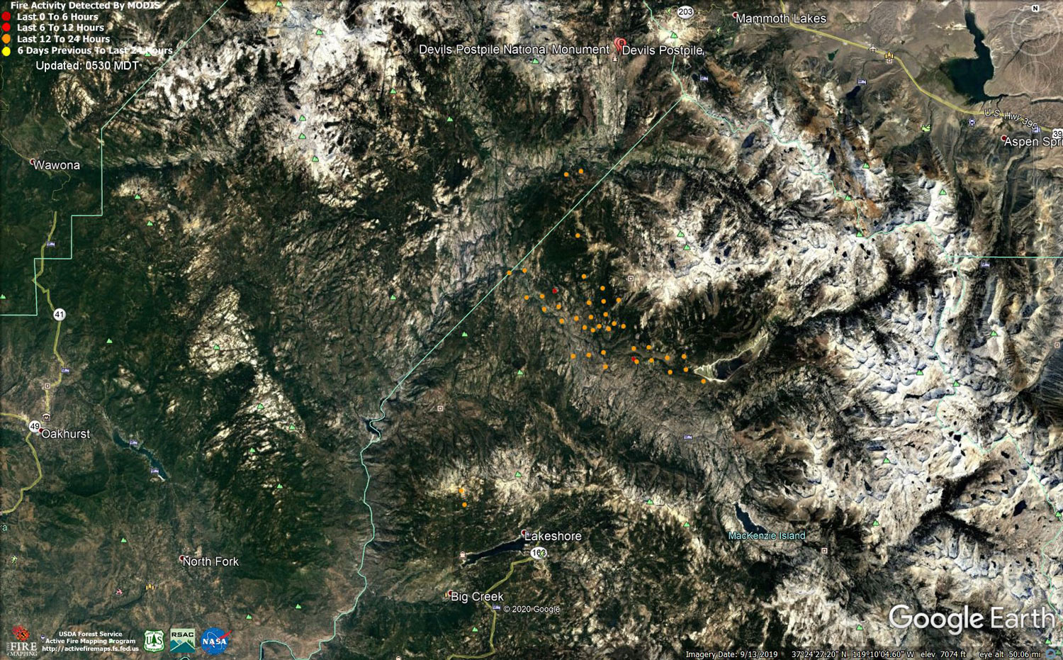
MODIS map of the Creek Fire on Thursday at 4:30 A.M. PST
Note: 1,500 Wide and older yellow detections removed
MODIS Active Fire Mapping Program Frequently Asked Questions
Update 9:00 P.M.: Sierra National Forest Creek Fire Evening Operations Briefing Video for Thursday, October 22, 2020
Update 12:25 P.M.: Sierra National Forest to Hold a Creek Fire Livestream Incident Briefing with CAL FIRE on Friday, October 23, 2020
Update 10:30 A.M.: Forest Service Wildland Fire Smoke/Air Quality Outlook Due to the Creek Fire in the Yosemite Area for October 22 & 23, 2020
Update 10:10 A.M.: Sierra National Forest Creek Fire Operations Briefing Video for Thursday, October 22, 2020
Update 9:25 A.M. CAL FIRE Morning Update for the Creek Fire: 357,656 acres and 61% containment.
Note: No PDF File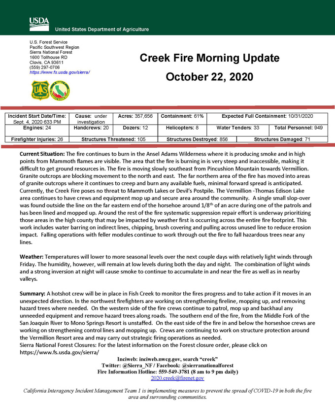
Update 5:05 A.M.: Sierra National Forest Creek Fire Incident Action Plan Map for Thursday, October 22, 2020 - Shows Contained Line and Uncontrolled Fire Edge
October 22, 2020 - Overnight infrared mapping has the Creek Fire at 357,656 Interpreted Acres.
Comments and notes on flight:
A lot of intense heat observed along the eastern perimeter north and northwest of Thomas A. Edison Reservoir.
Many isolated heat spots outside of the perimeter in that vicinity.
Overall growth is significantly more than two nights ago, the last time the fire was observed.
Wednesday Evening Update: 352,339 acres and 61% containment.
Sierra National Forest Creek Fire Updates for Wednesday, October 21, 2020
