


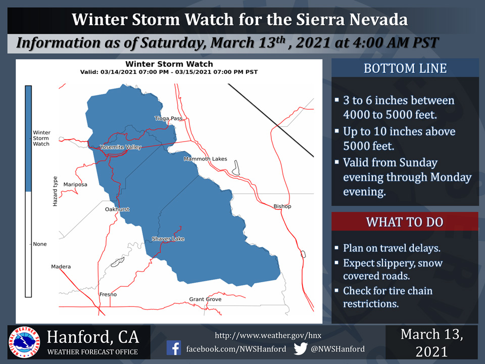
March 13, 2021 - The National Weather Service Hanford Office reports a Winter Storm Watch is in effect for the Sierra Nevada above 4,000 feet north of Kings Canyon to Yosemite National Park from 7:00 P.M. Sunday evening until 7:00 P.M. Monday evening.
Between 3 to 6 inches of snow is expected between 4,000 and 5,000 feet, with up to 10 inches of snow above 5,000 feet.
Be prepared for snow covered roads and limited visibilities, and use caution while driving.
Winds will gust as high as 60 mph on exposed ridgetops and near the crest.
Travel could be very to extremely difficult. If you must travel, remember to carry tire chains, plenty of food, a good deal of water, and warm clothing in your vehicle.
For information on road conditions, including closures or delays, call Caltrans at 1-800-427-7623.
Winter Storm Watch
URGENT - WINTER WEATHER MESSAGE
National Weather Service Hanford CA
351 AM PST Sat Mar 13 2021

Central Sierra-North Kings River-
Including the cities of Devils Postpile, Florence Lake,
Lake Thomas Edison, Tuolumne Meadows, Bass Lake, Fish Camp,
Wawona, and Shaver Lake
351 AM PST Sat Mar 13 2021

...WINTER STORM WATCH IN EFFECT FROM SUNDAY EVENING THROUGH
MONDAY EVENING...

* WHAT...Moderate to heavy snow possible. Between 3 to 6 inches of
  snow will be possible in the Sierra Nevada between 4000 and 5000
  feet, and up to 10 inches of snow will be possible above 5000
  feet. Winds gusting as high as 60 mph over higher elevations.

* WHERE...Central Sierra and North Kings River Counties.

* WHEN...From Sunday evening through Monday evening.

* IMPACTS...Plan on travel delays and slick, snow covered roads,
  some of which may become impassable or closed. Roads that remain
  open will require tire chains.

PRECAUTIONARY/PREPAREDNESS ACTIONS...

Monitor the latest forecasts for updates on this situation.

Be prepared for travel delays. If you plan to travel, consider
alternate strategies. If you must travel, remember to carry plenty
of food, a good deal of water, and warm clothing in your vehicle.
Source: NWS

