


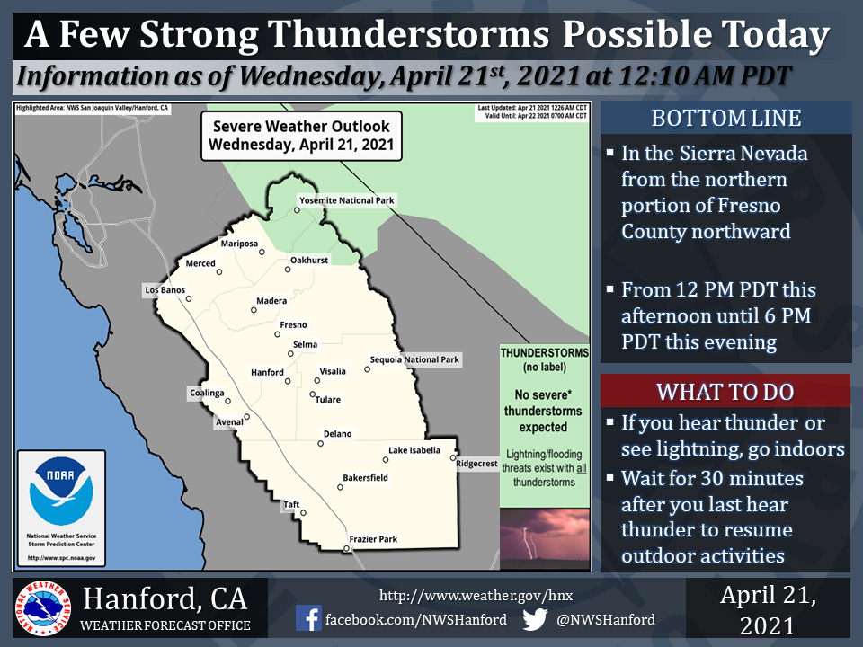
Includes Yosemite National Park and Eastern Madera and Mariposa Counties
April 21, 2021 - The National Weather Service Hanford Office reports a few strong thunderstorms are possible in the Sierra Nevada from the northern portion of Fresno County northward this afternoon into this evening.Small hail and wind gusts near 45 miles per hour are a couple of hazards associated with strong thunderstorms.
In addition to dangerous cloud to ground lightning strikes, any thunderstorm can produce intense rainfall rates, leading to localized flooding.
  Area Forecast Discussion
  National Weather Service Hanford CA
  255 AM PDT Wed Apr 21 2021

  .SYNOPSIS...
  A few thunderstorms are possible in the Sierra Nevada from Fresno
  County northward this afternoon. Strong, gusty west winds are
  expected in a portion of the Kern County mountains and desert this
  afternoon into tonight. A warming trend is likely Thursday and
  Friday. A storm system should impact Central California late this
  weekend into early next week.

  &&

  .DISCUSSION...
  An upper-level area of low pressure over Central California will
  move eastward over Nevada today. There should be enough
  atmospheric instability associated with this cyclone aloft to
  generate a few thunderstorms in the Sierra Nevada from Fresno
  County northward this afternoon. The upper-level area of low
  pressure will open into a trough of low pressure over Utah
  tonight. Strong, gusty west winds are expected in a portion of the
  Kern County mountains and desert this afternoon into tonight. A
  Wind Advisory is in effect for this area. A ridge of high pressure
  will progress eastward through the Eastern Pacific Ocean Thursday
  and Thursday night. This ridge of high pressure will move inland
  over the west coast of the United States Friday. A warming trend
  is expected Thursday and Friday. By Friday afternoon, high
  temperatures throughout Central California will be seven to nine
  degrees above normal for this time of year.

  Zonal flow aloft is expected Saturday and Saturday night. An
  upper-level area of low pressure will approach the coast of the
  Pacific Northwest Sunday. A trough of low pressure will advance
  toward Northern California Sunday night. This trough of low
  pressure will sweep through the Golden State Monday. The
  possibility of rain in the San Joaquin Valley is increasing Sunday
  through Monday. Accumulating snow is likely in the Sierra Nevada
  above 6,000 feet Sunday through Monday. In addition, significant
  cooling is expected Sunday and Monday. By Monday afternoon, high
  temperatures across Central California should be about ten degrees
  below their typical values for the end of April. A ridge of high
  pressure will build over California Monday night and Tuesday.
Source: NWS

