


Includes Eastern Mariposa and Madera Counties and Yosemite National Park
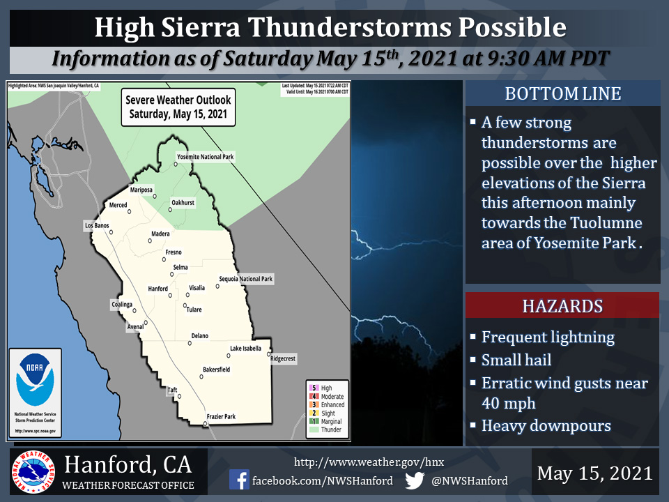
May 15, 2021 - The National Weather Service Hanford Office reports isolated thunderstorms can be expected near the Sierra crest each afternoon and evening through Monday.
Small hail and wind gusts near 40 miles per hour are a couple of hazards associated with strong thunderstorms.
In addition to dangerous cloud to ground lightning strikes, any thunderstorm can produce intense rainfall rates, leading to localized flooding.
  Area Forecast Discussion
  National Weather Service Hanford CA
  250 AM PDT Sat May 15 2021


  .SYNOPSIS...
  Increasing onshore flow today will lead to much lower afternoon
  highs compared to yesterday. Daily occurrences of afternoon
  showers and thunderstorms will be possible the next couple of days
  in the Sierra Nevada and foothills as the trough of low pressure
  moves overhead. A quick warm-up early next week will be followed
  by a cooldown as troughing resumes by next Wednesday.

  &&

  .DISCUSSION...
  Onshore flow this morning is bringing breezy conditions through
  the passes of the west side hills and much cooler temperatures.
  This is occuring due to a trough of low pressure centered over
  northern California that is digging southward bringing westerly
  winds and marine-cooled air to the valley. NBM guidance is
  suggesting that afternoon high temperatures today will be as much
  as 10-12 degrees cooler today than yesterday due to the modified
  airmass. In the afternoon hours, an isolated chance of showers and
  thunderstorms will exist in the Sierra Nevada north of Madera
  County, but the bulk of the activity will likely remain north of
  our forecast area where the better dynamics will be.

  The trough will continue to move south overnight and we will get a
  slight chance of showers over the Sierra Nevada and foothills,
  with an isolated shower possibly eking into the eastern portion
  of the valley. Any rainfall totals with these showers Sunday
  morning would be limited. Greater coverage of convection in the
  Sierra Nevada and foothills by Sunday afternoon as the combination
  afternoon heating and better dynamic support arrives. Brief heavy
  rain, lighting, and gusty winds would be the main impacts of
  these storms on Sunday. Showers and thunderstorms may also make it
  into the Kern County mountains and desert (near Ridgecrest) by
  late afternoon on Sunday as the low`s center tracks further to the
  south.

  By Monday, the upper low will shift east and be centered over the
  four corners region. For us, that means a brief warm-up under
  shortwave ridging taking afternoon highs back into the upper 80s
  across the valley. The ridge axis will be directly overhead
  Tuesday, which will likely signal a quick return to 90 degree heat
  for the valley. However, this heat will be short lived as both
  the EPS and GEFS are forecasting another trough of low pressure to
  reach the area by Wednesday, perhaps bringing another round of
  light precip over the mountains and cooler weather to the valley.
  Cool weather is expected through the end of the next work week as
  the troughing persists.
Source: NWS

