


Eastern Madera and Mariposa Counties
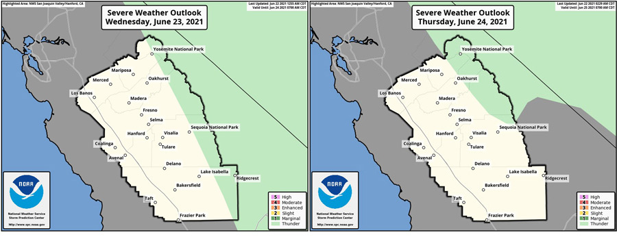
June 22, 2021 - The National Weather Service Hanford Office says we are forecasting dry thunderstorms across the Sierra Wednesday and Thursday as sub tropical moisture moves north into the area.
Dry thunderstorms can cause wildfire starts in the mountains, especially in the dry conditions due to the drought.
  Area Forecast Discussion
  National Weather Service Hanford CA
  340 AM PDT Tue Jun 22 2021


  .SYNOPSIS...
  A cooling trend expected through midweek will bring temperatures
  close to normal. Winds will be gusty at times through and below
  the mountain passes during the period. Although dry weather will
  prevail this week, isolated thunderstorms cannot be ruled out over
  the higher terrain from Tuesday night through Thursday.

  &&

  .DISCUSSION...
  A change in the weather is finally here as the Valley is expected
  to remain below the Century Mark today. The upper level
  disturbance that is slowly drifting toward the California Coast is
  responsible for the downward trend in temperatures. The
  disturbance supported the growth of the marine layer (as observed
  on the Fort Ord profiler) to well over 3000 feet MSL. At that
  altitude, will see a continuation of marine air surge into the
  Central Valley as cooler conditions spread beyond Merced County.
  In addition to the cooler marine air, the surge also provided for
  locally windy conditions over some of the areas higher terrain.
  With little change in the upper air pattern, temperatures and
  winds will once again dominate the areas weather conditions. Yet,
  further changes are expected as moisture filters in the region
  ahead of the rebuilding ridge pattern returning this weekend. The
  trajectory of the moisture may reach the area by midweek as
  isolated thunderstorms may be possible over the mountains and
  deserts.

  Observational data and model analysis show the upper disturbance
  moving slowly with pieces of energy rotating through California.
  While these pieces of energy will influence temperatures and winds
  today, the northward movement of moisture may begin to interact
  with the energy on Wednesday. Current upper air model analysis has
  the orientation of the disturbance able to draw-up monsoonal type
  moisture from the Baja Gulf for locally convective conditions
  across the Sierra Nevada range on Wednesday and even on Thursday.
  Fire weather conditions may become critical on those days as
  moisture may be limited and the lack of significant moisture may
  produce dry lightning conditions. Appropriate statement will be
  issued if conditions come into phase to produce the dangerous
  situation of low precipitation thunderstorms.

  Models still showing some uncertainty growing toward the end of
  the week, models lean toward the return of the West Coast Ridge
  pattern. Between Friday and Saturday, models attempt to dissipate
  the upper level disturbance and reintroduce the ridge axis over
  California. By Saturday, temperatures over the San Joaquin Valley
  may return to triple digit values as the ridge dominates the area
  once again. By the weekend, models place the ridge axis more over
  the Great Basin and Desert Southwest. Along with warming
  temperatures, the mid level wind flow under the position of the
  ridge pattern may become southwesterly and allow convective
  activity to diminish. While the extended may return to dry, the
  heat will once again affect the Central California Interior.
Source: NWS
