


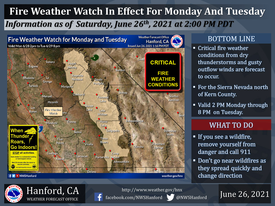
June 27, 2021 - The National Weather Service Hanford Office reports a Fire Weather Watch is in effect for the Sierra Nevada from Yosemite National Park to near the Kern County line from 2:00 P.M. Monday through 8:00 P.M. on Tuesday.
Thunderstorms developing during the afternoon and evening are expected to produce cloud to ground lightning strikes but little rainfall. Combined with very dry fuel conditions, any lightning strikes have the potential to ignite wildfires.
Gusty and erratic winds of 50 mph or greater may also accompany any thunderstorm.
Fire Weather Watch
URGENT - FIRE WEATHER MESSAGE
National Weather Service Hanford CA
847 PM PDT Sat Jun 26 2021

Central Sierra-North Kings River-Sequoia Kings-
847 PM PDT Sat Jun 26 2021

...FIRE WEATHER WATCH REMAINS IN EFFECT FROM MONDAY AFTERNOON
THROUGH TUESDAY EVENING FOR FIRE WEATHER ZONES 592, 593, AND
594...

* AFFECTED AREA...Fire weather zones 592, 593, and 594. This
  includes the Central Sierra Nevada, Kings River, and the
  Sequoia-Kings zones, or portions of Yosemite, Kings Canyon,
  and Sequoia National Parks, as well as portions of Sequoia and
  Sierra National Forests.

* WIND...Gusty and erratic winds may occur with any
  thunderstormsthat develop, and outflow winds of 50 mph or
  stronger are possible.

* THUNDERSTORMS...are expected to produce cloud to ground
  lightning and little or no rainfall. Combined with dry fuel
  conditions, any lightning strikes have the potential to
  ignite wildfires.

* IMPACTS...Any fires that develop will likely spread rapidly.

PRECAUTIONARY/PREPAREDNESS ACTIONS...

A Fire Weather Watch means that critical fire weather conditions
are forecast to occur. Listen for later forecasts and possible
Red Flag Warnings.
Source: NWS
