


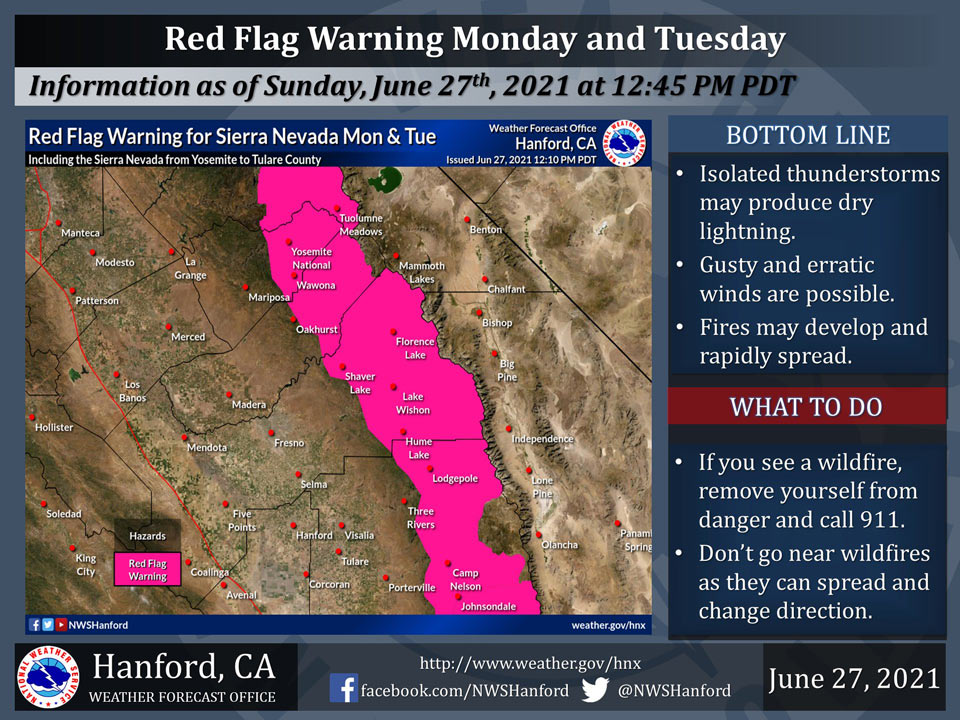
 June 27, 2021 - A Red Flag Warning is in effect for the Sierra Nevada from Yosemite to Tulare County on Monday afternoon until Tuesday evening, due to thunderstorms that may produce dry lightning and gusty erratic winds that could lead to rapidly spreading wildfires.
Red Flag Warning is in effect for the Kern County mountains, including the Lake Isabella and Tehachapi areas, on Tuesday afternoon and evening, due to thunderstorms that may produce dry lightning and gusty erratic winds that could lead to rapidly spreading wildfires.
Dry thunderstorms will be capable of producing lightning, along with strong outflow winds. When combined dry fuels, there is an increasing potential for wildfire ignitions.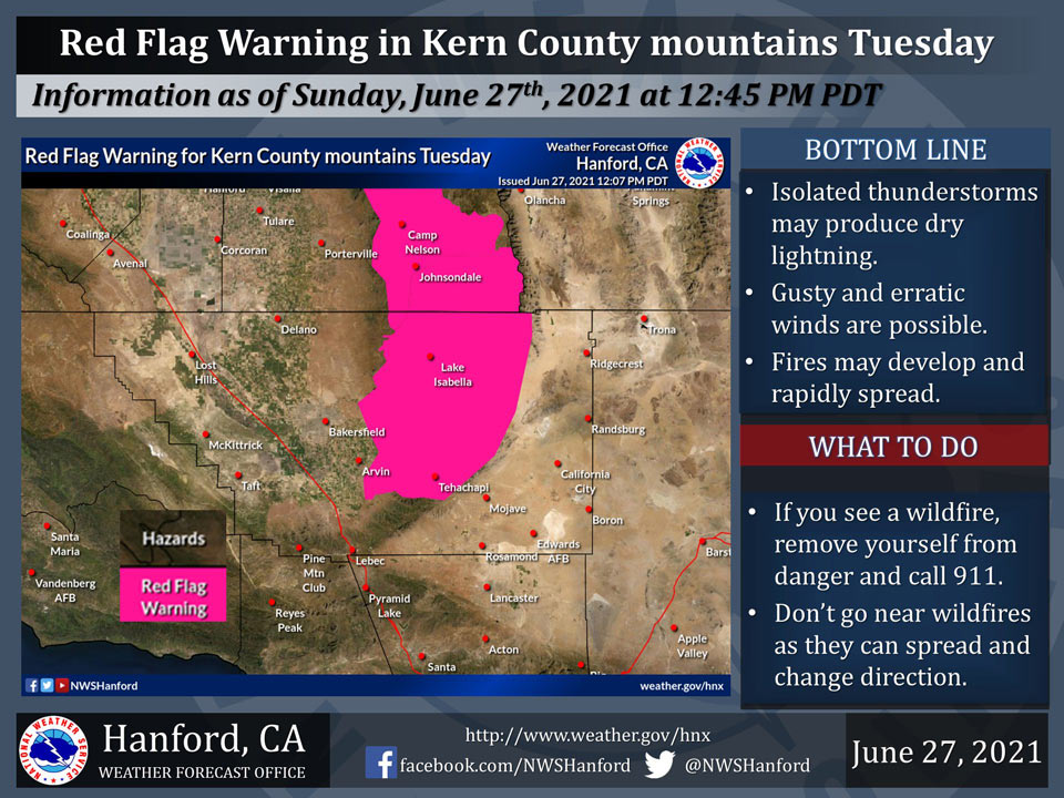
Source: NWS
Red Flag Warning
URGENT - FIRE WEATHER MESSAGE
National Weather Service Hanford CA
1157 AM PDT Sun Jun 27 2021


CAZ592>594-281030-
/O.UPG.KHNX.FW.A.0001.210628T2100Z-210630T0300Z/
/O.NEW.KHNX.FW.W.0001.210628T2100Z-210630T0300Z/
Central Sierra-North Kings River-Sequoia Kings-
1157 AM PDT Sun Jun 27 2021

...RED FLAG WARNING IN EFFECT FROM 2 PM MONDAY TO 8 PM PDT
TUESDAY FOR DRY THUNDERSTORMS AND GUSTY OUTFLOW WINDS FOR FIRE
WEATHER ZONES 592, 593, AND 594...

The National Weather Service in Hanford has issued a Red Flag
Warning, which is in effect from 2 PM Monday to 8 PM PDT Tuesday.
The Fire Weather Watch is no longer in effect.

* AFFECTED AREA...Fire weather zones 592, 593, and 594. This
  includes the Central Sierra Nevada, Kings River, and the
  Sequoia-Kings zones, or portions of Yosemite, Kings Canyon,
  and Sequoia National Parks, as well as portions of Sequoia and
  Sierra National Forests.

* WIND...Gusty and erratic winds may occur with any thunderstorm
  that develop. Outflow winds of 50 mph or stronger are
  possible.

* THUNDERSTORMS...expected to produce cloud to ground lightning
  and little or no rainfall. Combined with dry fuel conditions,
  any lightning strikes have the potential to ignite wildfires.

* IMPACTS...Any lightning caused fires can spread rapidly due to
  very dry fuel conditions and gusty outflow winds from
  thunderstorms.


PRECAUTIONARY/PREPAREDNESS ACTIONS...

A Red Flag Warning means that critical fire weather conditions
are expected to occur. A combination of locally strong winds, low
relative humidity, and warm temperatures can contribute to extreme
fire behavior from lightning caused fires.
