


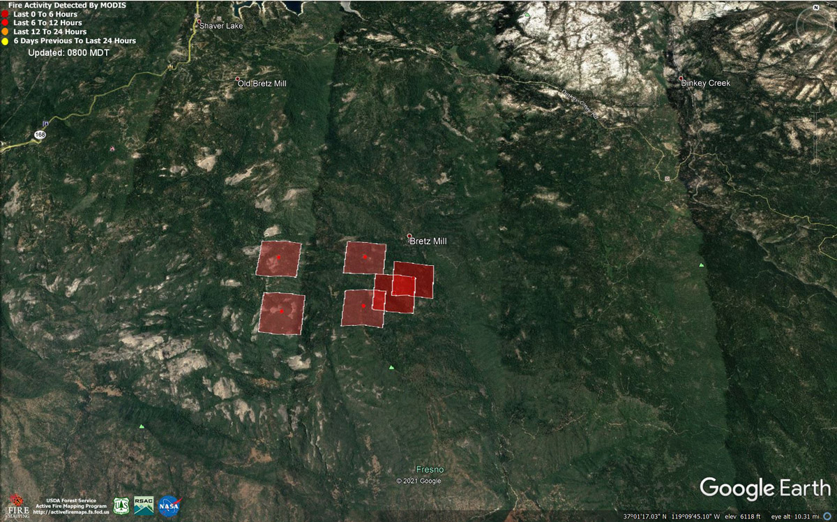
MODIS map of the Blue Fire on Wednesday at 7:00 A.M. PST
Note: 1,200 Wide
MODIS Active Fire Mapping Program Frequently Asked Questions
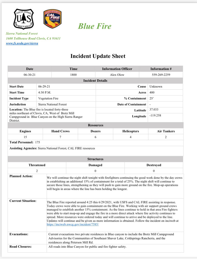
Afternoon Update: #BlueFire at 400 Acres with 25% Containment
Update 9:30 A.M. Map Added
Update: 8:00 A.M.
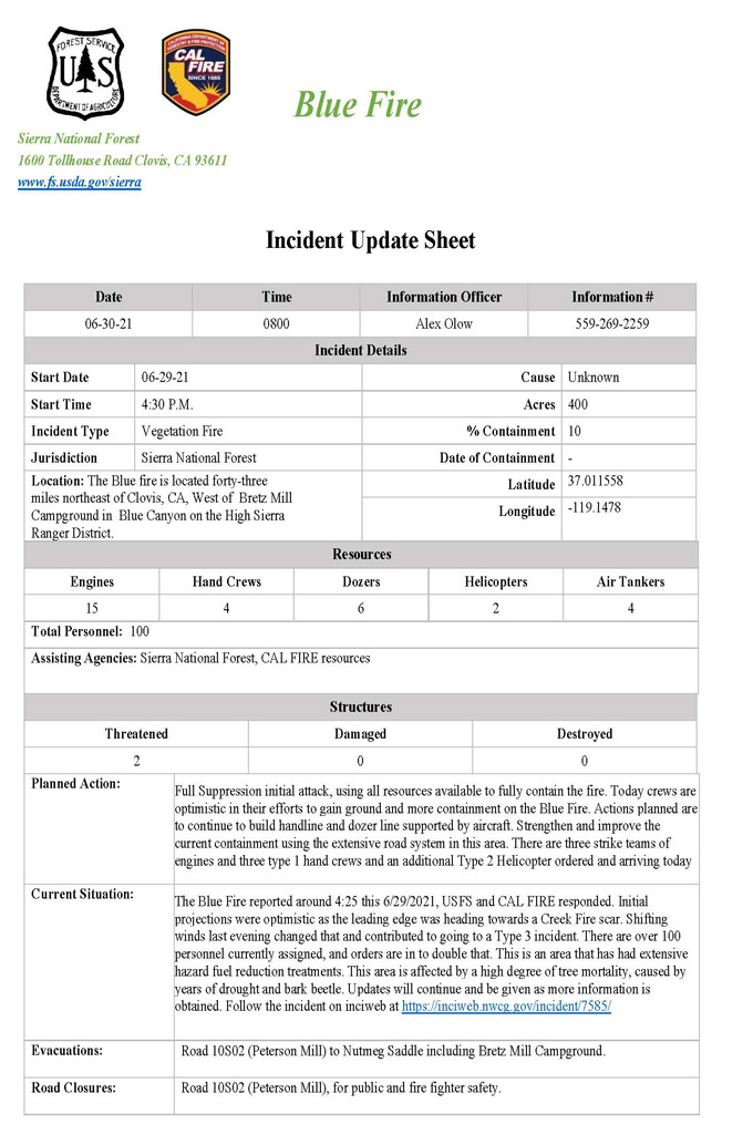
Update: 7:30 A.M.: #BlueFire at 400 Acres with 10% Containment
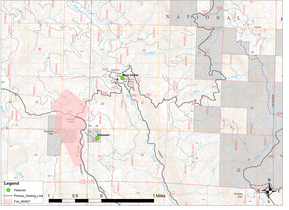
June 30, 2021 - The Sierra National Forest Blue Fire is burning in a NW direction toward the 2020 Creek Fire Burn area, and toward the ridge line at Soaproot Saddle where there has been extensive hazard fuel reduction treatments creating a fuel break.
A Moderate rate of spread at this time, burning single tree and group torching along with dead and down debris.
Initial projections were optimistic as the leading edge was heading towards a 2020 Creek Fire scar. Shifting winds this evening changed that and contributed to going to a Type 3 incident.
There are over 100 personnel currently assigned, and orders are in to double that. This is a full suppression response by USFS and CAL FIRE (FKU)
|
Date of Origin: |
Tuesday June 29th, 2021 approx. 04:30 PM |
| Incident Description | Fire Burning In Timber, Understory Litter, And Short Grass. Active Moderate Rate Of Spread With Single Tree And Group Torching With Short Crown Runs Being Observed. |
|
Location |
The Blue fire is located forty-three miles northeast of Clovis, CA, West of Bretz Mill Campground in Blue Canyon on the High Sierra Ranger District. |
|
Incident Commander |
USFS Sierra National Forest |
|
Cause |
Unknown |
