


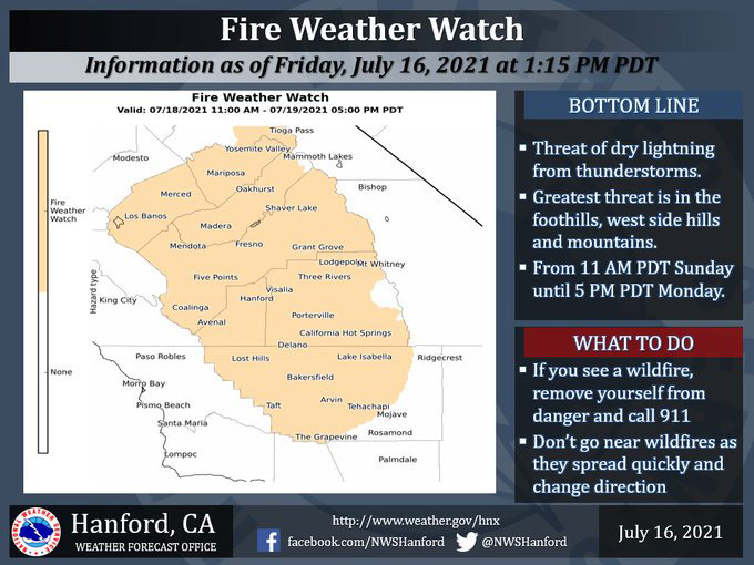
July 17, 2021 - The National Weather Service Hanford Office reports a Fire Weather Watch is in effect for much of the central California interior later this weekend into early next week.
Lightning from mainly dry thunderstorms could spark new wildfires within the Fire Weather Watch area.
The threat could occur as early as late Saturday night in the southern San Joaquin Valley and the Kern County mountains.
Fire Weather Watch
URGENT - FIRE WEATHER MESSAGE
National Weather Service Hanford CA
352 AM PDT Sat Jul 17 2021

West Side Hills-San Joaquin Valley-Central Sierra Foothills-
Southern Sierra Foothills-Central Sierra-North Kings River-
Sequoia Kings-Lake Isabella-Tehachapi Area-Fort Tejon-
352 AM PDT Sat Jul 17 2021

...FIRE WEATHER WATCH REMAINS IN EFFECT FROM SUNDAY MORNING
THROUGH MONDAY AFTERNOON FOR DRY THUNDERSTORMS FOR FIRE WEATHER
ZONES 579, 580, 590, 591, 592, 593, 594, 595, 596, AND 597...

* AFFECTED AREA...Mountain areas, including the Sierra Nevada
  from Yosemite National Park to Kern County, Sierra Nevada
  foothills, Central and Southern San Joaquin Valley, and the
  West Side Hills. The threat of thunderstorms will be most
  likely late Sunday morning until Monday afternoon.

* WIND...Gusty and erratic winds are possible near any
  thunderstorms with gusts to around 40 mph.

* THUNDERSTORMS...Isolated to scattered storms are expected
  that could produce little rainfall accompanied with cloud to
  ground lightning.

* IMPACTS...Any fires that develop will likely spread rapidly,
  due to dry fuels.

PRECAUTIONARY/PREPAREDNESS ACTIONS...

A Fire Weather Watch means that critical fire weather conditions
are forecast to occur. Listen for later forecasts and possible
Red Flag Warnings.
Source: NWS
