


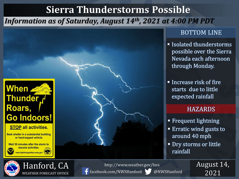
August 14, 2021 - The National Weather Service Hanford Office reports there is a low chance that thunderstorms will develop over the Sierra Nevada each afternoon through Monday.
The storms are expected to be dry or produce little rainfall.
In addition to dangerous cloud to ground lightning, there will be an increase threat of fire starts due to gusty erratic winds, dry vegetation and little rainfall.
  Area Forecast Discussion
  National Weather Service Hanford CA
  243 AM PDT Sat Aug 14 2021


  .SYNOPSIS...
  Hot temperatures will continue this weekend and early next week
  due to high pressure aloft over the area. Afternoon convection
  remains a possibility through Monday in the Sierra Nevada. Cooler
  by the middle of next week, but seasonably warm temperatures
  remain across the forecast area.

  &&

  .DISCUSSION...
  Another warm day is forecast for the San Joaquin Valley and the
  Mojave Desert as the ridge pattern continues to strengthen.
  Afternoon high temperatures ranging from 102 to 106 degrees are
  forecast for the valley, which is prompting the Heat Advisory
  today. Hot temperatures will occur in the Mojave Desert this
  afternoon, with highs of 105-110 expected there, so an Excessive
  Heat Warning will be in effect there today. The ridge of high
  pressure continues to strengthen tomorrow, so highs may top out a
  degree or two higher than today for the entire forecast area with
  similarly hot conditions Monday. An Excessive Heat Watch is valid
  in the valley on Sunday and Monday, where temperatures may reach
  the 105 to 110 degree depending on where you are in the valley.
  The Mojave Desert will get quite hot Sunday and Monday, with highs
  of 107-112 degrees forecast. The Excessive Heat Warning in the
  desert is in effect through 8 PM Monday.

  Along with these hot afternoon highs will be daily chances of
  afternoon thunderstorms in the Sierra Nevada. Modest
  easterly/southeasterly flow aloft will provide the mountains with
  enough moisture and instability for afternoon convection, however,
  not enough for any heavy rainfall. Low QPF is continued to be
  forecast for these thunderstorms. Dry weather is forecast after
  Monday as the ridge providing southeasterly flow gets eroded by
  an incoming trough.

  Cooler temperatures are forecast to begin starting on Tuesday (but
  still warm) as ensemble guidance shows the ridge of high pressure
  overhead getting squashed by a trough passing through the Pacific
  Northwest. We still are likely to see triple digit heat through
  much of the area on Tuesday. NBM guidance shows Wednesday to drop
  into the mid to upper 90s for the SJ Valley, with a rebound in
  high temps afterwards.

  &&


  .AVIATION...
  In the Sierra Nevada, areas of MVFR and local mountain obscuring
  IFR in showers and isolated thunderstorms until 03Z Sunday.
  Elsewhere, VFR conditions will prevail over the Central CA
  Interior for at least the next 24 hours.

  &&

  .AIR QUALITY ISSUES...
  On Saturday August 14 2021... Unhealthy for sensitive groups in
  Sequoia National Park and Forest.
  Further information is available at Valleyair.org
Source: NWS
