


Note: Upgraded to a Winter Storm Warning
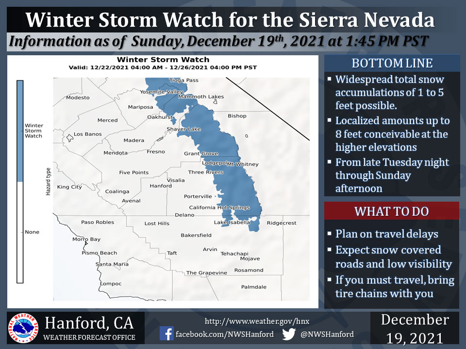
December 20, 2021 - The National Weather Service Hanford Office reports a Winter Storm Watch is in effect for the Southern Sierra Nevada north of Lake Isabella from late Tuesday night through Sunday afternoon.
Heavy snow will occur at times during this period as a series of storms moves through the region.
Winds could gust as high as 65 mph on exposed ridgetops and near the crest.
If you plan to travel, consider alternate strategies. If you must travel, remember to carry tire chains, plenty of food, a good deal of water, and warm clothing in your vehicle.
Continue to monitor the latest forecasts.
For information on road conditions, including closures or delays, call Caltrans at 1-800-427-7623 or Caltrans road conditions.
Winter Storm Watch
URGENT - WINTER WEATHER MESSAGE
National Weather Service Hanford CA
506 AM PST Mon Dec 20 2021

Yosemite NP outside of the valley-Upper San Joaquin River-
Kaiser to Rodgers Ridge-Kings Canyon NP-Grant Grove Area-
Sequoia NP-South End of the Upper Sierra-
Including the cities of Tuolumne Meadows, Wawona,
Devils Postpile, Florence Lake, Lake Thomas Edison, Lake Wishon,
Huntington Lake, Shaver Lake, Cedar Grove, Grant Grove,
Hume Lake, Giant Forest, Lodgepole, and Johnsondale
506 AM PST Mon Dec 20 2021

...WINTER STORM WATCH REMAINS IN EFFECT FROM LATE TUESDAY NIGHT
THROUGH SUNDAY AFTERNOON...

* WHAT...Heavy snow possible. Total snow accumulations of 1 to 5
  feet with localized accumulations up to 8 feet possible over
  higher elevations. Winds could gust as high as 65 mph.

* WHERE...Sierra Nevada from Yosemite NP to Lake Isabella.

* WHEN...From late Tuesday night through Sunday afternoon.

* IMPACTS...Travel could be very difficult to impossible.

PRECAUTIONARY/PREPAREDNESS ACTIONS...

A Winter Storm Watch means there is a potential for significant
snow, sleet, or ice accumulations that may imp
Source: NWS
