


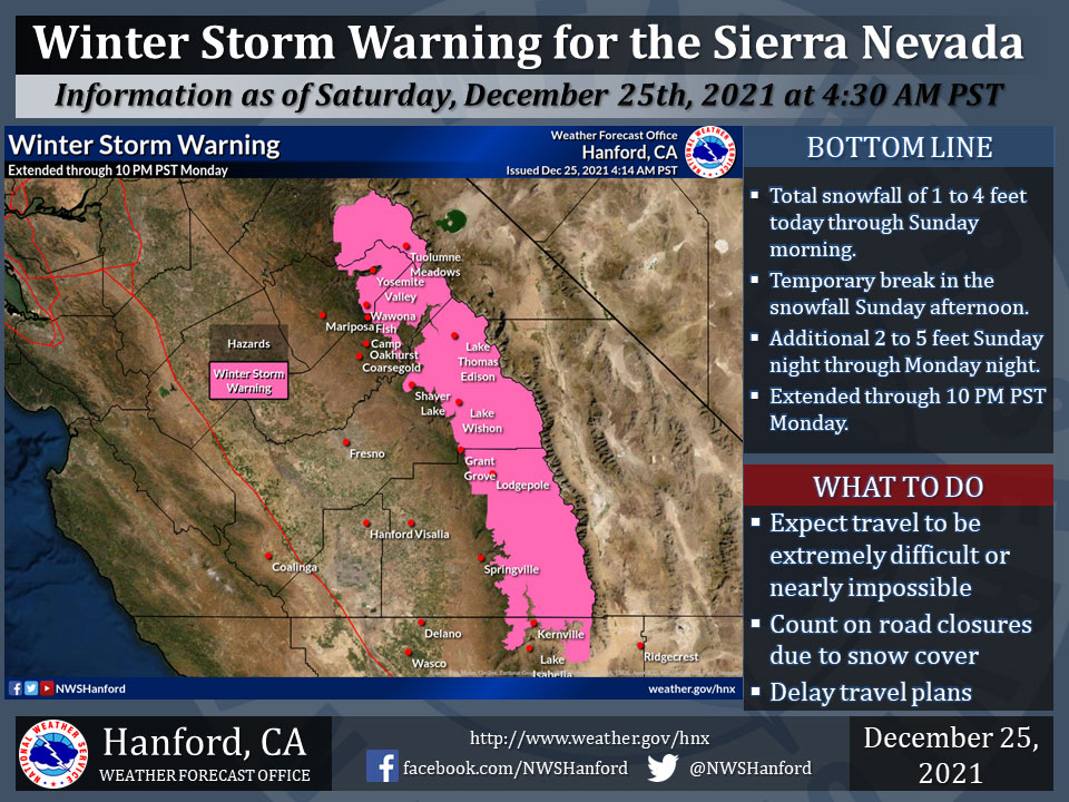
December 25, 2021 - The National Weather Service Hanford Office reports the Winter Storm Warning for the Sierra Nevada has been extended through 10:00 P.M. Monday.
The first storm will bring between 1 to 4 feet of snow today through Sunday morning.
There will be a break in the snowfall on Sunday, followed by an additional 2 to 5 feet from Sunday night through Monday night.
Travel will continue to be extremely difficult or impossible. If you plan to travel, consider alternate strategies.
For information on road conditions, including closures or delays, call Caltrans at 1-800-427-7623 or Caltrans Quick Map.
Winter Storm Warning
URGENT - WINTER WEATHER MESSAGE
National Weather Service Hanford CA
349 AM PST Sat Dec 25 2021

Yosemite NP outside of the valley-Upper San Joaquin River-
Kaiser to Rodgers Ridge-Kings Canyon NP-Grant Grove Area-
Sequoia NP-South End of the Upper Sierra-
Including the cities of Tuolumne Meadows, Wawona,
Devils Postpile, Florence Lake, Lake Thomas Edison, Lake Wishon,
Huntington Lake, Shaver Lake, Cedar Grove, Grant Grove,
Hume Lake, Giant Forest, Lodgepole, and Johnsondale
349 AM PST Sat Dec 25 2021

...WINTER STORM WARNING NOW IN EFFECT UNTIL 10 PM PST MONDAY...

* WHAT...Heavy snow. New snow accumulations of 1 to 4 feet through
  Sunday morning, then additional accumulations of 2 to 5 feet
  Sunday night through Monday night. Winds gusting as high as 55
  mph.

* WHERE...Sierra Nevada from Yosemite NP to Lake Isabella.

* WHEN...Until 10 PM PST Monday.

* IMPACTS...Travel will be very difficult to impossible. Strong
  winds and heavy snow could cause tree damage.

PRECAUTIONARY/PREPAREDNESS ACTIONS...

If you must travel, keep an extra flashlight, food, and water in
your vehicle in case of an emergency.

The latest road conditions for the state you are calling from can
be obtained by calling 5 1 1.
Source: NWS
