


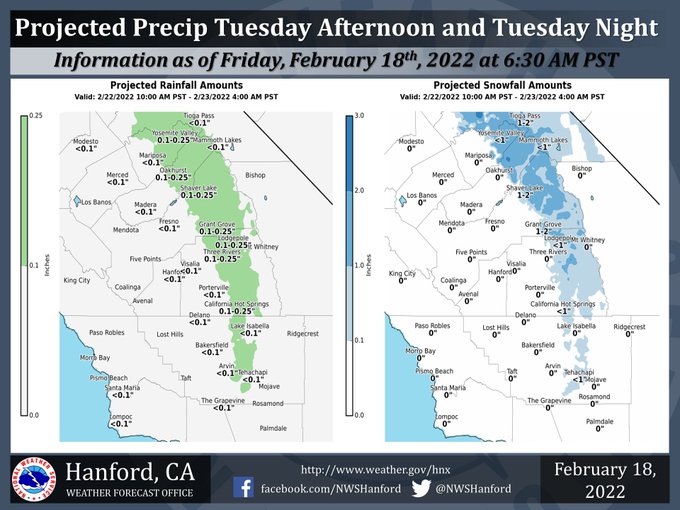
Projected Precipitation for Mariposa: Less than 0.10"
Projected Precipitation for Oakhurst 0.10" - 0.25"
Projected Precipitation for Yosemite Valley 0.10" - 0.25"
February 18, 2022 - The National Weather Service Hanford Office reports light snow is possible in the Sierra Nevada and adjacent foothills Tuesday afternoon and Tuesday night.
The snow level will be around 2,000 feet. Rain amounts, if any, in the San Joaquin Valley Tuesday afternoon and Tuesday night will be well below one tenth of an inch.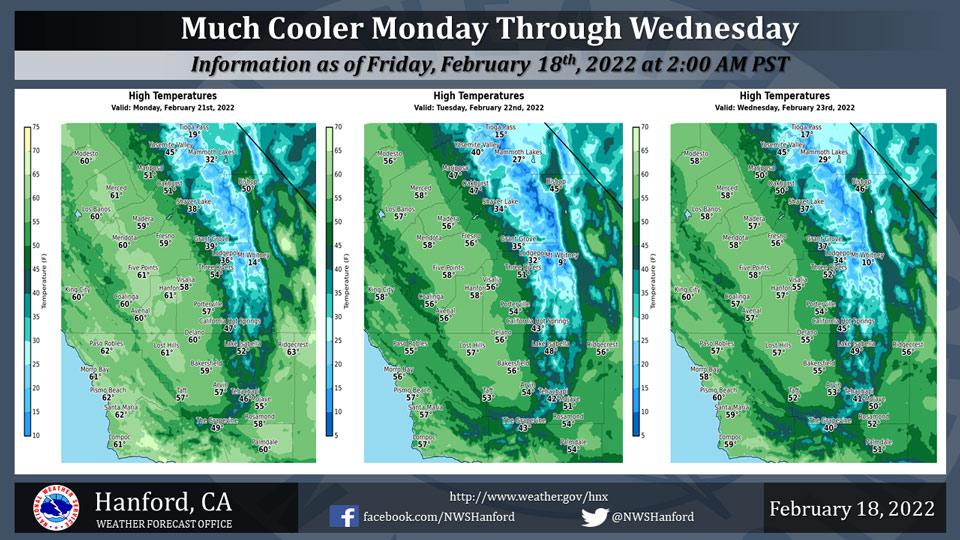
  National Weather Service Hanford CA
  226 AM PST Fri Feb 18 2022


  .SYNOPSIS...
  Above average temperatures will prevail through the weekend. A
  trough of low pressure will move into the region on Monday through
  Wednesday. This will bring a slight chance of showers in the
  valley and and a chance of snow showers into the Sierra. Cold
  minimum temperatures will then settle into the valley from Tuesday
  into Friday, with growing confidence of freezing conditions.


  &&


  .DISCUSSION...
  Looking at the synoptic setup through the weekend, the ridge axis
  will remain positioned at 136W. Meanwhile, a weak upper low will
  move south along the eastern edge of this ridge, paralleling the
  CA coast through Saturday. With high pressure in charge, today`s
  temperatures will be up to 3 to 6 degrees above seasonal average.
  Temperatures will increase a few more degrees on Saturday, and
  will be between 4 to 8 degrees above average. Well above average
  temperatures will continue into Sunday before the ridge begins to
  break down as an upper level trough digs into the PacNW.

  This trough moves into NV on Monday. This will bring a slight
  (20%) chance of snow showers for the higher elevations of the
  Sierra with little to no accumulations. With a strong northwest
  to southeast orientated jetstream aloft, strong winds will become
  an issue in the Kern County mountains and desert. Given the
  placement of the strong jetstream, I`ve opted to move toward the
  90th percentile NBM winds.

  The upper level trough then pivots through the region on Tuesday.
  This will bring a slight 20% chance of showers in the valley,
  with up to a 35% chance of snow in the Sierra. This is a cold
  system, so there is even a slight 20% chance of snow showers as
  low as 2000 feet in the Sierra foothills. Overall precipitation
  amounts will remain light due to the cold northern origin of the
  trough.

  Cold temperatures will then settle into a majority of the valley
  from Tuesday through Friday, with the best chances of freezing
  temperatures on Wednesday and Thursday. There is currently a
  45-55% chance of seeing temperatures of at least 32 degrees or
  lower on Wednesday and Thursday. The aforementioned trough swings
  east by Thursday as a ridge moves into the area by Friday.
  Temperatures by the end of the week will rebound to seasonal
  averages.


  &&

  .AVIATION...
  VFR conditions will prevail across Central California through at
  least the next 24 hours.

  &&

  .AIR QUALITY ISSUES...
  On Friday February 18 2022... Fireplace/Wood Stove Burning Status
  is: No Burning Unless Registered in Fresno... Kern and Madera
  Counties.
  Further information is available at Valleyair.org
Source: NWS
