


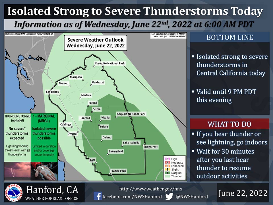
June 22, 2022 - The National Weather Service Hanford Office reports isolated, severe thunderstorms are possible in Kern County, Tulare County, Western Kings County, and Southern Fresno County today.
The primary thunderstorm hazards will be dangerous cloud to ground lightning strikes, damaging wind gusts of 58 mph or higher, and large hail.
Elsewhere, a few strong thunderstorms are possible in the remainder of Central California today.
Any thunderstorm can produce dangerous cloud to ground lightning strikes.
Area Forecast Discussion
National Weather Service Hanford CA
141 AM PDT Wed Jun 22 2022
.SYNOPSIS...
There is the threat of strong to isolated severe thunderstorms
across the central California interior through the evening hours.
The primary risk will be strong downburst winds and lightning. The
threat of showers and thunderstorms will continue through the
weekend. Above average temperatures will prevail across the
district through at least the start of next week.
&&
.DISCUSSION...
The ingredients are coming together for an active day across the
central California interior. The high resolution ensembles as
well as the higher resolution operational models are showing
decent instability along with a dry lower atmosphere from the
surface up to around 700mb. When combined with increasing sub-
tropical monsoon moisture, there is the chance of isolated severe
microbursts starting mid-afternoon and continuing into the late
evening. The greatest risk will extend northward from Kern County
into Fresno county. With the increase in cloud cover due to
storms across the region, today's high temperatures will stay shy
of the century mark for most of the district.
The closed upper low currently off the central CA coast will
start to open up and move over the central CA interior on
Thursday. The threat of showers and dry thunderstorms will
continue, although less severe and with less overall coverage. The
primary concern with these storms will continue to be gusty
erratic winds and lightning. The aforementioned low lifts into the
Great Basin on Friday with the risk of thunderstorms remaining in
the upper Sierra.
From Friday through the end of the 7-day forecast period, long
term ensembles are showing a ridge of high pressure building into
the area. This will allow for temperatures to increase up to 10
degrees above average for late June. There is a likely chance
(>70%) for temperatures off 100 degrees or greater for a majority
of the San Joaquin Valley through Monday.
&&
.AVIATION...
Isolated showers and thunderstorms are possible for the Sierra
Nevada, upper Mojave Desert, and the San Joaquin Valley through
06Z Thursday. Otherwise, VFR conditions will persist throughout
Central California today and tonight.
&&
.AIR QUALITY ISSUES...
None.
Source: NWS
