


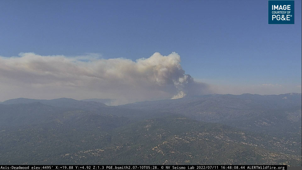
Washburn Fire in Yosemite National Park from the PG&E Deadwood Live Camera in Eastern Madera County on Monday Afternoon, July 11, 2022 at 4:48 P.M.
Click here for: Washburn Fire in Yosemite National Park Updates for Monday, July 11, 2022
July 11, 2022 - The Washburn Fire in Yosemite National Park was mapped by FIRIS on Monday afternoon, July 11, 2022.Fire Integrated Real-time Intelligence System (FIRIS) OCFA’s Intel 24 on the #WashburnFire in Yosemite National Park.
Fire is mapped at 2,720 acres at 2:42 P.M.
What is FIRIS?
The Fire Integrated Real-time Intelligence System (FIRIS) is a public-private partnership program that provides real-time intelligence data and analysis on emerging disaster incidents in California. Funded by the California Office of Emergency Services, the funding supports aircraft, a common operating picture, and near-real-time fire modeling by WIFIRE that is available at the onset of emerging incidents.
OES Intel 12 with video #2 on the #WashburnFire Yosemite National Forest. Fire is mapped at 2720 acres. pic.twitter.com/iwsRQtfsBq
— FIRIS (@FIRIS) July 11, 2022
OES Intel 12 on the #WashburnFire, Yosemite National Park. Fire is mapped at 2720 acres at 14:42 hours. Video #1 of 2. pic.twitter.com/oqJINjqy9t
— FIRIS (@FIRIS) July 11, 2022
Source: FIRIS
