Click here for: Washburn Fire in Yosemite National Park Updates for Sunday, July 17, 2022
Note: Map is 1,500 Pixels Wide.
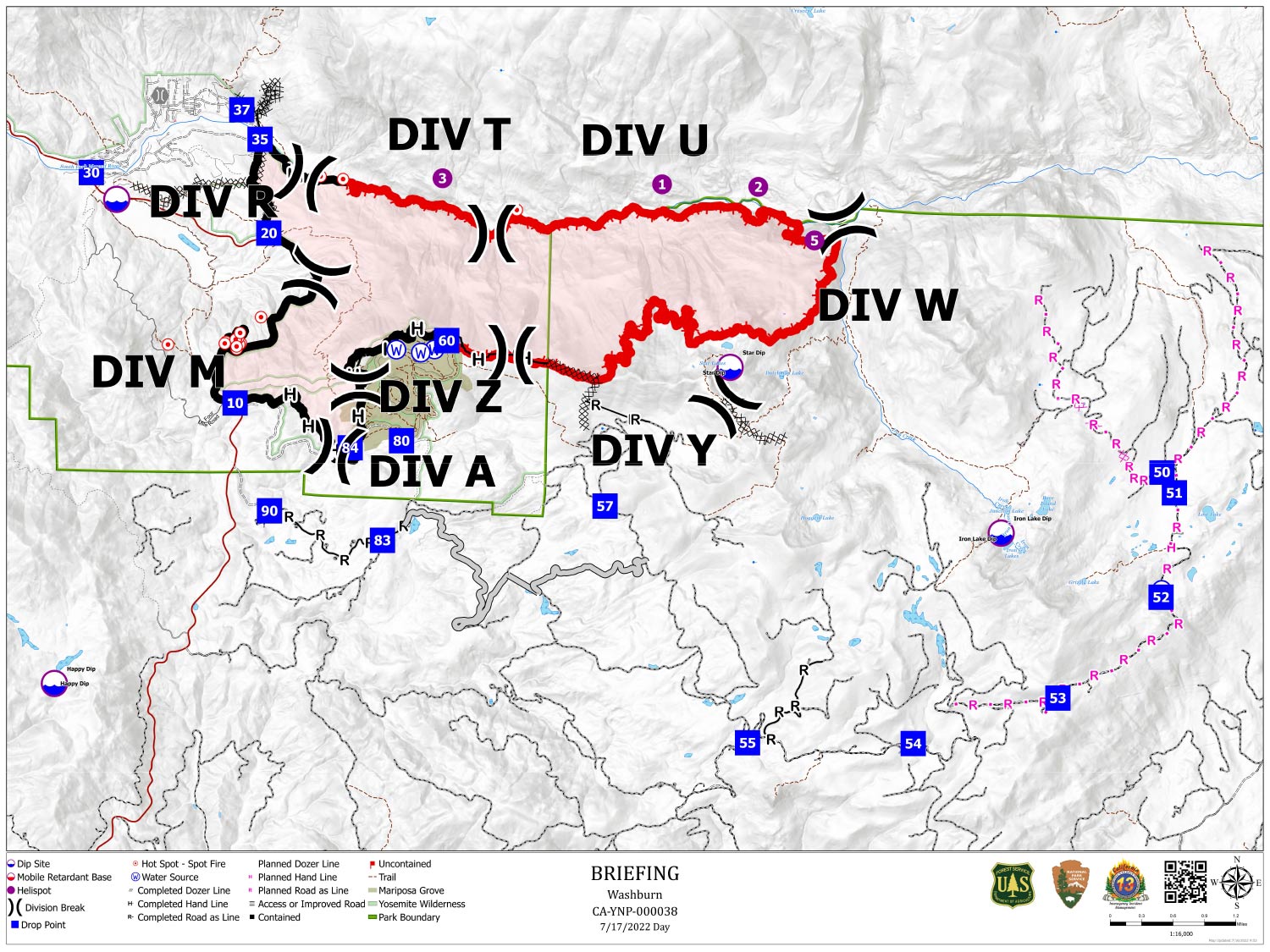
Shows Planned Hand Line, Planned Road as Line, Divisions, Dozer Lines and Uncontrolled Fire Edge.
Below Map:
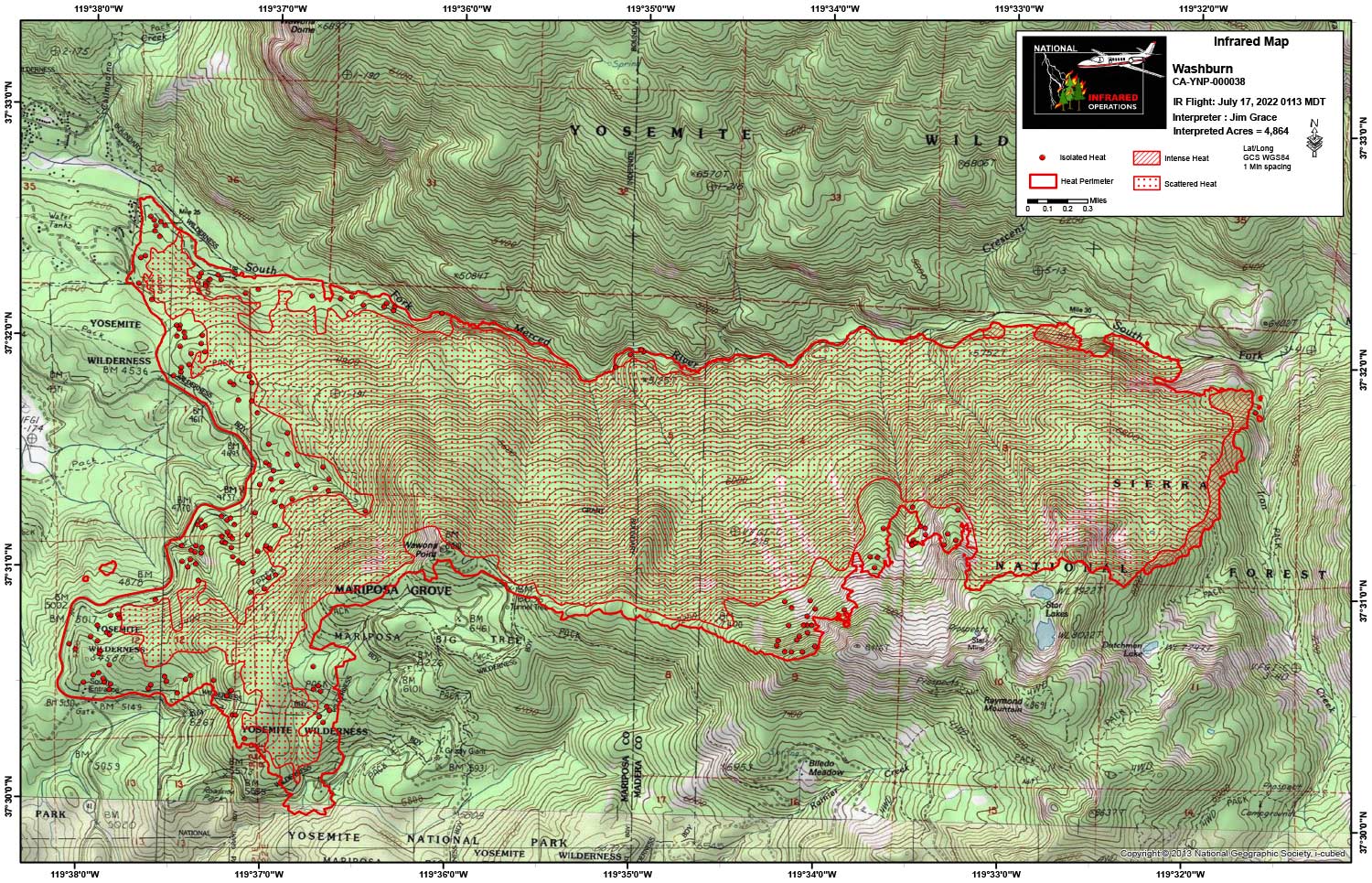
Infrared Map for Sunday, July 17, 2022
Note: Map is 1,500 Pixels Wide.
Acreage: 4,864 Acres (Growth since last flight: 7 Acres)
I Started interpretation with the new NIFS Perimeter.
Start Acres 4,857
End Acres 4,864
Still a large area (approximately 90%) of scattered heat in the interior. Some pockets of intense heat on the east end of the fire. 3 new areas of heat in the bottom of Iron creek but still on the West side of the creek.